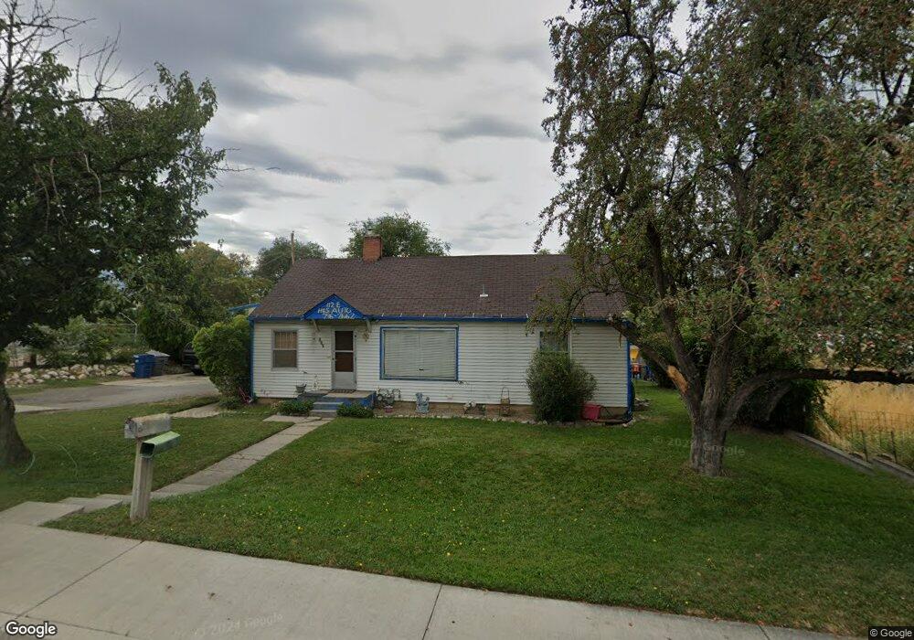
112 E 700 S Pleasant Grove, UT 84062
Estimated Value: $417,000 - $647,000
3
Beds
2
Baths
1,025
Sq Ft
$509/Sq Ft
Est. Value
About This Home
This home is located at 112 E 700 S, Pleasant Grove, UT 84062 and is currently estimated at $521,525, approximately $508 per square foot. 112 E 700 S is a home located in Utah County with nearby schools including Mount Mahogany School, Pleasant Grove Junior High School, and Pleasant Grove High School.
Ownership History
Date
Name
Owned For
Owner Type
Purchase Details
Closed on
Jan 2, 2008
Sold by
Sargent Harold
Bought by
Sargent Harold D
Current Estimated Value
Home Financials for this Owner
Home Financials are based on the most recent Mortgage that was taken out on this home.
Original Mortgage
$115,000
Outstanding Balance
$72,552
Interest Rate
6.15%
Mortgage Type
New Conventional
Estimated Equity
$448,973
Purchase Details
Closed on
Nov 27, 2006
Sold by
Gifford Jean N
Bought by
Sargent Harold
Home Financials for this Owner
Home Financials are based on the most recent Mortgage that was taken out on this home.
Original Mortgage
$244,350
Outstanding Balance
$146,658
Interest Rate
6.38%
Mortgage Type
Purchase Money Mortgage
Estimated Equity
$374,867
Create a Home Valuation Report for This Property
The Home Valuation Report is an in-depth analysis detailing your home's value as well as a comparison with similar homes in the area
Home Values in the Area
Average Home Value in this Area
Purchase History
| Date | Buyer | Sale Price | Title Company |
|---|---|---|---|
| Sargent Harold D | -- | Bartlett Title Insurance Ag | |
| Sargent Harold | -- | Equity Title Orem Blvd |
Source: Public Records
Mortgage History
| Date | Status | Borrower | Loan Amount |
|---|---|---|---|
| Open | Sargent Harold D | $115,000 | |
| Open | Sargent Harold | $244,350 |
Source: Public Records
Tax History
| Year | Tax Paid | Tax Assessment Tax Assessment Total Assessment is a certain percentage of the fair market value that is determined by local assessors to be the total taxable value of land and additions on the property. | Land | Improvement |
|---|---|---|---|---|
| 2025 | $1,898 | $248,215 | -- | -- |
| 2024 | $1,898 | $221,540 | $0 | $0 |
| 2023 | $1,765 | $215,655 | $0 | $0 |
| 2022 | $1,959 | $238,095 | $0 | $0 |
| 2021 | $1,675 | $312,200 | $174,600 | $137,600 |
| 2020 | $1,549 | $281,000 | $155,900 | $125,100 |
| 2019 | $1,343 | $252,100 | $143,300 | $108,800 |
| 2018 | $1,277 | $226,600 | $130,700 | $95,900 |
| 2017 | $1,124 | $106,150 | $0 | $0 |
| 2016 | $1,064 | $97,075 | $0 | $0 |
| 2015 | $1,055 | $91,080 | $0 | $0 |
| 2014 | $1,049 | $89,705 | $0 | $0 |
Source: Public Records
Map
Nearby Homes
- 435 E 790 S Unit 8
- 412 S 350 E
- 494 E Apple Blossom Dr
- 165 S 200 E
- 190 E 100 S
- 35 S 100 E
- 590 N Buffalo Grass Ln
- 588 N Buffalo Grass Ln
- 582 N Buffalo Grass Ln
- 578 N Buffalo Grass Ln
- 572 N Buffalo Grass Ln
- 576 N Buffalo Grass Ln
- 570 N Buffalo Grass Ln
- 574 N Buffalo Grass Ln
- 568 N Buffalo Grass Ln
- 46 S 100 W Unit 1
- 566 N Buffalo Grass Ln
- 564 N Buffalo Grass Ln Unit 1250
- 560 N Buffalo Grass Ln
- 556 N Buffalo Grass Ln
Your Personal Tour Guide
Ask me questions while you tour the home.