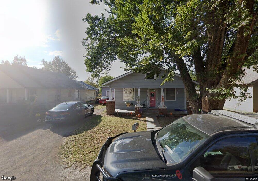
112 E Birch St Carnegie, OK 73015
Estimated Value: $46,098 - $79,000
3
Beds
1
Bath
1,160
Sq Ft
$56/Sq Ft
Est. Value
About This Home
This home is located at 112 E Birch St, Carnegie, OK 73015 and is currently estimated at $64,525, approximately $55 per square foot. 112 E Birch St is a home located in Caddo County with nearby schools including Carnegie Elementary School, Carnegie Middle School, and Carnegie High School.
Ownership History
Date
Name
Owned For
Owner Type
Purchase Details
Closed on
Mar 18, 2022
Sold by
Graham and Laura
Bought by
Foli Philip and Foli Debra
Current Estimated Value
Purchase Details
Closed on
Apr 16, 2010
Sold by
Ulrich Thelma L and Harrison Thelma L
Bought by
Foli Phillip
Purchase Details
Closed on
Aug 15, 2008
Purchase Details
Closed on
Aug 8, 2008
Purchase Details
Closed on
Nov 27, 2007
Purchase Details
Closed on
Jun 27, 2006
Purchase Details
Closed on
Mar 4, 1998
Purchase Details
Closed on
Sep 26, 1997
Purchase Details
Closed on
Jul 1, 1990
Purchase Details
Closed on
Sep 1, 1986
Create a Home Valuation Report for This Property
The Home Valuation Report is an in-depth analysis detailing your home's value as well as a comparison with similar homes in the area
Purchase History
| Date | Buyer | Sale Price | Title Company |
|---|---|---|---|
| Foli Philip | $6,000 | None Listed On Document | |
| Foli Phillip | $19,000 | -- | |
| -- | $45,000 | -- | |
| -- | -- | -- | |
| -- | $27,500 | -- | |
| -- | -- | -- | |
| -- | $27,500 | -- | |
| -- | -- | -- | |
| -- | $20,000 | -- | |
| -- | $10,000 | -- | |
| -- | -- | -- |
Source: Public Records
Tax History
| Year | Tax Paid | Tax Assessment Tax Assessment Total Assessment is a certain percentage of the fair market value that is determined by local assessors to be the total taxable value of land and additions on the property. | Land | Improvement |
|---|---|---|---|---|
| 2025 | $166 | $1,731 | $385 | $1,346 |
| 2024 | $166 | $1,648 | $385 | $1,263 |
| 2023 | $162 | $1,570 | $385 | $1,185 |
| 2022 | $143 | $1,495 | $385 | $1,110 |
| 2021 | $143 | $1,424 | $385 | $1,039 |
| 2020 | $175 | $1,870 | $385 | $1,485 |
| 2019 | $148 | $1,781 | $385 | $1,396 |
| 2018 | $152 | $1,781 | $385 | $1,396 |
| 2017 | $152 | $1,781 | $385 | $1,396 |
| 2016 | $211 | $2,380 | $385 | $1,995 |
| 2015 | $182 | $2,277 | $385 | $1,892 |
| 2014 | $195 | $2,168 | $385 | $1,783 |
Source: Public Records
Map
Nearby Homes
- 203 E 3rd St
- 715 E Oklahoma St
- 708 Town East Ash St
- 431 S Carnegie St
- 503 S Carnegie St
- 701 S Carnegie St
- 31185 County Street 2470
- 728 S Carol St
- N2420 Rd
- 36007 S State 58 Hwy
- TBD N 2420 Rd
- 14803 N 2400 Rd
- 29093 2530 Fields
- 29092 County Street 2530
- 483 S 2nd St
- 516 S 4th St
- 134 Wood St
- 128 Wood St
- 109 Cowan Ave
- 344 S 6th St
Your Personal Tour Guide
Ask me questions while you tour the home.