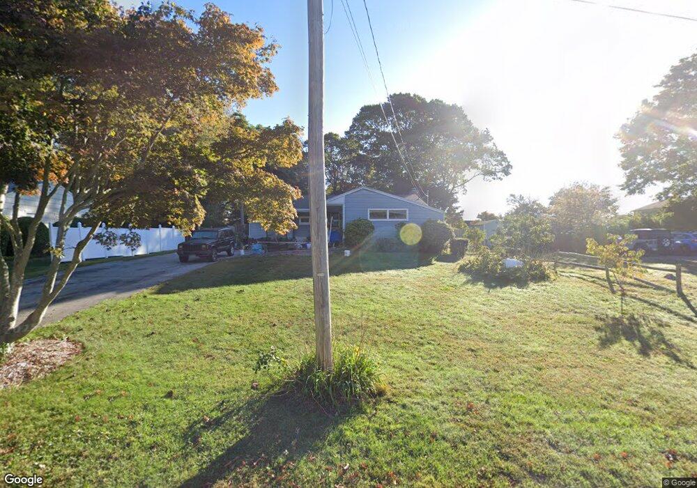
112 Eastwood Rd Groton, CT 06340
Estimated Value: $376,000 - $500,000
3
Beds
2
Baths
1,142
Sq Ft
$388/Sq Ft
Est. Value
About This Home
This home is located at 112 Eastwood Rd, Groton, CT 06340 and is currently estimated at $442,559, approximately $387 per square foot. 112 Eastwood Rd is a home located in New London County with nearby schools including Catherine Kolnaski STEAM Magnet School, Groton Middle School, and Robert E. Fitch High School.
Ownership History
Date
Name
Owned For
Owner Type
Purchase Details
Closed on
Nov 29, 2023
Sold by
Britt Timothy W
Bought by
Timothy W Britt T W and Timothy Britt
Current Estimated Value
Purchase Details
Closed on
Feb 19, 2002
Sold by
Luna Rose Est and Luna
Bought by
Britt Timothy W
Home Financials for this Owner
Home Financials are based on the most recent Mortgage that was taken out on this home.
Original Mortgage
$115,000
Interest Rate
7.14%
Mortgage Type
Purchase Money Mortgage
Create a Home Valuation Report for This Property
The Home Valuation Report is an in-depth analysis detailing your home's value as well as a comparison with similar homes in the area
Home Values in the Area
Average Home Value in this Area
Purchase History
| Date | Buyer | Sale Price | Title Company |
|---|---|---|---|
| Timothy W Britt T W | -- | None Available | |
| Britt Timothy W | $192,250 | -- |
Source: Public Records
Mortgage History
| Date | Status | Borrower | Loan Amount |
|---|---|---|---|
| Previous Owner | Britt Timothy W | $115,000 |
Source: Public Records
Tax History Compared to Growth
Tax History
| Year | Tax Paid | Tax Assessment Tax Assessment Total Assessment is a certain percentage of the fair market value that is determined by local assessors to be the total taxable value of land and additions on the property. | Land | Improvement |
|---|---|---|---|---|
| 2025 | $5,130 | $177,450 | $92,092 | $85,358 |
| 2024 | $4,772 | $177,450 | $92,092 | $85,358 |
| 2023 | $4,578 | $177,450 | $55,510 | $121,940 |
| 2022 | $4,427 | $177,450 | $55,510 | $121,940 |
| 2021 | $4,451 | $147,000 | $68,530 | $78,470 |
| 2020 | $4,323 | $147,000 | $68,530 | $78,470 |
| 2019 | $4,185 | $147,000 | $68,530 | $78,470 |
| 2018 | $4,226 | $147,000 | $68,530 | $78,470 |
| 2017 | $4,241 | $147,000 | $68,530 | $78,470 |
| 2016 | $4,143 | $152,530 | $74,270 | $78,260 |
| 2015 | $4,091 | $152,530 | $74,270 | $78,260 |
| 2014 | $3,806 | $152,530 | $74,270 | $78,260 |
Source: Public Records
Map
Nearby Homes
- 88 Eastwood Rd
- 895 Shennecossett Rd
- 760 Shennecossett Rd
- 53 Westwood Dr
- 26 Bakers Cove Ln
- 49 Bayberry Ln
- 222 Tyler Ave
- 90 Jupiter Point Rd
- 520 Shennecossett Rd Unit J
- 119 High Rock Rd
- 42 A St
- 63 Johl Dr
- 42 Godfrey St
- 174 D St
- 172 D St
- 51 Warner St
- 55 Virginia Ave Unit C
- 41 Joe Ave
- 597 Pequot Ave
- 74 Twin Hills Dr
- 110 Eastwood Rd
- 400 Tyler Ave
- 414 Tyler Ave
- 396 Tyler Ave
- 100 Eastwood Rd
- 855 Shennecossett Rd
- 809 Shennecossett Rd
- 845 Shennecossett Rd
- 801 Shennecossett Rd
- 125 Eastwood Rd
- 380 Tyler Ave
- 115 Eastwood Rd
- 105 Eastwood Rd
- 793 Shennecossett Rd
- 881 Shennecossett Rd
- 823 Shennecossett Rd
- 789 Shennecossett Rd
- 95 Eastwood Rd
- 7 Bayberry Ln
- 876 Shennecossett Rd