Estimated Value: $151,000 - $183,920
--
Bed
1
Bath
1,388
Sq Ft
$122/Sq Ft
Est. Value
About This Home
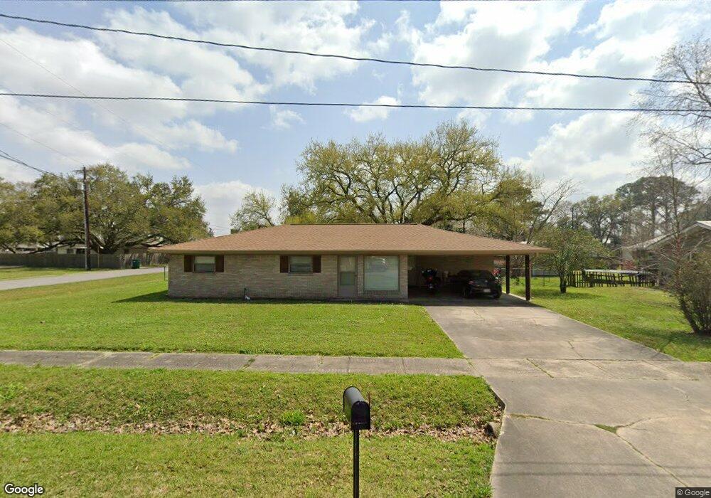
This home is located at 112 Elm Dr, Lafayette, LA 70506 and is currently estimated at $168,730, approximately $121 per square foot. 112 Elm Dr is a home located in Lafayette Parish with nearby schools including Cedar Elementary School, Prairie Elementary School, and Gateway Academy.
Ownership History
Date
Name
Owned For
Owner Type
Purchase Details
Closed on
Jul 15, 2020
Sold by
Roger Stonie James and Roger Monica Lynn
Bought by
Albarado Tyler P and Bautista Jacquelinne Rodriguez
Current Estimated Value
Purchase Details
Closed on
Jan 17, 2020
Sold by
Prejean Marlene Landry
Bought by
Roger Stonie James and Roger Monica Lynn
Home Financials for this Owner
Home Financials are based on the most recent Mortgage that was taken out on this home.
Original Mortgage
$96,000
Interest Rate
3.74%
Mortgage Type
New Conventional
Purchase Details
Closed on
Jul 31, 2015
Sold by
Landry Jacque Christopher and Landry Mary B
Bought by
Prejean Marlene Anne Landry
Create a Home Valuation Report for This Property
The Home Valuation Report is an in-depth analysis detailing your home's value as well as a comparison with similar homes in the area
Home Values in the Area
Average Home Value in this Area
Purchase History
| Date | Buyer | Sale Price | Title Company |
|---|---|---|---|
| Albarado Tyler P | $132,500 | None Available | |
| Roger Stonie James | $120,000 | First American Title | |
| Prejean Marlene Anne Landry | $62,500 | None Available |
Source: Public Records
Mortgage History
| Date | Status | Borrower | Loan Amount |
|---|---|---|---|
| Previous Owner | Roger Stonie James | $96,000 |
Source: Public Records
Tax History Compared to Growth
Tax History
| Year | Tax Paid | Tax Assessment Tax Assessment Total Assessment is a certain percentage of the fair market value that is determined by local assessors to be the total taxable value of land and additions on the property. | Land | Improvement |
|---|---|---|---|---|
| 2024 | $678 | $12,622 | $3,600 | $9,022 |
| 2023 | $678 | $11,928 | $3,600 | $8,328 |
| 2022 | $1,248 | $11,928 | $3,600 | $8,328 |
| 2021 | $1,252 | $11,928 | $3,600 | $8,328 |
| 2020 | $1,044 | $9,979 | $3,600 | $6,379 |
| 2019 | $204 | $9,979 | $3,600 | $6,379 |
| 2018 | $387 | $9,979 | $3,600 | $6,379 |
| 2017 | $386 | $9,980 | $1,800 | $8,180 |
| 2015 | $701 | $9,980 | $1,800 | $8,180 |
| 2013 | -- | $9,980 | $1,800 | $8,180 |
Source: Public Records
Map
Nearby Homes
- 111 Elm Dr
- 116 Castle Row
- 133 Castle Row Unit A
- 102 Judice Meadows Ln
- 210 Essex St
- 501 Crawford St
- 103 Newcastle Dr
- 495 Mount Vernon Dr
- 409 Daniel Dr
- 216 Highland Dr
- 100 Winchester Dr Unit 108
- 100 Winchester Dr Unit 306
- 100 Winchester Dr Unit 308
- 100 Winchester Dr Unit 704
- 100 Winchester Dr Unit 109
- 207 N William Dr
- 204 Parliament Dr
- 225 Downing St
- 117 Alyene Dr
- 124 Alyene Dr