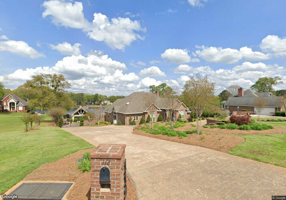
112 Fieldfare Dr Kathleen, GA 31047
Estimated Value: $449,000 - $503,000
--
Bed
--
Bath
3,312
Sq Ft
$144/Sq Ft
Est. Value
About This Home
This home is located at 112 Fieldfare Dr, Kathleen, GA 31047 and is currently estimated at $475,792, approximately $143 per square foot. 112 Fieldfare Dr is a home located in Houston County with nearby schools including Matthew Arthur Elementary School, Bonaire Middle School, and Veterans High School.
Ownership History
Date
Name
Owned For
Owner Type
Purchase Details
Closed on
Jun 26, 2017
Sold by
Alan K Cu Chiam
Bought by
Meade Deborah and Meade Randall
Current Estimated Value
Home Financials for this Owner
Home Financials are based on the most recent Mortgage that was taken out on this home.
Original Mortgage
$286,393
Outstanding Balance
$238,010
Interest Rate
3.9%
Estimated Equity
$237,782
Purchase Details
Closed on
Apr 30, 1992
Sold by
Smith Bobby Lee
Bought by
Meade Randall and Deborah L*
Create a Home Valuation Report for This Property
The Home Valuation Report is an in-depth analysis detailing your home's value as well as a comparison with similar homes in the area
Home Values in the Area
Average Home Value in this Area
Purchase History
| Date | Buyer | Sale Price | Title Company |
|---|---|---|---|
| Meade Deborah | $329,900 | -- | |
| Meade Randall | $27,000 | -- |
Source: Public Records
Mortgage History
| Date | Status | Borrower | Loan Amount |
|---|---|---|---|
| Open | Meade Deborah | $286,393 | |
| Closed | Meade Deborah | -- |
Source: Public Records
Tax History Compared to Growth
Tax History
| Year | Tax Paid | Tax Assessment Tax Assessment Total Assessment is a certain percentage of the fair market value that is determined by local assessors to be the total taxable value of land and additions on the property. | Land | Improvement |
|---|---|---|---|---|
| 2024 | $4,175 | $174,520 | $15,120 | $159,400 |
| 2023 | $3,487 | $144,280 | $15,120 | $129,160 |
| 2022 | $3,182 | $131,640 | $15,120 | $116,520 |
| 2021 | $2,931 | $120,640 | $15,120 | $105,520 |
| 2020 | $2,914 | $119,400 | $15,120 | $104,280 |
| 2019 | $2,914 | $119,400 | $15,120 | $104,280 |
| 2018 | $2,914 | $119,400 | $15,120 | $104,280 |
| 2017 | $2,917 | $119,400 | $15,120 | $104,280 |
| 2016 | $2,922 | $119,400 | $15,120 | $104,280 |
| 2015 | $2,928 | $119,400 | $15,120 | $104,280 |
| 2014 | -- | $119,400 | $15,120 | $104,280 |
| 2013 | -- | $126,160 | $15,120 | $111,040 |
Source: Public Records
Map
Nearby Homes
- 105 Cabin Cove Dr
- 202 Westward Point
- 202 Westward Pointe
- 231 Grove Ln
- 135 Pond Dr
- 117 Black Birch Ln
- 115 Black Birch Ln
- 102 Emberwood Dr
- 200 Emberwood Way
- 102 Emberwood Way
- 206 Emberwood Way
- 119 Richfield Cir
- 117 Richfield Cir
- 316 Shoshone Cir
- 103 Hidesta Ct
- 410 Woodlands Blvd
- 202 Brook Hollow Ct
- 101 Pond Dr
- 110 Fieldfare Dr
- 108 Fieldfare Dr
- 114 Fieldfare Dr
- 113 Fieldfare Dr
- 111 Fieldfare Dr
- 106 Fieldfare Dr
- 100 Cabin Cove Dr
- 109 Fieldfare Dr
- 107 Fieldfare Dr
- 200 Fieldfare Dr
- 102 Cabin Cove Dr
- 202 Fieldfare Dr
- 104 Fieldfare Dr
- 203 Fieldfare Dr
- 204 Fieldfare Dr
- 413 Woodlands Blvd
- 407 Woodlands Blvd
- 114 Silverleaf Way
- 111 Silverleaf Way
- 113 Silverleaf Way