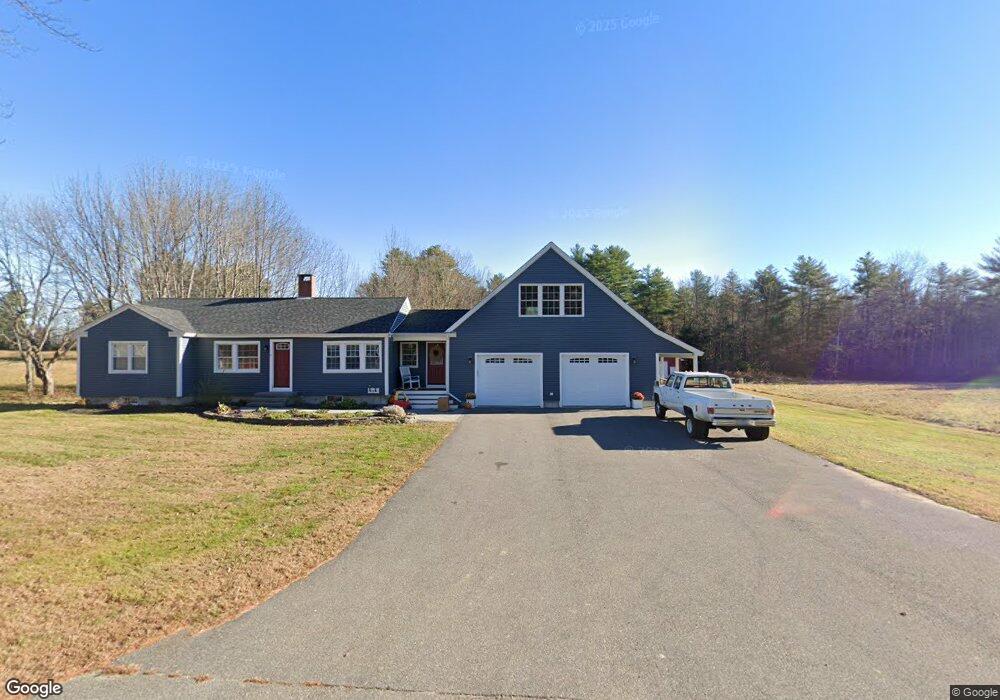
112 Files Rd Gorham, ME 04038
Estimated Value: $499,608 - $684,000
3
Beds
1
Bath
1,118
Sq Ft
$502/Sq Ft
Est. Value
About This Home
This home is located at 112 Files Rd, Gorham, ME 04038 and is currently estimated at $560,902, approximately $501 per square foot. 112 Files Rd is a home located in Cumberland County with nearby schools including Village Elementary School, Gorham Middle School, and Gorham High School.
Create a Home Valuation Report for This Property
The Home Valuation Report is an in-depth analysis detailing your home's value as well as a comparison with similar homes in the area
Home Values in the Area
Average Home Value in this Area
Tax History Compared to Growth
Tax History
| Year | Tax Paid | Tax Assessment Tax Assessment Total Assessment is a certain percentage of the fair market value that is determined by local assessors to be the total taxable value of land and additions on the property. | Land | Improvement |
|---|---|---|---|---|
| 2024 | $6,771 | $460,600 | $77,600 | $383,000 |
| 2023 | $6,333 | $460,600 | $77,600 | $383,000 |
| 2022 | $5,919 | $460,600 | $77,600 | $383,000 |
| 2021 | $4,123 | $212,500 | $65,300 | $147,200 |
| 2020 | $4,038 | $212,500 | $65,300 | $147,200 |
| 2019 | $4,027 | $212,500 | $65,300 | $147,200 |
| 2018 | $3,604 | $198,000 | $65,300 | $132,700 |
| 2017 | $2,823 | $165,100 | $65,300 | $99,800 |
| 2016 | $3,279 | $192,900 | $65,300 | $127,600 |
| 2015 | $4,320 | $265,000 | $137,400 | $127,600 |
| 2014 | $4,197 | $241,200 | $126,200 | $115,000 |
| 2013 | $4,173 | $241,200 | $126,200 | $115,000 |
Source: Public Records
Map
Nearby Homes
- 866 Parker Farm Rd Unit A
- 866 Parker Farm Rd Unit B
- 186 Line Rd
- 192 Cemetery Rd
- 125 Old Thompson Rd
- 4 Musket Dr
- 42 Brandons Way
- 89 Shaws Mill Rd
- 116 Dingley Spring Rd
- 35 Rust Rd
- 30 Joan Dixon Way
- 6 Sunrise St
- 63 Ossipee Trail E
- 66 Ossipee Trail East Trail E
- TBD Fort Hill Rd
- 27 Ossipee Trail E Unit 1
- 56 Hay Field Dr
- Lot 2 Commerce Way
- 580 Bonny Eagle Rd
- 6 Cortland Place Unit 4