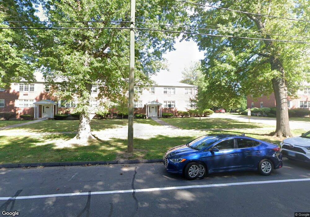
112 Folly Brook Blvd Wethersfield, CT 06109
Estimated Value: $383,000
8
Beds
4
Baths
3,968
Sq Ft
$97/Sq Ft
Est. Value
About This Home
This home is located at 112 Folly Brook Blvd, Wethersfield, CT 06109 and is currently priced at $383,000, approximately $96 per square foot. 112 Folly Brook Blvd is a home located in Hartford County with nearby schools including Samuel B. Webb Elementary School, Silas Deane Middle School, and Wethersfield High School.
Ownership History
Date
Name
Owned For
Owner Type
Purchase Details
Closed on
Dec 30, 2020
Sold by
Feratovic Esad
Bought by
Sabovic Amra
Current Estimated Value
Purchase Details
Closed on
Dec 29, 2011
Sold by
112 Folly Brook Llc
Bought by
Graziano 3Rd Frank
Purchase Details
Closed on
Dec 12, 2003
Sold by
Wirkus Richard T and Wirkus Linda C
Bought by
Graziano 3Rd Frank
Home Financials for this Owner
Home Financials are based on the most recent Mortgage that was taken out on this home.
Original Mortgage
$202,500
Interest Rate
5.9%
Purchase Details
Closed on
Aug 23, 1988
Sold by
Wirkus Eugene B
Bought by
Wirkus Richard T
Home Financials for this Owner
Home Financials are based on the most recent Mortgage that was taken out on this home.
Original Mortgage
$147,200
Interest Rate
10.32%
Mortgage Type
Purchase Money Mortgage
Create a Home Valuation Report for This Property
The Home Valuation Report is an in-depth analysis detailing your home's value as well as a comparison with similar homes in the area
Home Values in the Area
Average Home Value in this Area
Purchase History
| Date | Buyer | Sale Price | Title Company |
|---|---|---|---|
| Sabovic Amra | $300,000 | None Available | |
| Graziano 3Rd Frank | -- | -- | |
| Graziano 3Rd Frank | $225,000 | -- | |
| Wirkus Richard T | $184,000 | -- |
Source: Public Records
Mortgage History
| Date | Status | Borrower | Loan Amount |
|---|---|---|---|
| Previous Owner | Wirkus Richard T | $202,500 | |
| Previous Owner | Wirkus Richard T | $147,200 |
Source: Public Records
Tax History Compared to Growth
Tax History
| Year | Tax Paid | Tax Assessment Tax Assessment Total Assessment is a certain percentage of the fair market value that is determined by local assessors to be the total taxable value of land and additions on the property. | Land | Improvement |
|---|---|---|---|---|
| 2022 | $7,873 | $191,660 | $0 | $191,660 |
| 2021 | $7,795 | $191,660 | $0 | $191,660 |
| 2020 | $7,795 | $191,660 | $0 | $191,660 |
| 2019 | $7,808 | $191,660 | $0 | $191,660 |
| 2018 | $7,911 | $194,000 | $0 | $194,000 |
| 2017 | $7,715 | $194,000 | $0 | $194,000 |
| 2016 | $7,477 | $194,000 | $0 | $194,000 |
| 2015 | $7,409 | $194,000 | $0 | $194,000 |
| 2014 | $7,128 | $194,000 | $0 | $194,000 |
Source: Public Records
Map
Nearby Homes
- 5 Wolcott Hill Rd
- 47 Bolton St
- 166 George St
- 24 Williams St
- 71 Hanmer St
- 51 Hanmer St
- 390 Fairfield Ave
- 105 Albert Ave
- 839 Wethersfield Ave
- 18 Mclean St Unit 20
- 244 Brown St
- 308 Brown St
- 159 Gilman St
- 193 Wolcott Hill Rd Unit 195
- 1320 Berlin Turnpike Unit 118
- 1320 Berlin Turnpike Unit 625
- 375 Hartford Ave
- 1310 Berlin Turnpike Unit 412
- 1310 Berlin Turnpike Unit 607
- 63 Booth Ave
- 300 Jordan Ln
- 134 Folly Brook Blvd
- 128 Folly Brook Blvd
- 124 Folly Brook Blvd
- 120 Folly Brook Blvd
- 106 Folly Brook Blvd
- 98 Folly Brook Blvd
- 94 Folly Brook Blvd
- 90 Folly Brook Blvd
- 80 Folly Brook Blvd
- 76 Folly Brook Blvd
- 72 Folly Brook Blvd
- 68 Folly Brook Blvd
- 62 Folly Brook Blvd
- 58 Folly Brook Blvd
- 50 Folly Brook Blvd
- 46 Folly Brook Blvd
- 42 Folly Brook Blvd
- 38 Folly Brook Blvd
- 36 Folly Brook Blvd