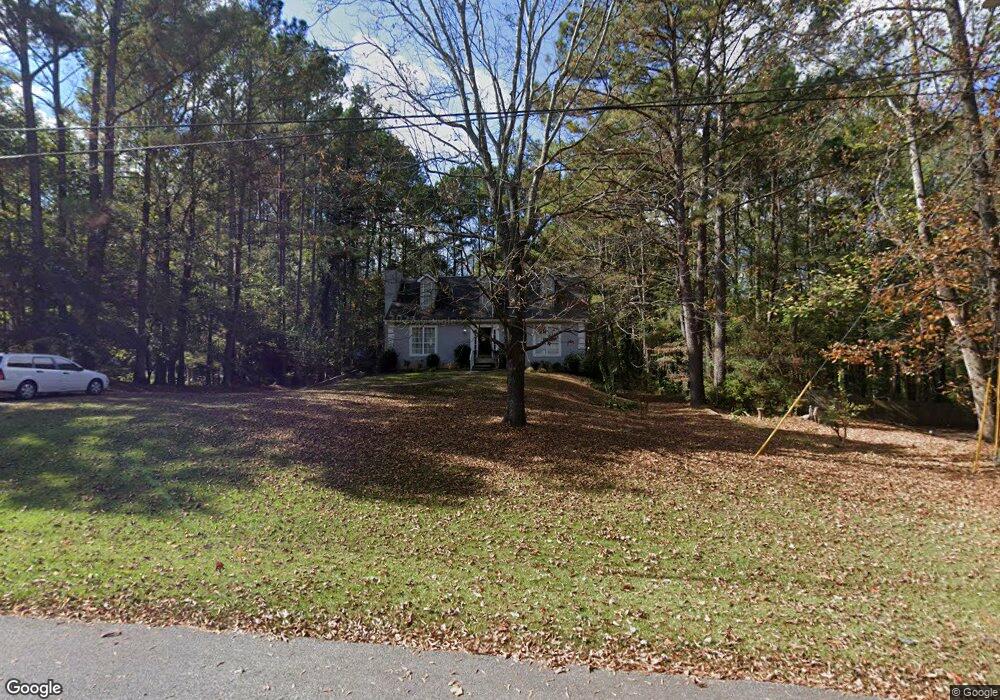
112 Franklin Place Lagrange, GA 30240
Estimated Value: $254,000 - $282,000
3
Beds
3
Baths
1,216
Sq Ft
$220/Sq Ft
Est. Value
About This Home
This home is located at 112 Franklin Place, Lagrange, GA 30240 and is currently estimated at $268,088, approximately $220 per square foot. 112 Franklin Place is a home located in Troup County with nearby schools including Long Cane Elementary School, Berta Weathersbee Elementary School, and Whitesville Road Elementary School.
Ownership History
Date
Name
Owned For
Owner Type
Purchase Details
Closed on
Sep 5, 2006
Sold by
Jarrell Judd M
Bought by
Jarrell Judd M
Current Estimated Value
Home Financials for this Owner
Home Financials are based on the most recent Mortgage that was taken out on this home.
Original Mortgage
$144,500
Outstanding Balance
$86,066
Interest Rate
6.52%
Mortgage Type
New Conventional
Estimated Equity
$182,022
Purchase Details
Closed on
Jul 29, 1992
Sold by
Dan-Ric Inc
Bought by
Judd M Jarrell
Purchase Details
Closed on
Jun 1, 1986
Bought by
Dan-Ric Inc
Create a Home Valuation Report for This Property
The Home Valuation Report is an in-depth analysis detailing your home's value as well as a comparison with similar homes in the area
Home Values in the Area
Average Home Value in this Area
Purchase History
| Date | Buyer | Sale Price | Title Company |
|---|---|---|---|
| Jarrell Judd M | -- | -- | |
| Jarrell Judd M | -- | -- | |
| Judd M Jarrell | $100,000 | -- | |
| Dan-Ric Inc | $124,500 | -- |
Source: Public Records
Mortgage History
| Date | Status | Borrower | Loan Amount |
|---|---|---|---|
| Open | Jarrell Judd M | $144,500 |
Source: Public Records
Tax History Compared to Growth
Tax History
| Year | Tax Paid | Tax Assessment Tax Assessment Total Assessment is a certain percentage of the fair market value that is determined by local assessors to be the total taxable value of land and additions on the property. | Land | Improvement |
|---|---|---|---|---|
| 2024 | $1,973 | $82,280 | $14,000 | $68,280 |
| 2023 | $1,804 | $76,080 | $14,000 | $62,080 |
| 2022 | $1,619 | $67,960 | $10,000 | $57,960 |
| 2021 | $1,323 | $53,800 | $10,000 | $43,800 |
| 2020 | $1,323 | $53,800 | $10,000 | $43,800 |
| 2019 | $1,264 | $51,840 | $8,000 | $43,840 |
| 2018 | $1,197 | $49,640 | $8,000 | $41,640 |
| 2017 | $1,197 | $49,640 | $8,000 | $41,640 |
| 2016 | $1,181 | $49,066 | $8,000 | $41,066 |
| 2015 | $1,184 | $49,066 | $8,000 | $41,066 |
| 2014 | $1,117 | $46,784 | $8,000 | $38,784 |
| 2013 | -- | $48,414 | $8,000 | $40,414 |
Source: Public Records
Map
Nearby Homes
- 102 Franklin Place
- 119 Plymouth Dr
- 101 Ivy Springs Dr
- 141 Plymouth Dr
- 474 Newton Rd
- 40 River Point Dr
- 100 Huntcliff Ct
- 105 Hawthorne Cir
- 103 Hawthorne Cir
- 110 Hawthorne Cir
- 108 Hidden Springs Dr
- 135 Planters Ridge Dr
- 1565 Glass Bridge Rd
- 124 Foxdale Dr
- 106 Landings Way
- 102 Landings Way
- 190 Hill Rd
- 101 Riverbluff Dr
- 201 Lakeview Ct
- 109 Riverbluff Dr
- 114 Franklin Place
- 110 Franklin Place
- 107 Independence Ct
- 105 Independence Ct
- 101 Franklin Place
- 116 Franklin Place Unit 166
- 116 Franklin Place
- 103 Independence Ct
- 104 Madison Place
- 106 Franklin Place
- 0 Independence Ct Unit 3173244
- 0 Independence Ct Unit 8262357
- 0 Independence Ct Unit 8055002
- 0 Independence Ct Unit 8761045
- 0 Independence Ct
- 109 Independence Ct
- 102 Independence Ct
- 103 Franklin Place
- 104 Franklin Place
- 101 Independence Ct