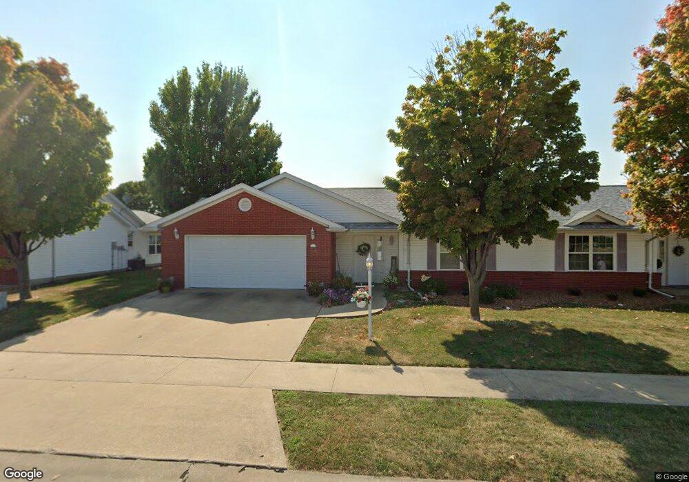
112 Freedom Ln Jerseyville, IL 62052
Estimated Value: $193,000 - $223,000
--
Bed
--
Bath
1,582
Sq Ft
$130/Sq Ft
Est. Value
About This Home
This home is located at 112 Freedom Ln, Jerseyville, IL 62052 and is currently estimated at $204,883, approximately $129 per square foot. 112 Freedom Ln is a home located in Jersey County with nearby schools including Jersey Community High School, St Francis/Holy Ghost Catholic School, and Victory Baptist School.
Ownership History
Date
Name
Owned For
Owner Type
Purchase Details
Closed on
Mar 6, 2025
Sold by
Updike Charles D and Updike Joseph
Bought by
Updike Thomas S
Current Estimated Value
Purchase Details
Closed on
Sep 29, 2006
Sold by
Guilander Robert and Guilander Robert
Bought by
Updike Charles D and Updike Thomas
Home Financials for this Owner
Home Financials are based on the most recent Mortgage that was taken out on this home.
Original Mortgage
$99,375
Interest Rate
6.49%
Create a Home Valuation Report for This Property
The Home Valuation Report is an in-depth analysis detailing your home's value as well as a comparison with similar homes in the area
Home Values in the Area
Average Home Value in this Area
Purchase History
| Date | Buyer | Sale Price | Title Company |
|---|---|---|---|
| Updike Thomas S | -- | None Listed On Document | |
| Updike Charles D | -- | -- |
Source: Public Records
Mortgage History
| Date | Status | Borrower | Loan Amount |
|---|---|---|---|
| Previous Owner | Updike Charles D | $99,375 |
Source: Public Records
Tax History Compared to Growth
Tax History
| Year | Tax Paid | Tax Assessment Tax Assessment Total Assessment is a certain percentage of the fair market value that is determined by local assessors to be the total taxable value of land and additions on the property. | Land | Improvement |
|---|---|---|---|---|
| 2024 | $4,855 | $62,710 | $7,015 | $55,695 |
| 2023 | $4,655 | $58,605 | $6,555 | $52,050 |
| 2022 | $4,498 | $54,770 | $6,125 | $48,645 |
| 2021 | $3,837 | $51,915 | $5,805 | $46,110 |
| 2020 | $3,604 | $49,915 | $5,580 | $44,335 |
| 2019 | $3,604 | $48,700 | $5,445 | $43,255 |
| 2018 | $3,486 | $48,340 | $5,405 | $42,935 |
| 2017 | $3,539 | $47,980 | $5,365 | $42,615 |
| 2016 | $3,557 | $48,310 | $5,400 | $42,910 |
| 2015 | -- | $49,045 | $5,480 | $43,565 |
| 2014 | -- | $49,120 | $5,490 | $43,630 |
Source: Public Records
Map
Nearby Homes
- 36 Witt Mill Rd
- 40 Witt Mill Rd
- 46 Witt Mill Rd
- 34 Witt Mill Rd
- 38 Witt Mill Rd
- 42 Witt Mill Rd
- 33 Witt Mill Rd
- 48 Witt Mill Rd
- 44 Witt Mill Rd
- 50 Witt Mill Rd
- 1141 Warren St
- 1137 Warren St
- 119 Dressel Dr
- 820 N Liberty St
- 402 Minard St
- 404 Lott St
- 713 N State St
- 105 Hollow Ave
- 621 Cleveland St
- 809 N Giddings Ave
- 114 Freedom Ln
- 110 Freedom Ln
- 116 Freedom Ln
- 108 Freedom Ln
- 111 Freedom Ln
- 118 Freedom Ln
- 106 Freedom Ln
- 104 Freedom Ln
- 107 E Fairgrounds Ave
- 109 E Fairgrounds Ave
- 105 E Fairgrounds Ave
- 139 E Fairgrounds Ave
- 103 E Fairgrounds Ave
- 1212 Witt Mill Rd
- 1214 Witt Mill Rd
- 1210 Witt Mill Rd
- 141 E Fairgrounds Ave
- 1627 U S 67
- 19 E Fairgrounds Ave
- 13 E Fairgrounds Ave