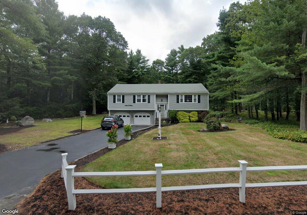
112 Heritage Way Hanover, MA 02339
Estimated Value: $635,000 - $792,000
4
Beds
2
Baths
1,488
Sq Ft
$475/Sq Ft
Est. Value
About This Home
This home is located at 112 Heritage Way, Hanover, MA 02339 and is currently estimated at $706,080, approximately $474 per square foot. 112 Heritage Way is a home located in Plymouth County with nearby schools including Hanover High School, Cadence Academy Preschool - Hanover, and The Master's Academy.
Ownership History
Date
Name
Owned For
Owner Type
Purchase Details
Closed on
Dec 29, 2020
Sold by
Edgar Patricia A and Edgar Robert J
Bought by
Edgar Ft
Current Estimated Value
Purchase Details
Closed on
Jul 13, 2007
Sold by
Edgar Robert J and Edgar Patricia A
Bought by
Edgar Robert J and Edgar Patricia A
Create a Home Valuation Report for This Property
The Home Valuation Report is an in-depth analysis detailing your home's value as well as a comparison with similar homes in the area
Home Values in the Area
Average Home Value in this Area
Purchase History
| Date | Buyer | Sale Price | Title Company |
|---|---|---|---|
| Edgar Ft | -- | None Available | |
| Edgar Robert J | -- | -- |
Source: Public Records
Mortgage History
| Date | Status | Borrower | Loan Amount |
|---|---|---|---|
| Previous Owner | Edgar Robert J | $215,000 | |
| Previous Owner | Edgar Robert J | $29,000 | |
| Previous Owner | Edgar Robert J | $32,425 |
Source: Public Records
Tax History
| Year | Tax Paid | Tax Assessment Tax Assessment Total Assessment is a certain percentage of the fair market value that is determined by local assessors to be the total taxable value of land and additions on the property. | Land | Improvement |
|---|---|---|---|---|
| 2025 | $8,146 | $659,600 | $323,600 | $336,000 |
| 2024 | $6,397 | $498,200 | $245,100 | $253,100 |
| 2023 | $6,721 | $498,200 | $245,100 | $253,100 |
| 2022 | $7,598 | $498,200 | $245,100 | $253,100 |
| 2021 | $7,322 | $448,400 | $222,800 | $225,600 |
| 2020 | $7,248 | $444,400 | $222,800 | $221,600 |
| 2019 | $6,776 | $412,900 | $222,800 | $190,100 |
| 2018 | $6,659 | $409,000 | $222,800 | $186,200 |
| 2015 | $6,173 | $382,200 | $229,200 | $153,000 |
Source: Public Records
Map
Nearby Homes
- 36 Grove St
- 250 Center St
- 51 Cervelli Farm Dr
- 37 Dr
- 23 Cervelli Farm Dr
- 38 Cervelli Farm Dr
- 9 Cervelli Farm Dr
- 95 Tecumseh Dr
- 114 Graham Hill Dr
- 35 Sproul Rd
- 62 Larchmont Ln
- 70 Bardin St
- 75 School St
- 561 Circuit St
- 180 Elm St
- 108 Waterford Dr
- 177 Dwelley St
- 339 State St
- 430 Brook Bend Rd
- 7 Farmside Dr