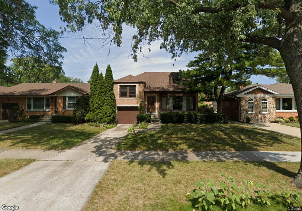
112 Imperial St Park Ridge, IL 60068
Estimated Value: $540,000 - $651,000
3
Beds
2
Baths
1,462
Sq Ft
$403/Sq Ft
Est. Value
About This Home
This home is located at 112 Imperial St, Park Ridge, IL 60068 and is currently estimated at $589,846, approximately $403 per square foot. 112 Imperial St is a home located in Cook County with nearby schools including Theodore Roosevelt Elementary School, Lincoln Middle School, and Maine South High School.
Ownership History
Date
Name
Owned For
Owner Type
Purchase Details
Closed on
Apr 15, 2025
Sold by
Susan F Mcgovern 2011 Revocable Trust and Michael F Mcgovern 2011 Revocable Trust
Bought by
Mcgovern Susan F and Mcgovern Michael F
Current Estimated Value
Purchase Details
Closed on
Dec 23, 2011
Sold by
Mcgovern Michael F and Mcgovern Susan Fox
Bought by
Revoca Mcgovern Michael F and Michael F Mcgovern 2011 Revocable Trust
Create a Home Valuation Report for This Property
The Home Valuation Report is an in-depth analysis detailing your home's value as well as a comparison with similar homes in the area
Home Values in the Area
Average Home Value in this Area
Purchase History
| Date | Buyer | Sale Price | Title Company |
|---|---|---|---|
| Mcgovern Susan F | -- | None Listed On Document | |
| Revoca Mcgovern Michael F | -- | None Available |
Source: Public Records
Tax History Compared to Growth
Tax History
| Year | Tax Paid | Tax Assessment Tax Assessment Total Assessment is a certain percentage of the fair market value that is determined by local assessors to be the total taxable value of land and additions on the property. | Land | Improvement |
|---|---|---|---|---|
| 2024 | $10,212 | $43,593 | $10,625 | $32,968 |
| 2023 | $10,362 | $46,000 | $10,625 | $35,375 |
| 2022 | $10,362 | $46,000 | $10,625 | $35,375 |
| 2021 | $6,509 | $27,396 | $6,562 | $20,834 |
| 2020 | $6,088 | $27,396 | $6,562 | $20,834 |
| 2019 | $6,005 | $31,450 | $6,562 | $24,888 |
| 2018 | $6,605 | $30,435 | $5,625 | $24,810 |
| 2017 | $6,462 | $30,435 | $5,625 | $24,810 |
| 2016 | $7,163 | $30,435 | $5,625 | $24,810 |
| 2015 | $9,037 | $31,922 | $4,687 | $27,235 |
| 2014 | $9,247 | $33,154 | $4,687 | $28,467 |
| 2013 | $8,742 | $33,154 | $4,687 | $28,467 |
Source: Public Records
Map
Nearby Homes
- 718 S Washington Ave
- 6815 N Olmsted Ave Unit 203
- 1021 Cleveland Ave
- 6852 N Northwest Hwy Unit 2B
- 6858 N Northwest Hwy Unit 2E
- 6841 N Northwest Hwy Unit 3C
- 400 S Northwest Hwy Unit 312B
- 460 S Northwest Hwy Unit 307A
- 6681 N Northwest Hwy
- 6919 N Overhill Ave
- 1220 Canfield Rd
- 249 S Vine Ave Unit B
- 623 S Prospect Ave
- 6625 N Northwest Hwy Unit 202
- 7039 N Ottawa Ave
- 301 S Prospect Ave
- 7101 N Ottawa Ave
- 6727 N Oketo Ave
- 1220 Courtland Ave
- 7425 W Devon Ave
- 108 Imperial St
- 116 Imperial St
- 104 Imperial St
- 120 Imperial St
- 115 Gillick St
- 119 Gillick St
- 126 Imperial St
- 100 Imperial St
- 111 Gillick St
- 121 Gillick St
- 107 Gillick St
- 115 Imperial St
- 111 Imperial St
- 119 Imperial St
- 18 Imperial St
- 127 Gillick St
- 103 Gillick St
- 105 Imperial St
- 123 Imperial St
- 103 Imperial St