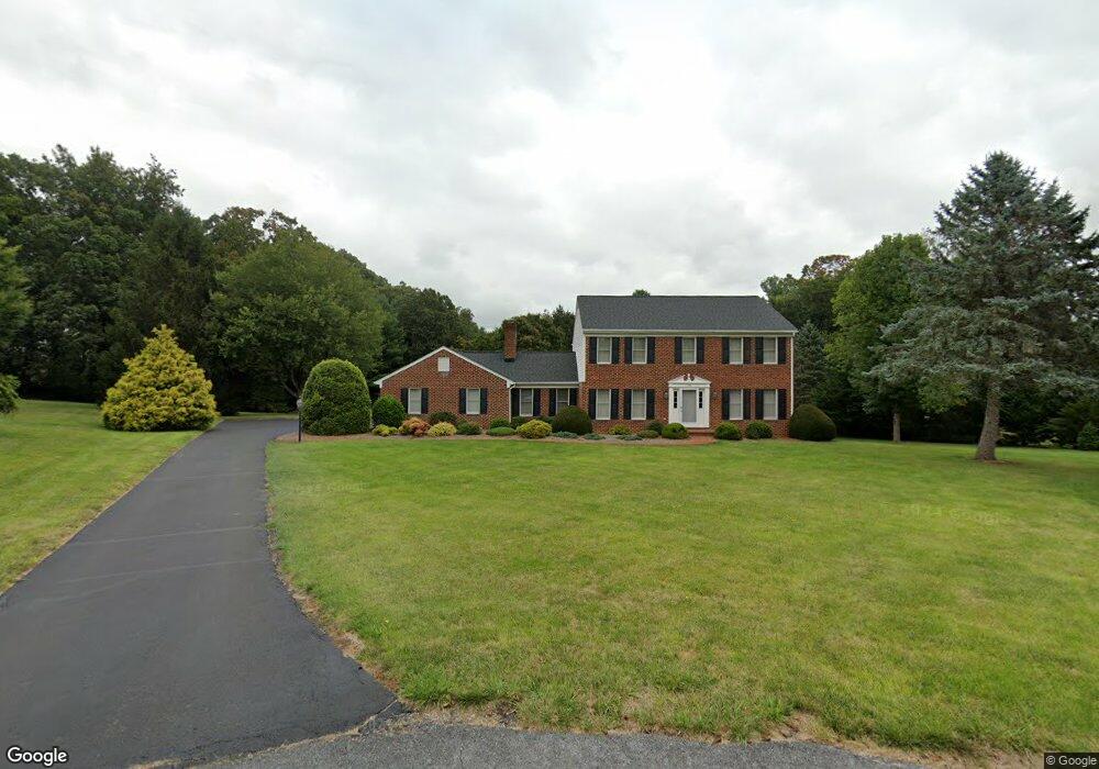
112 Lanchester Ct Waynesboro, VA 22980
Estimated Value: $488,000 - $551,000
3
Beds
3
Baths
2,707
Sq Ft
$191/Sq Ft
Est. Value
About This Home
This home is located at 112 Lanchester Ct, Waynesboro, VA 22980 and is currently estimated at $515,956, approximately $190 per square foot. 112 Lanchester Ct is a home located in Waynesboro City with nearby schools including Westwood Hills Elementary School, Kate Collins Middle School, and Waynesboro High School.
Ownership History
Date
Name
Owned For
Owner Type
Purchase Details
Closed on
Nov 1, 2023
Sold by
Obrien Michael H
Bought by
Obrien Stephen and Obrien Wendy
Current Estimated Value
Home Financials for this Owner
Home Financials are based on the most recent Mortgage that was taken out on this home.
Original Mortgage
$121,000
Outstanding Balance
$118,811
Interest Rate
7.31%
Mortgage Type
New Conventional
Estimated Equity
$397,145
Purchase Details
Closed on
Nov 1, 2021
Sold by
Obrien Michael H
Bought by
Estes Darren William and Estes Cassandra S
Create a Home Valuation Report for This Property
The Home Valuation Report is an in-depth analysis detailing your home's value as well as a comparison with similar homes in the area
Home Values in the Area
Average Home Value in this Area
Purchase History
| Date | Buyer | Sale Price | Title Company |
|---|---|---|---|
| Obrien Stephen | $412,000 | None Listed On Document | |
| Estes Darren William | $500 | None Listed On Document |
Source: Public Records
Mortgage History
| Date | Status | Borrower | Loan Amount |
|---|---|---|---|
| Open | Obrien Stephen | $121,000 |
Source: Public Records
Tax History Compared to Growth
Tax History
| Year | Tax Paid | Tax Assessment Tax Assessment Total Assessment is a certain percentage of the fair market value that is determined by local assessors to be the total taxable value of land and additions on the property. | Land | Improvement |
|---|---|---|---|---|
| 2025 | $4,104 | $500,500 | $89,500 | $411,000 |
| 2024 | $3,563 | $462,700 | $83,500 | $379,200 |
| 2023 | $3,563 | $462,700 | $83,500 | $379,200 |
| 2022 | $3,307 | $367,400 | $75,700 | $291,700 |
| 2021 | $3,307 | $367,400 | $75,700 | $291,700 |
| 2020 | $2,941 | $326,800 | $75,700 | $251,100 |
| 2019 | $2,941 | $326,800 | $75,700 | $251,100 |
| 2018 | $2,742 | $304,700 | $75,700 | $229,000 |
| 2017 | $2,651 | $304,700 | $75,700 | $229,000 |
| 2016 | $2,435 | $304,400 | $75,700 | $228,700 |
| 2015 | $2,435 | $304,400 | $75,700 | $228,700 |
| 2014 | -- | $331,500 | $94,700 | $236,800 |
| 2013 | -- | $0 | $0 | $0 |
Source: Public Records
Map
Nearby Homes
- 505 Pelham Dr
- 316 Lee Dr
- 2814 Jefferson Ln
- 201 Pelham Knolls Dr
- 515 Le Grande Ave
- 212 Princess Anne Rd
- 203 Pelham Dr
- 2404 Village Dr
- 2805 Village Dr
- 112 Kings Ct
- 116 Pelham Dr
- 757 Governors Way
- 1073 Pendleton Dr
- 2455 Mount Vernon St
- 912 Battery Rd
- 2418 Mount Vernon St
- 4 Ashleigh Dr
- 2548 Belvue Rd
- 159 Old White Bridge Rd
- 41 Ashleigh Dr
- 116 Lanchester Ct
- 108 Lanchester Ct
- 140 Pelham Woods Cir
- 417 Pelham Dr
- 104 Lanchester Ct
- 124 Huntington Place
- 120 Huntington Place
- 136 Pelham Woods Cir
- 144 Pelham Woods Cir
- 413 Pelham Dr
- 144 Pelham Woods Cir
- 421 Pelham Dr
- 128 Huntington Place
- 409 Pelham Dr
- 136 Huntington Place
- 132 Pelham Woods Cir
- 100 Huntington Place
- 425 Pelham Dr
- 132 Huntington Place
- 105 Pelham Woods Cir