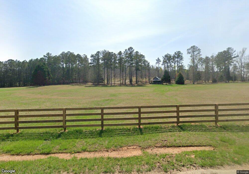
112 Lee Rd Unit TRACT 1 Cedartown, GA 30125
Estimated Value: $858,000 - $1,986,523
4
Beds
4
Baths
724
Sq Ft
$2,149/Sq Ft
Est. Value
About This Home
This home is located at 112 Lee Rd Unit TRACT 1, Cedartown, GA 30125 and is currently estimated at $1,556,174, approximately $2,149 per square foot. 112 Lee Rd Unit TRACT 1 is a home located in Polk County.
Ownership History
Date
Name
Owned For
Owner Type
Purchase Details
Closed on
Oct 23, 2025
Sold by
Cedar Valley Endeavors Llc
Bought by
Floyd Russell S
Current Estimated Value
Purchase Details
Closed on
Mar 14, 2023
Sold by
Robinson Drew
Bought by
Floyd Russell
Purchase Details
Closed on
Sep 5, 2014
Sold by
Lee Laurie S
Bought by
Robinson Joy and Robinson Drew
Home Financials for this Owner
Home Financials are based on the most recent Mortgage that was taken out on this home.
Original Mortgage
$960,000
Interest Rate
4.2%
Mortgage Type
New Conventional
Purchase Details
Closed on
Mar 26, 1998
Sold by
Lee Laurie S
Bought by
Lee Laurie S and Pierce Linda D
Purchase Details
Closed on
Mar 29, 1991
Sold by
Lindsey Gary W
Bought by
Lee Laurie S
Purchase Details
Closed on
Nov 21, 1988
Sold by
Davis John C and Davis Carol
Bought by
Lendsey Gary W
Create a Home Valuation Report for This Property
The Home Valuation Report is an in-depth analysis detailing your home's value as well as a comparison with similar homes in the area
Home Values in the Area
Average Home Value in this Area
Purchase History
| Date | Buyer | Sale Price | Title Company |
|---|---|---|---|
| Floyd Russell S | -- | -- | |
| Floyd Russell | $1,562,500 | -- | |
| Cedar Valley Endeavors Llc | -- | -- | |
| Robinson Joy | $970,000 | -- | |
| Lee Laurie S | $87,500 | -- | |
| Lee Laurie S | $30,000 | -- | |
| Lendsey Gary W | $25,800 | -- |
Source: Public Records
Mortgage History
| Date | Status | Borrower | Loan Amount |
|---|---|---|---|
| Previous Owner | Robinson Joy | $960,000 |
Source: Public Records
Tax History Compared to Growth
Tax History
| Year | Tax Paid | Tax Assessment Tax Assessment Total Assessment is a certain percentage of the fair market value that is determined by local assessors to be the total taxable value of land and additions on the property. | Land | Improvement |
|---|---|---|---|---|
| 2024 | $17,314 | $876,361 | $77,041 | $799,320 |
| 2023 | $10,331 | $437,334 | $34,620 | $402,714 |
| 2022 | $9,019 | $382,030 | $23,080 | $358,950 |
| 2021 | $9,136 | $382,030 | $23,080 | $358,950 |
| 2020 | $7,971 | $332,897 | $23,080 | $309,817 |
| 2019 | $10,095 | $377,901 | $23,080 | $354,821 |
| 2018 | $10,293 | $375,553 | $23,080 | $352,473 |
| 2017 | $10,165 | $375,553 | $23,080 | $352,473 |
| 2016 | $10,296 | $380,362 | $27,889 | $352,473 |
| 2015 | $10,531 | $387,843 | $27,889 | $359,954 |
| 2014 | $10,608 | $387,843 | $27,889 | $359,954 |
Source: Public Records
Map
Nearby Homes
- 176 Runyon Loop
- 1838 Antioch Rd
- 4267 Buchanan Hwy
- 0 Runyon Loop Unit 10606366
- 0 Runyon Loop Unit 7650113
- 258 Rainey Lake Rd
- 1912 Hightower Rd
- 296 Winkle Rd
- 0 Mckibben Rd Unit 7665027
- 0 Mckibben Rd Unit 210
- 0 Mckibben Rd Unit 10623982
- 0 Youngs Farm Rd Unit 24829378
- 4550 Buchanan Hwy
- 0 Buchanan Hwy Unit 10558945
- 160 Tate Rd
- 102 acres Youngs Farm Rd
- 7474 Highway 27
- 45 York Cir
- 487 Grogan Rd
- 0 Everett Mtn Rd
