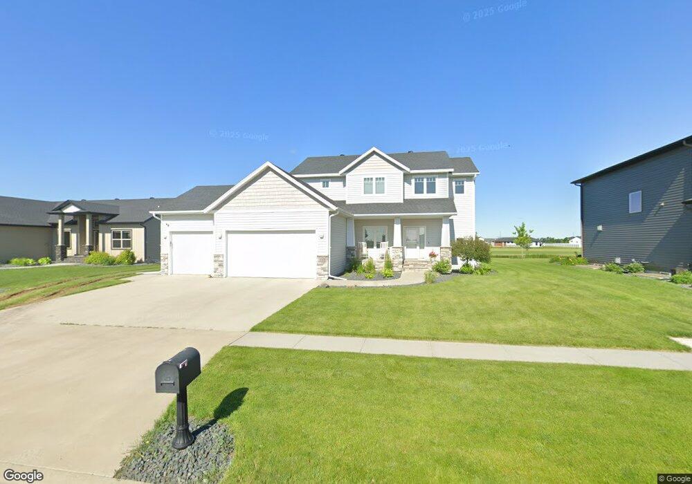
112 Lindsey Ct Mapleton, ND 58059
Estimated Value: $505,913 - $594,000
4
Beds
2
Baths
2,358
Sq Ft
$234/Sq Ft
Est. Value
About This Home
This home is located at 112 Lindsey Ct, Mapleton, ND 58059 and is currently estimated at $551,478, approximately $233 per square foot. 112 Lindsey Ct is a home with nearby schools including Mapleton Elementary School.
Ownership History
Date
Name
Owned For
Owner Type
Purchase Details
Closed on
Dec 18, 2015
Sold by
Monarch Homes Llc
Bought by
Stock Reed and Stock Brittany
Current Estimated Value
Home Financials for this Owner
Home Financials are based on the most recent Mortgage that was taken out on this home.
Original Mortgage
$353,400
Interest Rate
3.88%
Mortgage Type
New Conventional
Create a Home Valuation Report for This Property
The Home Valuation Report is an in-depth analysis detailing your home's value as well as a comparison with similar homes in the area
Purchase History
| Date | Buyer | Sale Price | Title Company |
|---|---|---|---|
| Stock Reed | $379,751 | Title Co |
Source: Public Records
Mortgage History
| Date | Status | Borrower | Loan Amount |
|---|---|---|---|
| Previous Owner | Stock Reed | $353,400 |
Source: Public Records
Tax History
| Year | Tax Paid | Tax Assessment Tax Assessment Total Assessment is a certain percentage of the fair market value that is determined by local assessors to be the total taxable value of land and additions on the property. | Land | Improvement |
|---|---|---|---|---|
| 2024 | $8,202 | $233,300 | $36,700 | $196,600 |
| 2023 | $8,494 | $227,050 | $36,700 | $190,350 |
| 2022 | $7,709 | $210,550 | $36,700 | $173,850 |
| 2021 | $7,397 | $195,100 | $29,850 | $165,250 |
| 2020 | $7,286 | $193,100 | $29,850 | $163,250 |
| 2019 | $7,591 | $193,100 | $29,850 | $163,250 |
| 2018 | $7,642 | $189,850 | $29,850 | $160,000 |
| 2017 | $7,577 | $187,400 | $29,850 | $157,550 |
| 2016 | $4,517 | $91,350 | $20,800 | $70,550 |
| 2015 | $3,181 | $19,250 | $19,250 | $0 |
| 2014 | $2,905 | $200 | $200 | $0 |
| 2013 | $2,974 | $150 | $150 | $0 |
Source: Public Records
Map
Nearby Homes
- 114 Lindsey Ct
- 110 Lindsey Ct
- 108 Lindsey Ct
- 106 Lindsey Ct
- 118 Lindsey Ct
- 229 Emma Ct
- 104 Lindsey Ct
- 101 Annie's Way
- 211 Emma Ct
- 217 Emma Ct
- 103 Sunrise Dr
- 103 Annie's Way
- 103 Annies Way
- 62601 626 Falcon St Unit 1
- 62602 626 Falcon St Unit 2
- 626 Falcon St Unit 1
- 626 Falcon St Unit 2
- 102 Annie's Way
- 651 Christensen Ct
- 100 Sunrise Dr
Your Personal Tour Guide
Ask me questions while you tour the home.