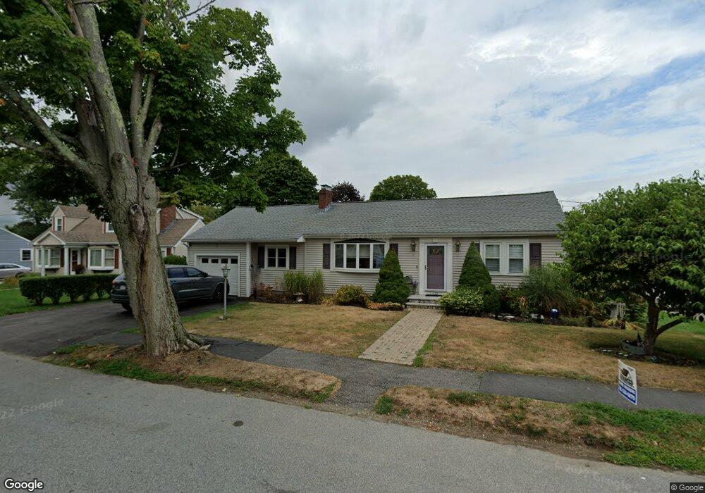
112 Longfellow Rd Waltham, MA 02453
Warrendale NeighborhoodEstimated Value: $910,000 - $1,051,000
4
Beds
3
Baths
2,058
Sq Ft
$474/Sq Ft
Est. Value
About This Home
This home is located at 112 Longfellow Rd, Waltham, MA 02453 and is currently estimated at $975,743, approximately $474 per square foot. 112 Longfellow Rd is a home located in Middlesex County with nearby schools including James Fitzgerald Elementary School, John W. Mcdevitt Middle School, and Waltham Sr High School.
Ownership History
Date
Name
Owned For
Owner Type
Purchase Details
Closed on
May 15, 2007
Sold by
Alegria C Elise
Bought by
Mullaney Anne T
Current Estimated Value
Home Financials for this Owner
Home Financials are based on the most recent Mortgage that was taken out on this home.
Original Mortgage
$320,000
Outstanding Balance
$195,071
Interest Rate
6.21%
Mortgage Type
Purchase Money Mortgage
Estimated Equity
$780,672
Purchase Details
Closed on
Apr 25, 2007
Sold by
Nessolini Ft
Bought by
Alegria C Elise
Home Financials for this Owner
Home Financials are based on the most recent Mortgage that was taken out on this home.
Original Mortgage
$320,000
Outstanding Balance
$195,071
Interest Rate
6.21%
Mortgage Type
Purchase Money Mortgage
Estimated Equity
$780,672
Purchase Details
Closed on
Aug 26, 2003
Sold by
Alergria C Elise
Bought by
Alergria Paul A
Create a Home Valuation Report for This Property
The Home Valuation Report is an in-depth analysis detailing your home's value as well as a comparison with similar homes in the area
Home Values in the Area
Average Home Value in this Area
Purchase History
| Date | Buyer | Sale Price | Title Company |
|---|---|---|---|
| Mullaney Anne T | $400,000 | -- | |
| Alegria C Elise | -- | -- | |
| Alergria Paul A | -- | -- | |
| Alegria C Elise | -- | -- |
Source: Public Records
Mortgage History
| Date | Status | Borrower | Loan Amount |
|---|---|---|---|
| Open | Mullaney Anne T | $320,000 |
Source: Public Records
Tax History Compared to Growth
Tax History
| Year | Tax Paid | Tax Assessment Tax Assessment Total Assessment is a certain percentage of the fair market value that is determined by local assessors to be the total taxable value of land and additions on the property. | Land | Improvement |
|---|---|---|---|---|
| 2025 | $7,242 | $737,500 | $465,000 | $272,500 |
| 2024 | $6,854 | $711,000 | $442,500 | $268,500 |
| 2023 | $6,970 | $675,400 | $420,000 | $255,400 |
| 2022 | $7,083 | $635,800 | $390,000 | $245,800 |
| 2021 | $14,724 | $620,600 | $390,000 | $230,600 |
| 2020 | $6,843 | $572,600 | $360,000 | $212,600 |
| 2019 | $6,803 | $537,400 | $352,400 | $185,000 |
| 2018 | $12,235 | $490,600 | $326,300 | $164,300 |
| 2017 | $5,785 | $460,600 | $296,300 | $164,300 |
| 2016 | $5,132 | $419,300 | $255,000 | $164,300 |
| 2015 | $4,995 | $380,400 | $225,000 | $155,400 |
Source: Public Records
Map
Nearby Homes
- 71 Gleason St
- 78 Barbara Rd Unit 1
- 21 Warren St Unit 2-4
- 5 Chapman St
- 63-65 Evans St
- 253 Sycamore St Unit 253
- 38 Carey Ave Unit 3
- 38 Carey Ave Unit 6
- 20 Rosedale Rd
- 186 Lexington St Unit 8
- 59 Farnum Rd
- 109 A Lexington St
- 27 Oakland St
- 57 Pierce Rd Unit 57
- 51 Harrington St Unit 51
- 51 Harrington St Unit 53
- 27-29 Edenfield Ave
- 172 Westminster Ave Unit 1
- 164 Grove St
- 290 Pleasant St Unit 220
- 118 Longfellow Rd
- 106 Longfellow Rd
- 123 Whitman Rd
- 117 Whitman Rd
- 127 Whitman Rd
- 124 Longfellow Rd
- 113 Longfellow Rd
- 100 Longfellow Rd
- 107 Longfellow Rd
- 111 Whitman Rd
- 119 Longfellow Rd
- 133 Whitman Rd
- 101 Longfellow Rd
- 103 Whitman Rd
- 130 Longfellow Rd
- 123 Longfellow Rd
- 139 Whitman Rd
- 92 Longfellow Rd
- 114 Whitman Rd
- 91 Longfellow Rd