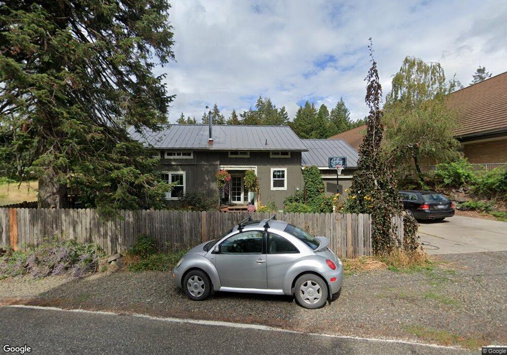
112 Loop Rd Stevenson, WA 98648
Estimated Value: $437,819 - $554,000
7
Beds
3
Baths
3,651
Sq Ft
$140/Sq Ft
Est. Value
About This Home
This home is located at 112 Loop Rd, Stevenson, WA 98648 and is currently estimated at $512,455, approximately $140 per square foot. 112 Loop Rd is a home located in Skamania County with nearby schools including Stevenson Elementary School, Carson Elementary School, and Wind River Middle School.
Ownership History
Date
Name
Owned For
Owner Type
Purchase Details
Closed on
Sep 23, 2009
Sold by
Deutsche Bank National Trust Co
Bought by
Cooper David R and Cooper Petra R
Current Estimated Value
Home Financials for this Owner
Home Financials are based on the most recent Mortgage that was taken out on this home.
Original Mortgage
$138,969
Outstanding Balance
$91,162
Interest Rate
5.25%
Mortgage Type
New Conventional
Estimated Equity
$421,293
Purchase Details
Closed on
Jan 2, 2009
Sold by
Jamison David A
Bought by
Americas Moneyline Inc
Create a Home Valuation Report for This Property
The Home Valuation Report is an in-depth analysis detailing your home's value as well as a comparison with similar homes in the area
Purchase History
| Date | Buyer | Sale Price | Title Company |
|---|---|---|---|
| Cooper David R | $136,191 | Skamania County Title Compan | |
| Americas Moneyline Inc | $127,500 | Multiple |
Source: Public Records
Mortgage History
| Date | Status | Borrower | Loan Amount |
|---|---|---|---|
| Open | Cooper David R | $138,969 |
Source: Public Records
Tax History
| Year | Tax Paid | Tax Assessment Tax Assessment Total Assessment is a certain percentage of the fair market value that is determined by local assessors to be the total taxable value of land and additions on the property. | Land | Improvement |
|---|---|---|---|---|
| 2025 | $3,054 | $369,200 | $123,000 | $246,200 |
| 2024 | $2,964 | $347,900 | $115,000 | $232,900 |
| 2023 | $2,783 | $307,000 | $100,000 | $207,000 |
| 2022 | $2,765 | $269,800 | $80,000 | $189,800 |
| 2021 | $2,574 | $180,100 | $80,000 | $100,100 |
| 2020 | $1,903 | $180,100 | $80,000 | $100,100 |
| 2019 | $1,443 | $149,000 | $70,000 | $79,000 |
| 2018 | $1,582 | $144,000 | $65,000 | $79,000 |
| 2017 | $1,219 | $136,800 | $65,000 | $71,800 |
| 2015 | $1,375 | $136,800 | $65,000 | $71,800 |
| 2013 | -- | $135,000 | $65,000 | $70,000 |
Source: Public Records
Map
Nearby Homes
- 1010 NW Still Cove Ln
- 79 NW Lasher St
- 960 NW Angel Heights Rd
- 438 NW Roselawn St
- 403 NW Roselawn St
- 41 NW Lasher St Unit C4
- 189 NW Falcon Ct
- 0 School St Unit 761845716
- 000 NW School (Lot 2 Land) Rd Unit 2
- 541 NW Vancouver Ave
- 0 E Loop Rd Unit 751523806
- 1090 SW Briggs St
- 22 Venado Trail
- 72 Brunning Rd
- 1225 SW Ryan Allen Rd
- 145 NE Upper Basso Cir
- 147 NE Bruce Heights
- 344 Lutheran Church Rd
- 151 Lower Basso Cir
- 243 NE Hemmingway Dr
Your Personal Tour Guide
Ask me questions while you tour the home.