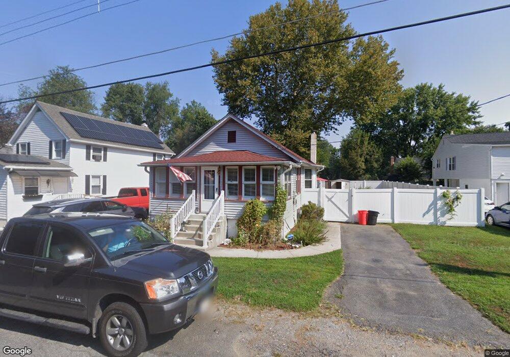
112 Main St Deepwater, NJ 08023
Estimated Value: $132,000 - $183,000
--
Bed
--
Bath
872
Sq Ft
$174/Sq Ft
Est. Value
About This Home
This home is located at 112 Main St, Deepwater, NJ 08023 and is currently estimated at $152,080, approximately $174 per square foot. 112 Main St is a home located in Salem County with nearby schools including Lafayette-Pershing Elementary School, Paul W. Carleton Elementary School, and Field Street Elementary School.
Ownership History
Date
Name
Owned For
Owner Type
Purchase Details
Closed on
Jan 3, 2024
Sold by
Bondiskey Carol A
Bought by
Richman Bryson and Dodd David
Current Estimated Value
Home Financials for this Owner
Home Financials are based on the most recent Mortgage that was taken out on this home.
Original Mortgage
$95,243
Outstanding Balance
$93,681
Interest Rate
7.29%
Mortgage Type
FHA
Estimated Equity
$58,399
Purchase Details
Closed on
Jun 28, 2007
Sold by
Laperriere Barbara J and Laperriere Thomas A
Bought by
Robinson Walter and Robinson Clara
Create a Home Valuation Report for This Property
The Home Valuation Report is an in-depth analysis detailing your home's value as well as a comparison with similar homes in the area
Home Values in the Area
Average Home Value in this Area
Purchase History
| Date | Buyer | Sale Price | Title Company |
|---|---|---|---|
| Richman Bryson | $97,000 | None Listed On Document | |
| Robinson Walter | $60,000 | -- |
Source: Public Records
Mortgage History
| Date | Status | Borrower | Loan Amount |
|---|---|---|---|
| Open | Richman Bryson | $95,243 |
Source: Public Records
Tax History Compared to Growth
Tax History
| Year | Tax Paid | Tax Assessment Tax Assessment Total Assessment is a certain percentage of the fair market value that is determined by local assessors to be the total taxable value of land and additions on the property. | Land | Improvement |
|---|---|---|---|---|
| 2025 | $3,587 | $143,600 | $40,000 | $103,600 |
| 2024 | $3,214 | $97,300 | $19,600 | $77,700 |
| 2023 | $3,214 | $97,300 | $19,600 | $77,700 |
| 2022 | $3,010 | $97,300 | $19,600 | $77,700 |
| 2021 | $2,978 | $97,300 | $19,600 | $77,700 |
| 2020 | $3,257 | $97,300 | $19,600 | $77,700 |
| 2019 | $3,284 | $97,300 | $19,600 | $77,700 |
| 2018 | $3,606 | $114,500 | $23,000 | $91,500 |
| 2017 | $3,362 | $114,500 | $23,000 | $91,500 |
| 2016 | $3,239 | $114,500 | $23,000 | $91,500 |
| 2015 | $3,088 | $114,500 | $23,000 | $91,500 |
| 2014 | $2,923 | $114,500 | $23,000 | $91,500 |
Source: Public Records
Map
Nearby Homes
- 12 Chester Ave
- 62 Penns Ave
- 16 Pine St
- 5 Harrison St
- 40 Filmore St
- 239 Pin Oak Dr
- 94 White Oak Dr
- 604 Hawks Bridge Rd
- 1 Victory Ave Unit 84
- 1 Victory Ave Unit 82
- 1 Victory Ave Unit 74
- 1 Victory Ave Unit 72
- 1 Victory Ave Unit 8
- 1 Victory Ave Unit 93
- 1 Victory Ave
- 1 Victory Ave Unit 56
- 1 Victory Ave Unit 22
- 609 Hawks Bridge Rd
- 613 Soders Rd
- 613 Hawks Bridge Rd