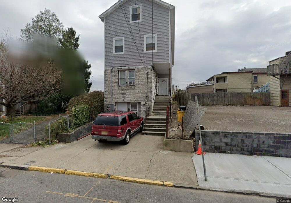
112 Maple St Paterson, NJ 07522
Totowa Section NeighborhoodEstimated Value: $345,000 - $507,000
--
Bed
--
Bath
740
Sq Ft
$544/Sq Ft
Est. Value
About This Home
This home is located at 112 Maple St, Paterson, NJ 07522 and is currently estimated at $402,729, approximately $544 per square foot. 112 Maple St is a home located in Passaic County with nearby schools including Dale Avenue Elementary School, Edward W. Kilpatrick School of Discovery, and Paterson Public School No. 5.
Ownership History
Date
Name
Owned For
Owner Type
Purchase Details
Closed on
Oct 23, 2023
Sold by
Hayath Hldg Ltd Liability Co
Bought by
Hayath Holding 112 Llc
Current Estimated Value
Purchase Details
Closed on
Mar 27, 2019
Sold by
Ahmed Mohammed H and Jusmin Shamsun
Bought by
Hayath Holdings Ltd Liability Co
Home Financials for this Owner
Home Financials are based on the most recent Mortgage that was taken out on this home.
Original Mortgage
$258,000
Interest Rate
4.3%
Mortgage Type
Commercial
Purchase Details
Closed on
Dec 9, 2009
Sold by
Dodick Helen C and Castaldi Robert
Bought by
Ahmed Mohammed H and Jusmin Shamsun
Home Financials for this Owner
Home Financials are based on the most recent Mortgage that was taken out on this home.
Original Mortgage
$78,551
Interest Rate
4.92%
Mortgage Type
FHA
Create a Home Valuation Report for This Property
The Home Valuation Report is an in-depth analysis detailing your home's value as well as a comparison with similar homes in the area
Home Values in the Area
Average Home Value in this Area
Purchase History
| Date | Buyer | Sale Price | Title Company |
|---|---|---|---|
| Hayath Holding 112 Llc | -- | None Listed On Document | |
| Hayath Holding 112 Llc | -- | None Listed On Document | |
| Hayath Holdings Ltd Liability Co | $160,000 | 1St Rate Ttl & Setmnt Svcs L | |
| Ahmed Mohammed H | $80,000 | -- |
Source: Public Records
Mortgage History
| Date | Status | Borrower | Loan Amount |
|---|---|---|---|
| Previous Owner | Hayath Holdings Ltd Liability Co | $258,000 | |
| Previous Owner | Ahmed Mohammed H | $78,551 |
Source: Public Records
Tax History Compared to Growth
Tax History
| Year | Tax Paid | Tax Assessment Tax Assessment Total Assessment is a certain percentage of the fair market value that is determined by local assessors to be the total taxable value of land and additions on the property. | Land | Improvement |
|---|---|---|---|---|
| 2025 | $7,286 | $143,000 | $44,400 | $98,600 |
| 2024 | $7,011 | $143,000 | $44,400 | $98,600 |
| 2022 | $6,638 | $143,000 | $44,400 | $98,600 |
| 2021 | $6,401 | $143,000 | $44,400 | $98,600 |
| 2020 | $5,970 | $143,000 | $44,400 | $98,600 |
| 2019 | $4,647 | $112,400 | $41,100 | $71,300 |
| 2018 | $4,633 | $107,100 | $40,700 | $66,400 |
| 2017 | $4,422 | $106,300 | $40,400 | $65,900 |
| 2016 | $4,864 | $112,100 | $42,500 | $69,600 |
| 2015 | $4,605 | $112,100 | $42,500 | $69,600 |
| 2014 | $5,220 | $180,000 | $102,100 | $77,900 |
Source: Public Records
Map
Nearby Homes
- 241 Liberty St
- 371 Totowa Ave Unit 373
- 72-74 Maple St
- 63 Front St
- 288 Totowa Ave
- 41-43 Paterson Ave
- 48 Jasper St
- 195 Preakness Ave
- 94 Manchester Ave
- 19 Market St Unit 405
- 25-27 Rossiter Ave
- 18 Market St Unit 301
- 25 Rossiter Ave Unit 27
- 194-196 Union Ave
- 105 Marion St Unit 18
- 100 Albion Ave
- 22 Cianci St
- 111 Marion St Unit 18
- 53-55 Henderson St
- 53 Henderson St Unit 55
- 114 Maple St Unit 116
- 34 Paterson Ave Unit 36
- 32 Paterson Ave
- 34-36 Paterson Ave
- 26 Paterson Ave
- 97-99 Birch St
- 42 Paterson Ave
- 118 Maple St Unit 120
- 51 Ryle Ave
- 97 Birch St Unit 99
- 101 Birch St Unit 105
- 115 Maple St
- 113 Maple St Unit 115
- 111 Maple St
- 117-121 Maple St
- 117 Maple St Unit 121
- 122 Maple St
- 107 Birch St Unit 109
- 111 Birch St Unit 113
- 124 Maple St