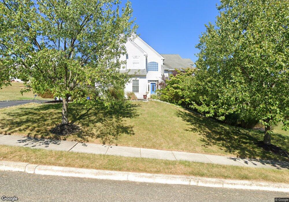
112 Mclaughlin Dr Aston, PA 19014
Estimated Value: $638,000 - $854,000
5
Beds
4
Baths
4,285
Sq Ft
$176/Sq Ft
Est. Value
About This Home
This home is located at 112 Mclaughlin Dr, Aston, PA 19014 and is currently estimated at $756,044, approximately $176 per square foot. 112 Mclaughlin Dr is a home located in Delaware County with nearby schools including St. Thomas Apostle School.
Ownership History
Date
Name
Owned For
Owner Type
Purchase Details
Closed on
Jun 11, 2003
Sold by
Baker Residential Of Pennsylvania Llc
Bought by
Palmarini Giuseppe and Palmarini Lisa
Current Estimated Value
Home Financials for this Owner
Home Financials are based on the most recent Mortgage that was taken out on this home.
Original Mortgage
$298,000
Outstanding Balance
$129,875
Interest Rate
5.71%
Mortgage Type
Purchase Money Mortgage
Estimated Equity
$626,169
Create a Home Valuation Report for This Property
The Home Valuation Report is an in-depth analysis detailing your home's value as well as a comparison with similar homes in the area
Home Values in the Area
Average Home Value in this Area
Purchase History
| Date | Buyer | Sale Price | Title Company |
|---|---|---|---|
| Palmarini Giuseppe | $372,570 | Commonwealth Land Title Insu |
Source: Public Records
Mortgage History
| Date | Status | Borrower | Loan Amount |
|---|---|---|---|
| Open | Palmarini Giuseppe | $298,000 |
Source: Public Records
Tax History Compared to Growth
Tax History
| Year | Tax Paid | Tax Assessment Tax Assessment Total Assessment is a certain percentage of the fair market value that is determined by local assessors to be the total taxable value of land and additions on the property. | Land | Improvement |
|---|---|---|---|---|
| 2025 | $13,568 | $522,870 | $83,440 | $439,430 |
| 2024 | $13,568 | $522,870 | $83,440 | $439,430 |
| 2023 | $12,960 | $522,870 | $83,440 | $439,430 |
| 2022 | $12,497 | $522,870 | $83,440 | $439,430 |
| 2021 | $19,285 | $522,870 | $83,440 | $439,430 |
| 2020 | $11,548 | $282,755 | $62,960 | $219,795 |
| 2019 | $11,327 | $282,755 | $62,960 | $219,795 |
| 2018 | $10,846 | $282,755 | $0 | $0 |
| 2017 | $10,616 | $282,755 | $0 | $0 |
| 2016 | $1,552 | $282,755 | $0 | $0 |
| 2015 | $1,552 | $282,755 | $0 | $0 |
| 2014 | $1,552 | $282,755 | $0 | $0 |
Source: Public Records
Map
Nearby Homes
- 21 Hoag Ln
- 21 Eusden Dr
- 220 Spring Valley Way
- 505 Schick Rd
- 214 Bishop Dr
- 213 Bishop Dr
- 198 Bishop Dr
- 103 Valleybrook Rd
- 305 Crozerville Rd
- 3 Rolling Heights Ln
- 108 Grace Ln
- 2370 Crestview Ln
- 887 Red Hill Rd
- 190 Lake Dr
- 268 Miley Rd Unit 268
- 346 Lenni Rd
- 216 Park Dr
- 8 Travelo Ln
- 2300 Overlook Dr
- 440 Derry Dr Unit 440
- 114 Mclaughlin Dr
- 110 Mclaughlin Dr
- 111 Mclaughlin Dr
- 109 Mclaughlin Dr
- 113 Mclaughlin Dr
- 116 Mclaughlin Dr
- 115 Mclaughlin Dr
- 107 Mclaughlin Dr
- 108 Mclaughlin Dr
- 105 Mclaughlin Dr
- 117 Mclaughlin Dr
- 119 Mclaughlin Dr
- 103 Mclaughlin Dr
- 118 Mclaughlin Dr
- 121 Mclaughlin Dr
- 106 Mclaughlin Dr
- 123 Mclaughlin Dr
- 800 Birney Hwy
- 4801 Birney Hwy
- 101 Mclaughlin Dr