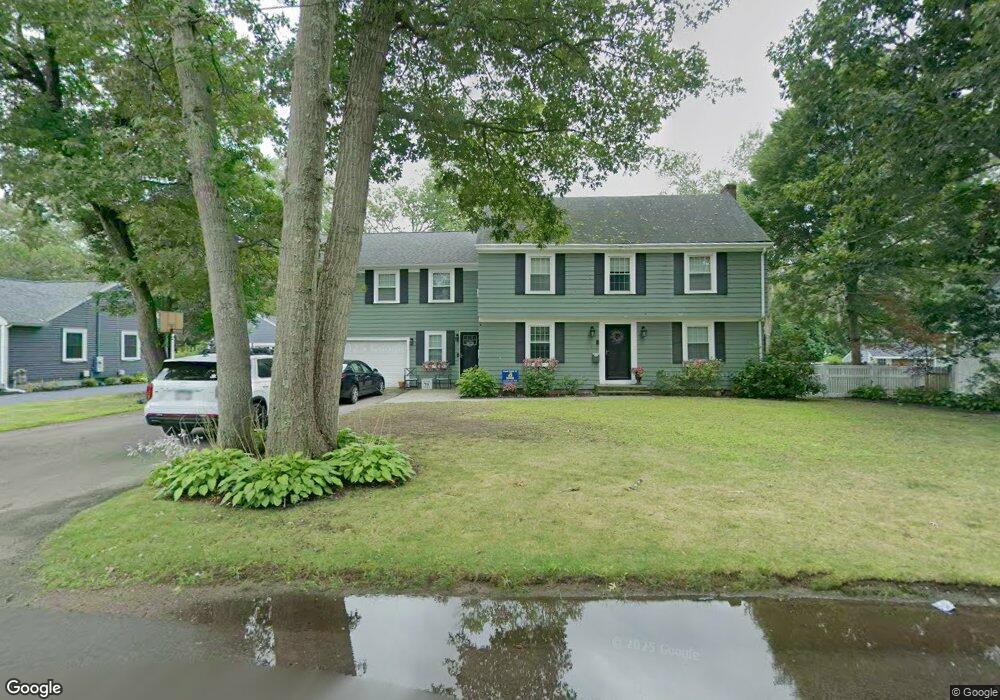
112 Metcalf Rd North Attleboro, MA 02760
North Attleboro NeighborhoodEstimated Value: $587,000 - $756,000
3
Beds
2
Baths
1,658
Sq Ft
$414/Sq Ft
Est. Value
About This Home
This home is located at 112 Metcalf Rd, North Attleboro, MA 02760 and is currently estimated at $685,778, approximately $413 per square foot. 112 Metcalf Rd is a home located in Bristol County with nearby schools including North Attleboro High School, Cadence Academy Preschool - North Attleborough, and Bishop Feehan High School.
Ownership History
Date
Name
Owned For
Owner Type
Purchase Details
Closed on
Feb 28, 2022
Sold by
Charpenter Alfred P and Charpenter Michelle J
Bought by
Charpentier Ft
Current Estimated Value
Purchase Details
Closed on
Jul 15, 2005
Sold by
Sutherland John M and Lombardi Dante C
Bought by
Charpentier Alfred P and Charpentier Michelle J
Home Financials for this Owner
Home Financials are based on the most recent Mortgage that was taken out on this home.
Original Mortgage
$324,950
Interest Rate
5.67%
Mortgage Type
Purchase Money Mortgage
Create a Home Valuation Report for This Property
The Home Valuation Report is an in-depth analysis detailing your home's value as well as a comparison with similar homes in the area
Home Values in the Area
Average Home Value in this Area
Purchase History
| Date | Buyer | Sale Price | Title Company |
|---|---|---|---|
| Charpentier Ft | -- | None Available | |
| Charpentier Alfred P | $335,000 | -- |
Source: Public Records
Mortgage History
| Date | Status | Borrower | Loan Amount |
|---|---|---|---|
| Previous Owner | Charpentier Alfred P | $324,950 |
Source: Public Records
Tax History Compared to Growth
Tax History
| Year | Tax Paid | Tax Assessment Tax Assessment Total Assessment is a certain percentage of the fair market value that is determined by local assessors to be the total taxable value of land and additions on the property. | Land | Improvement |
|---|---|---|---|---|
| 2025 | $7,002 | $593,900 | $145,000 | $448,900 |
| 2024 | $6,978 | $604,700 | $145,000 | $459,700 |
| 2023 | $6,932 | $542,000 | $151,300 | $390,700 |
| 2022 | $6,447 | $462,800 | $145,000 | $317,800 |
| 2021 | $6,116 | $428,600 | $145,000 | $283,600 |
| 2020 | $6,031 | $420,300 | $145,000 | $275,300 |
| 2019 | $5,797 | $407,100 | $131,800 | $275,300 |
| 2018 | $5,212 | $390,700 | $131,800 | $258,900 |
| 2017 | $5,062 | $382,900 | $131,800 | $251,100 |
| 2016 | $4,954 | $374,700 | $152,800 | $221,900 |
| 2015 | $4,833 | $367,800 | $159,200 | $208,600 |
| 2014 | $4,611 | $348,300 | $139,700 | $208,600 |
Source: Public Records
Map
Nearby Homes
- 50 Metcalf Rd
- 19 Metcalf Cir
- 80 Broadway Unit 9
- 160 Crescent Ave
- 0 Anawan Rd
- 40 Sperry Ln
- 30 Sperry Ln Unit Lot 15
- 334 S Washington St
- 33 Ash St
- 151 Roosevelt Ave Unit A
- 130 E Washington St Unit 84
- 130 E Washington St Unit 71
- 49 Hoppin Hill Ave
- 60 Crescent Ave
- 25 Gregory Way
- 16 Johnson St
- 12 Roosevelt Ave
- 300 E Washington St Unit 4M
- 300 E Washington St Unit 54R
- 121 E Washington St Unit 13
- 104 Metcalf Rd
- 120 Metcalf Rd
- 91 Sutherland Rd
- 83 Sutherland Rd
- 97 Sutherland Rd
- 113 Metcalf Rd
- 8 Hillside Rd
- 96 Metcalf Rd
- 128 Metcalf Rd
- 121 Metcalf Rd
- 109 Sutherland Rd
- 91 Metcalf Rd
- 88 Metcalf Rd
- 136 Metcalf Rd
- 16 Hillside Rd
- 88 Sutherland Rd
- 65 Sutherland Rd
- 17 Pine Rd
- 165 Anawan Rd
- 96 Sutherland Rd