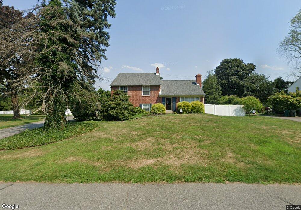
112 Michaels Ln Wallingford, PA 19086
Estimated Value: $507,643 - $601,000
4
Beds
2
Baths
1,879
Sq Ft
$297/Sq Ft
Est. Value
About This Home
This home is located at 112 Michaels Ln, Wallingford, PA 19086 and is currently estimated at $558,911, approximately $297 per square foot. 112 Michaels Ln is a home located in Delaware County with nearby schools including Swarthmore-Rutledge School, Strath Haven Middle School, and Strath Haven High School.
Ownership History
Date
Name
Owned For
Owner Type
Purchase Details
Closed on
Jun 30, 2010
Sold by
Marion Deborah L
Bought by
Louis and Louis Lynnsey
Current Estimated Value
Home Financials for this Owner
Home Financials are based on the most recent Mortgage that was taken out on this home.
Original Mortgage
$266,412
Outstanding Balance
$178,357
Interest Rate
4.87%
Mortgage Type
FHA
Estimated Equity
$380,554
Purchase Details
Closed on
Feb 2, 2001
Sold by
Shank Catherine A
Bought by
Shank Michael K and Moore Jeanne B
Create a Home Valuation Report for This Property
The Home Valuation Report is an in-depth analysis detailing your home's value as well as a comparison with similar homes in the area
Home Values in the Area
Average Home Value in this Area
Purchase History
| Date | Buyer | Sale Price | Title Company |
|---|---|---|---|
| Louis | $270,000 | None Available | |
| Shank Michael K | -- | -- |
Source: Public Records
Mortgage History
| Date | Status | Borrower | Loan Amount |
|---|---|---|---|
| Open | Louis | $266,412 |
Source: Public Records
Tax History
| Year | Tax Paid | Tax Assessment Tax Assessment Total Assessment is a certain percentage of the fair market value that is determined by local assessors to be the total taxable value of land and additions on the property. | Land | Improvement |
|---|---|---|---|---|
| 2025 | $10,802 | $302,990 | $109,430 | $193,560 |
| 2024 | $10,802 | $302,990 | $109,430 | $193,560 |
| 2023 | $10,379 | $302,990 | $109,430 | $193,560 |
| 2022 | $10,159 | $302,990 | $109,430 | $193,560 |
| 2021 | $16,504 | $302,990 | $109,430 | $193,560 |
| 2020 | $8,826 | $152,310 | $59,550 | $92,760 |
| 2019 | $8,583 | $152,310 | $59,550 | $92,760 |
| 2018 | $8,416 | $152,310 | $0 | $0 |
| 2017 | $8,185 | $152,310 | $0 | $0 |
| 2016 | $836 | $152,310 | $0 | $0 |
| 2015 | $836 | $152,310 | $0 | $0 |
| 2014 | $836 | $152,310 | $0 | $0 |
Source: Public Records
Map
Nearby Homes
- 302 Governors Dr
- 1365 Valley Rd
- 1 Sproul Ln
- 203 Stanford Dr
- 1013 Glen Rd
- 1316 Bullens Ln
- 800 Avondale Rd Unit 7N
- 800 Avondale Rd Unit 7M
- 800 Avondale Rd Unit 2C
- 319 Fairview Rd
- 1401 Grant Ave
- 102 Harvey Rd Unit 1BMP
- 102 Harvey Rd Unit 1AP
- 102 Harvey Rd Unit 1PS
- 102 Harvey Rd Unit 1BP
- 1210 Harper Ave
- 700 Avondale Rd Unit 3J
- 1212 Meadow Rd
- 1201 Colson Rd
- 1424 Blackrock Rd
- 110 Michaels Ln
- 114 Michaels Ln
- 111 Michaels Ln
- 108 Michaels Ln
- 116 Michaels Ln
- 109 Michaels Ln
- 310 Governors Dr
- 107 Michaels Ln
- 108 Sharlow Dr
- 106 Michaels Ln
- 106 Sharlow Dr
- 308 Governors Dr
- 114 Sharlow Dr
- 105 Michaels Ln
- 104 Sharlow Dr
- 104 Michaels Ln
- 306 Governors Dr
- 102 Sharlow Dr
- 103 Michaels Ln
- 111 Sharlow Dr
Your Personal Tour Guide
Ask me questions while you tour the home.