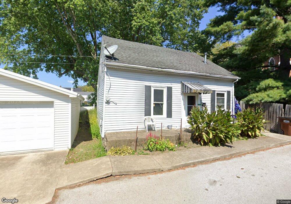
112 Mulberry St Ripley, OH 45167
Estimated Value: $58,329 - $200,000
3
Beds
1
Bath
1,160
Sq Ft
$111/Sq Ft
Est. Value
About This Home
This home is located at 112 Mulberry St, Ripley, OH 45167 and is currently estimated at $128,832, approximately $111 per square foot. 112 Mulberry St is a home located in Brown County with nearby schools including Ripley Union Lewis Huntington Elementary School, Ripley Union Lewis Huntington Middle School, and Ripley-Union-Lewis-Huntington High School.
Ownership History
Date
Name
Owned For
Owner Type
Purchase Details
Closed on
Sep 27, 2000
Sold by
Pollitt Frances J
Bought by
Pollitt James E
Current Estimated Value
Home Financials for this Owner
Home Financials are based on the most recent Mortgage that was taken out on this home.
Original Mortgage
$13,176
Interest Rate
7.98%
Mortgage Type
New Conventional
Create a Home Valuation Report for This Property
The Home Valuation Report is an in-depth analysis detailing your home's value as well as a comparison with similar homes in the area
Home Values in the Area
Average Home Value in this Area
Purchase History
| Date | Buyer | Sale Price | Title Company |
|---|---|---|---|
| Pollitt James E | $12,283 | -- |
Source: Public Records
Mortgage History
| Date | Status | Borrower | Loan Amount |
|---|---|---|---|
| Closed | Pollitt James E | $13,176 |
Source: Public Records
Tax History Compared to Growth
Tax History
| Year | Tax Paid | Tax Assessment Tax Assessment Total Assessment is a certain percentage of the fair market value that is determined by local assessors to be the total taxable value of land and additions on the property. | Land | Improvement |
|---|---|---|---|---|
| 2024 | $161 | $14,590 | $1,530 | $13,060 |
| 2023 | $154 | $10,600 | $1,240 | $9,360 |
| 2022 | $67 | $10,600 | $1,240 | $9,360 |
| 2021 | $66 | $10,600 | $1,240 | $9,360 |
| 2020 | $18 | $9,220 | $1,080 | $8,140 |
| 2019 | $17 | $9,220 | $1,080 | $8,140 |
| 2018 | $9 | $9,220 | $1,080 | $8,140 |
| 2017 | $0 | $8,270 | $1,190 | $7,080 |
| 2016 | -- | $8,270 | $1,190 | $7,080 |
| 2015 | -- | $8,270 | $1,190 | $7,080 |
| 2014 | -- | $8,160 | $1,080 | $7,080 |
| 2013 | -- | $8,160 | $1,080 | $7,080 |
Source: Public Records
Map
Nearby Homes
- 220 Main St
- 45 Main St
- 610 N Second St
- 316 Circle Dr
- 402 Circle Dr
- 633 Robins Way
- 3635 Circle Dr
- 800 Catherine St
- 4381 E Us Highway 52
- 65 Governor St
- 1016 Elizabeth St
- 1205 Pearl St
- 5205 U S 52
- 3111 Lees Creek Rd
- 3179 Stephenson Rd
- 2028 Lucretia St
- 5796 Mary Ingles Hwy
- 2053 Johnson St
- 5050 U S 52
- 3150 Dover Minerva Rd