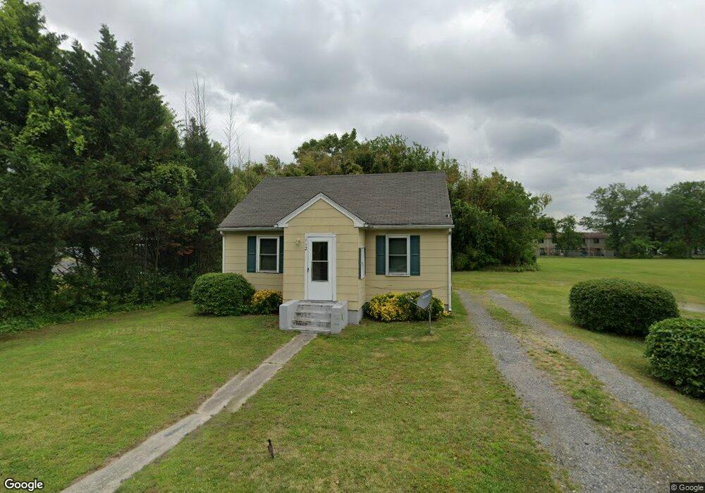
112 N Division St Fruitland, MD 21826
Estimated Value: $131,884 - $163,000
--
Bed
1
Bath
776
Sq Ft
$188/Sq Ft
Est. Value
About This Home
This home is located at 112 N Division St, Fruitland, MD 21826 and is currently estimated at $145,721, approximately $187 per square foot. 112 N Division St is a home located in Wicomico County with nearby schools including Fruitland Primary School, Fruitland Intermediate School, and Bennett Middle School.
Ownership History
Date
Name
Owned For
Owner Type
Purchase Details
Closed on
Aug 8, 1997
Sold by
Morris C Stanley
Bought by
Carter Rudolph
Current Estimated Value
Purchase Details
Closed on
Aug 7, 1997
Sold by
Morris C Stanley
Bought by
Carter Rudolph
Purchase Details
Closed on
Apr 30, 1982
Sold by
Dashiell Elmer M and Dashiell Agnes E
Bought by
Abbott Lewis A
Home Financials for this Owner
Home Financials are based on the most recent Mortgage that was taken out on this home.
Original Mortgage
$27,000
Interest Rate
16.81%
Create a Home Valuation Report for This Property
The Home Valuation Report is an in-depth analysis detailing your home's value as well as a comparison with similar homes in the area
Home Values in the Area
Average Home Value in this Area
Purchase History
| Date | Buyer | Sale Price | Title Company |
|---|---|---|---|
| Carter Rudolph | $45,000 | -- | |
| Carter Rudolph | $45,000 | -- | |
| Abbott Lewis A | $30,000 | -- |
Source: Public Records
Mortgage History
| Date | Status | Borrower | Loan Amount |
|---|---|---|---|
| Previous Owner | Abbott Lewis A | $27,000 | |
| Closed | Carter Rudolph | -- |
Source: Public Records
Tax History Compared to Growth
Tax History
| Year | Tax Paid | Tax Assessment Tax Assessment Total Assessment is a certain percentage of the fair market value that is determined by local assessors to be the total taxable value of land and additions on the property. | Land | Improvement |
|---|---|---|---|---|
| 2025 | $571 | $69,800 | $0 | $0 |
| 2024 | $571 | $59,600 | $19,200 | $40,400 |
| 2023 | $562 | $56,867 | $0 | $0 |
| 2022 | $552 | $54,133 | $0 | $0 |
| 2021 | $525 | $51,400 | $19,200 | $32,200 |
| 2020 | $526 | $51,000 | $0 | $0 |
| 2019 | $530 | $50,600 | $0 | $0 |
| 2018 | $463 | $50,200 | $19,200 | $31,000 |
| 2017 | $534 | $50,200 | $0 | $0 |
| 2016 | $625 | $50,200 | $0 | $0 |
| 2015 | $625 | $58,100 | $0 | $0 |
| 2014 | $625 | $58,100 | $0 | $0 |
Source: Public Records
Map
Nearby Homes
- 212 Green St
- 213 N Brown St
- 215 N Brown St
- 221 N Brown St
- 304 Elizabeth St
- 207 & 209 N Dulany Ave
- 223 N Brown St
- 227 N Brown St
- 103 W Main St
- 3960 Saint Lukes Rd
- 105 Russell Ave
- 229 Sand Castle Blvd
- 202A School St
- 134 Liberty Way
- 209 W Main St
- 318 Holiday St
- 211 Moonglow Rd
- 225 Moonglow Rd
- 111 Ridgefield Ln
- 415 Creekside Trail
- 110 N Division St
- 108 N Division St
- 111 N Division St
- 109 N Division St
- 113 N Division St
- 106 N Division St
- 114 N Division St
- 107 N Division St
- 105 N Division St
- 400 Saint Lukes Rd
- 102 N Division St
- 104 N Division St
- 321 E Main St
- 319 E Main St
- 103 N Division St
- 201 N Division St
- 317 E Main St
- 405 Saint Lukes Rd
- 402 Saint Lukes Rd
- 115 Church St