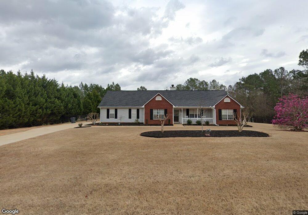
112 New Farm Dr Locust Grove, GA 30248
Estimated Value: $255,803 - $275,000
3
Beds
2
Baths
1,380
Sq Ft
$194/Sq Ft
Est. Value
About This Home
This home is located at 112 New Farm Dr, Locust Grove, GA 30248 and is currently estimated at $268,201, approximately $194 per square foot. 112 New Farm Dr is a home located in Henry County with nearby schools including New Hope Elementary School, Locust Grove Middle School, and Locust Grove High School.
Ownership History
Date
Name
Owned For
Owner Type
Purchase Details
Closed on
Jun 18, 2014
Sold by
Rice Dorsey
Bought by
Britt Virgil Warren
Current Estimated Value
Home Financials for this Owner
Home Financials are based on the most recent Mortgage that was taken out on this home.
Original Mortgage
$99,813
Outstanding Balance
$75,891
Interest Rate
4.19%
Mortgage Type
New Conventional
Estimated Equity
$192,310
Purchase Details
Closed on
Apr 25, 2001
Sold by
Coile Wendy A
Bought by
Rice Dorsey and Rice Kelli
Home Financials for this Owner
Home Financials are based on the most recent Mortgage that was taken out on this home.
Original Mortgage
$117,063
Interest Rate
6.98%
Mortgage Type
FHA
Purchase Details
Closed on
Jul 16, 1999
Sold by
New Hope Homes Llc
Bought by
Zaletel Wendy A
Home Financials for this Owner
Home Financials are based on the most recent Mortgage that was taken out on this home.
Original Mortgage
$90,980
Interest Rate
7.51%
Mortgage Type
New Conventional
Create a Home Valuation Report for This Property
The Home Valuation Report is an in-depth analysis detailing your home's value as well as a comparison with similar homes in the area
Home Values in the Area
Average Home Value in this Area
Purchase History
| Date | Buyer | Sale Price | Title Company |
|---|---|---|---|
| Britt Virgil Warren | $104,813 | -- | |
| Rice Dorsey | $118,900 | -- | |
| Zaletel Wendy A | $113,800 | -- |
Source: Public Records
Mortgage History
| Date | Status | Borrower | Loan Amount |
|---|---|---|---|
| Open | Britt Virgil Warren | $99,813 | |
| Previous Owner | Rice Dorsey | $117,063 | |
| Previous Owner | Zaletel Wendy A | $90,980 |
Source: Public Records
Tax History Compared to Growth
Tax History
| Year | Tax Paid | Tax Assessment Tax Assessment Total Assessment is a certain percentage of the fair market value that is determined by local assessors to be the total taxable value of land and additions on the property. | Land | Improvement |
|---|---|---|---|---|
| 2025 | $3,726 | $100,280 | $14,000 | $86,280 |
| 2024 | $3,726 | $103,240 | $14,000 | $89,240 |
| 2023 | $4,263 | $109,120 | $14,000 | $95,120 |
| 2022 | $3,378 | $86,040 | $14,000 | $72,040 |
| 2021 | $2,649 | $67,040 | $14,000 | $53,040 |
| 2020 | $2,440 | $61,600 | $12,000 | $49,600 |
| 2019 | $2,255 | $56,760 | $12,000 | $44,760 |
| 2018 | $2,041 | $51,200 | $10,800 | $40,400 |
| 2016 | $1,923 | $48,120 | $10,000 | $38,120 |
| 2015 | $1,737 | $41,960 | $7,679 | $34,281 |
| 2014 | $1,558 | $37,000 | $8,000 | $29,000 |
Source: Public Records
Map
Nearby Homes
- 1712 New Hope Rd
- 214 Knob Hill Dr
- 0 New Hope Rd Unit 10647656
- 407 Victoria Place Dr
- 610 Kyle Ct
- 114 Aristocratic Way
- 238 Knob Hill Dr
- 1611 Laney Rd
- 314 Marbella Way
- 601 Dyer Dr
- 0 Sunset Dr Unit 10485299
- 2371 Leguin Mill Rd
- 312 Black Willow Ct
- 147 Whitworth Dr
- 150 Whitworth Dr
- 143 Whitworth Dr Unit 10
- 143 Whitworth Dr
- 148 Leguin Forest Dr
- 655 Sunset Dr
- 162 Belford Way
- 116 New Farm Dr
- 110 New Farm Dr
- 402 Harvest Ct
- 404 Harvest Ct
- 113 New Farm Dr
- 115 New Farm Dr
- 400 Harvest Ct
- 111 New Farm Dr
- 108 New Farm Dr
- 121 New Farm Dr
- 117 New Farm Dr
- 109 New Farm Dr
- 406 Harvest Ct
- 119 New Farm Dr
- 123 New Farm Dr
- 0 New Farm Dr Unit 8609964
- 0 New Farm Dr Unit 8518789
- 0 New Farm Dr Unit 8485044
- 0 New Farm Dr Unit 8463628
- 0 New Farm Dr Unit 8975580