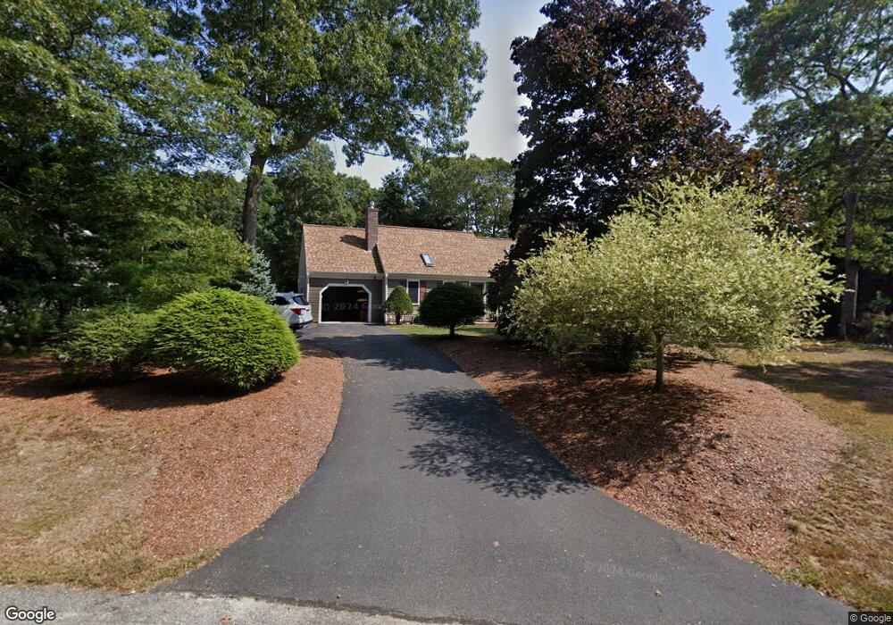
112 Nobadeer Rd Centerville, MA 02632
Centerville NeighborhoodEstimated Value: $587,000 - $683,000
3
Beds
2
Baths
1,128
Sq Ft
$561/Sq Ft
Est. Value
About This Home
This home is located at 112 Nobadeer Rd, Centerville, MA 02632 and is currently estimated at $632,734, approximately $560 per square foot. 112 Nobadeer Rd is a home located in Barnstable County with nearby schools including Centerville Elementary School, Barnstable United Elementary School, and Barnstable Intermediate School.
Ownership History
Date
Name
Owned For
Owner Type
Purchase Details
Closed on
Jun 30, 2005
Sold by
Feeny Helen J and Feeny Thomas P
Bought by
Storie Robert H
Current Estimated Value
Home Financials for this Owner
Home Financials are based on the most recent Mortgage that was taken out on this home.
Original Mortgage
$287,200
Outstanding Balance
$150,599
Interest Rate
5.73%
Mortgage Type
Purchase Money Mortgage
Estimated Equity
$482,135
Purchase Details
Closed on
Aug 25, 1989
Sold by
Arthur William S
Bought by
Feeny Thomas P
Create a Home Valuation Report for This Property
The Home Valuation Report is an in-depth analysis detailing your home's value as well as a comparison with similar homes in the area
Home Values in the Area
Average Home Value in this Area
Purchase History
| Date | Buyer | Sale Price | Title Company |
|---|---|---|---|
| Storie Robert H | $359,000 | -- | |
| Feeny Thomas P | $155,900 | -- |
Source: Public Records
Mortgage History
| Date | Status | Borrower | Loan Amount |
|---|---|---|---|
| Open | Storie Robert H | $287,200 | |
| Closed | Feeny Thomas P | $0 |
Source: Public Records
Tax History
| Year | Tax Paid | Tax Assessment Tax Assessment Total Assessment is a certain percentage of the fair market value that is determined by local assessors to be the total taxable value of land and additions on the property. | Land | Improvement |
|---|---|---|---|---|
| 2025 | $4,579 | $494,000 | $156,800 | $337,200 |
| 2024 | $4,320 | $477,400 | $156,800 | $320,600 |
| 2023 | $4,106 | $429,100 | $142,600 | $286,500 |
| 2022 | $3,984 | $344,300 | $105,600 | $238,700 |
| 2021 | $3,736 | $313,700 | $105,600 | $208,100 |
| 2020 | $3,787 | $307,100 | $105,600 | $201,500 |
| 2019 | $3,602 | $286,300 | $105,600 | $180,700 |
| 2018 | $3,328 | $270,600 | $111,200 | $159,400 |
| 2017 | $3,164 | $263,900 | $111,200 | $152,700 |
| 2016 | $3,108 | $265,000 | $112,300 | $152,700 |
| 2015 | $2,940 | $254,100 | $110,000 | $144,100 |
Source: Public Records
Map
Nearby Homes
- 140 Wequaquet Ln
- 21 Brian Ln
- 423 Lincoln Road Extension
- 75 Olander Dr
- 75 Olander Dr
- 10 Sail -A-way
- 10 Sail a Way
- 522 Lincoln Road Extension
- 576 Strawberry Hill Rd
- 357 Lakeside Dr W
- 481 Lakeside Dr W
- 83 Lake Dr
- 720 Pitchers Way Unit 52
- 720 Pitchers Way Unit 40
- 180 Pond View Dr
- 40 Sachem Dr
- 800 Bearses Way Unit 2SB
- 800 Bearses Way Unit 3NF
- 800 Bearses Way Unit 5NB
- 800 Bearses Way Unit 5NB
- 18 Christina's Path
- 7 Christinas Path
- 124 Nobadeer Rd
- 7 Christinas Path
- 7 Christina's
- 18 Christinas Path
- 92 Nobadeer Rd
- 117 Captain Ellis Ln
- 132 Nobadeer Rd
- 115 Nobadeer Rd
- 135 Captain Ellis Ln
- 241 Longview Dr
- 109 Nobadeer Rd
- 105 Captain Ellis Ln
- 130 Captain Ellis Ln
- 134 Nobadeer Rd
- 105 Nobadeer Rd
- 93 Nobadeer Rd
- 118 Captain Ellis Ln
- 127 Nobadeer Rd
Your Personal Tour Guide
Ask me questions while you tour the home.