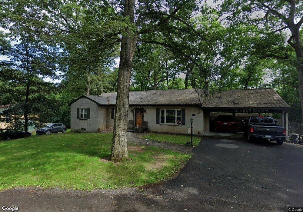
112 Oak Forest Dr Saint Thomas, PA 17252
Estimated Value: $80,257 - $263,000
--
Bed
2
Baths
1,546
Sq Ft
$130/Sq Ft
Est. Value
About This Home
This home is located at 112 Oak Forest Dr, Saint Thomas, PA 17252 and is currently estimated at $201,564, approximately $130 per square foot. 112 Oak Forest Dr is a home located in Franklin County with nearby schools including St. Thomas Elementary School, James Buchanan Middle School, and James Buchanan High School.
Ownership History
Date
Name
Owned For
Owner Type
Purchase Details
Closed on
Apr 28, 2006
Sold by
Burket Max W and Hoffman Darlene B
Bought by
Powell Edward L and Powell Lisa K
Current Estimated Value
Home Financials for this Owner
Home Financials are based on the most recent Mortgage that was taken out on this home.
Original Mortgage
$70,000
Outstanding Balance
$40,541
Interest Rate
6.4%
Mortgage Type
New Conventional
Estimated Equity
$161,023
Create a Home Valuation Report for This Property
The Home Valuation Report is an in-depth analysis detailing your home's value as well as a comparison with similar homes in the area
Home Values in the Area
Average Home Value in this Area
Purchase History
| Date | Buyer | Sale Price | Title Company |
|---|---|---|---|
| Powell Edward L | $135,000 | None Available |
Source: Public Records
Mortgage History
| Date | Status | Borrower | Loan Amount |
|---|---|---|---|
| Open | Powell Edward L | $70,000 |
Source: Public Records
Tax History Compared to Growth
Tax History
| Year | Tax Paid | Tax Assessment Tax Assessment Total Assessment is a certain percentage of the fair market value that is determined by local assessors to be the total taxable value of land and additions on the property. | Land | Improvement |
|---|---|---|---|---|
| 2025 | $3,196 | $19,500 | $1,300 | $18,200 |
| 2024 | $3,157 | $19,500 | $1,300 | $18,200 |
| 2023 | $3,108 | $19,500 | $1,300 | $18,200 |
| 2022 | $3,060 | $19,500 | $1,300 | $18,200 |
| 2021 | $3,060 | $19,500 | $1,300 | $18,200 |
| 2020 | $3,030 | $19,500 | $1,300 | $18,200 |
| 2019 | $2,979 | $19,500 | $1,300 | $18,200 |
| 2018 | $2,879 | $19,500 | $1,300 | $18,200 |
| 2017 | $2,833 | $19,500 | $1,300 | $18,200 |
| 2016 | $559 | $19,500 | $1,300 | $18,200 |
| 2015 | $521 | $19,500 | $1,300 | $18,200 |
| 2014 | $521 | $19,500 | $1,300 | $18,200 |
Source: Public Records
Map
Nearby Homes
- 165 Sherwood Ave
- 6586 Town Dr
- 71 Maranatha Dr
- 0 Maranatha Dr Unit PAFL2014288
- 0 Maranatha Dr Unit PAFL2014294
- 5178 Lincoln Way W
- 6892 Lincoln Way W
- Chamberlain Plan at Country Meadow
- Dartmouth Plan at Country Meadow
- Greenwood Plan at Country Meadow
- Coleford Plan at Country Meadow
- Monroe Plan at Country Meadow
- Hawthorne Plan at Country Meadow
- Aspen Plan at Country Meadow
- Crestmont Plan at Country Meadow
- Rockford Plan at Country Meadow
- Charlotte Plan at Country Meadow
- Hampton Plan at Country Meadow
- Fairmont Plan at Country Meadow
- Bayberry Plan at Country Meadow
- 78 Oak Forest Dr
- Oak Forest Dr
- 132 Oak Forest Dr
- 123 Oak Forest Dr
- 72 Oak Forest Dr
- 184 Oak Forest Dr
- 135 Oak Forest Dr
- 6032 Lincoln Way W
- 66 Oak Forest Dr
- 167 Oak Forest Dr
- 204 Oak Forest Dr
- 6056 Lincoln Way W
- 187 Oak Forest Dr
- 6084 Lincoln Way W
- 5992 Lincoln Way W
- 5980 Lincoln Way W
- 213 Oak Forest Dr
- 330 Oak Forest Dr
- 5956 Lincoln Way W
- 6106 Lincoln Way W