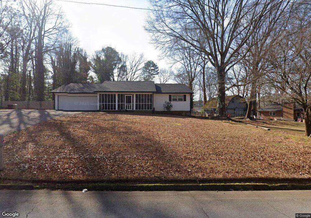
112 Odell Rd Griffin, GA 30224
Spalding County NeighborhoodEstimated Value: $212,000 - $242,000
3
Beds
2
Baths
1,581
Sq Ft
$145/Sq Ft
Est. Value
About This Home
This home is located at 112 Odell Rd, Griffin, GA 30224 and is currently estimated at $229,536, approximately $145 per square foot. 112 Odell Rd is a home located in Spalding County with nearby schools including Crescent Road Elementary School, Rehoboth Road Middle School, and Spalding High School.
Ownership History
Date
Name
Owned For
Owner Type
Purchase Details
Closed on
Nov 7, 2016
Sold by
Edward Steven
Bought by
Varnadoe Gayle Brown
Current Estimated Value
Purchase Details
Closed on
Dec 15, 1994
Sold by
Varnadoe Preston Gayle
Bought by
Mitchell Juanita
Purchase Details
Closed on
Aug 21, 1979
Sold by
Mitchell Archie B
Bought by
Varnadoe Preston T and Varnadoe Gayle B
Purchase Details
Closed on
Nov 23, 1977
Sold by
Karr Harry C
Bought by
Mitchell Archie B
Purchase Details
Closed on
Dec 14, 1976
Sold by
Coronet Homes Inc
Bought by
Karr Harry C
Purchase Details
Closed on
Jul 29, 1975
Sold by
Cumming W Barron Etal
Bought by
Coronet Homes Inc
Purchase Details
Closed on
Aug 17, 1974
Sold by
Mathis O N
Bought by
Cumming W Barron Etal
Create a Home Valuation Report for This Property
The Home Valuation Report is an in-depth analysis detailing your home's value as well as a comparison with similar homes in the area
Home Values in the Area
Average Home Value in this Area
Purchase History
| Date | Buyer | Sale Price | Title Company |
|---|---|---|---|
| Varnadoe Gayle Brown | $26,445 | -- | |
| Brown Steven Edward | -- | -- | |
| Mitchell Juanita | $73,000 | -- | |
| Varnadoe Preston T | $9,700 | -- | |
| Mitchell Archie B | $6,100 | -- | |
| Karr Harry C | $42,500 | -- | |
| Coronet Homes Inc | $20,000 | -- | |
| Cumming W Barron Etal | $477,000 | -- |
Source: Public Records
Tax History Compared to Growth
Tax History
| Year | Tax Paid | Tax Assessment Tax Assessment Total Assessment is a certain percentage of the fair market value that is determined by local assessors to be the total taxable value of land and additions on the property. | Land | Improvement |
|---|---|---|---|---|
| 2024 | $1,043 | $59,926 | $12,000 | $47,926 |
| 2023 | $2,113 | $59,926 | $12,000 | $47,926 |
| 2022 | $1,818 | $51,812 | $10,000 | $41,812 |
| 2021 | $1,609 | $46,069 | $10,000 | $36,069 |
| 2020 | $1,501 | $42,927 | $10,000 | $32,927 |
| 2019 | $1,501 | $42,141 | $10,000 | $32,141 |
| 2018 | $1,500 | $41,073 | $10,000 | $31,073 |
| 2017 | $1,393 | $39,288 | $10,000 | $29,288 |
| 2016 | $773 | $39,288 | $10,000 | $29,288 |
| 2015 | $807 | $39,288 | $10,000 | $29,288 |
| 2014 | $814 | $39,288 | $10,000 | $29,288 |
Source: Public Records
Map
Nearby Homes
- 1338 Canal St
- 115 Kline Cir
- 1801, 1831 & 19 Zebulon Rd
- 105 Jewel Dr
- 114 Maddox Rd
- 7 Crabapple Cir
- 36 Laurelwood Cir
- 450 Carver Rd
- 1610 Williamson Rd
- TRACT B Zebulon Rd
- 133 Coldwater Ln
- 108 Mckinley Dr
- 227 Brown Acres Rd
- 139 Coldwater Ln
- 145 Coldwater Way
- 1064 Cold Water Dr
- 201 Laramie Rd
- 1119 George Cir
- 102 Summit Dr
- 316 Wynterhall Dr
- 1306 Lakeshore Dr
- 1310 Lakeshore Dr
- 1314 Lakeshore Dr
- 1301 Everee Inn Rd
- 191 Odell Rd
- 1307 Everee Inn Rd
- 1303 Everee Inn Rd
- 1320 Lakeshore Dr
- 1305 Everee Inn Rd
- 1239 Everee Inn Rd
- 1303 Lakeshore Dr
- 201 Odell Rd
- 1305 Lakeshore Dr
- 1322 Lakeshore Dr
- 1307 Lakeshore Dr
- 0 Lakeshore Dr Unit 7138100
- 0 Lakeshore Dr Unit 7085455
- 0 Lakeshore Dr Unit 8314782
- 0 Lakeshore Dr Unit 8022088
- 0 Lakeshore Dr Unit 8899608