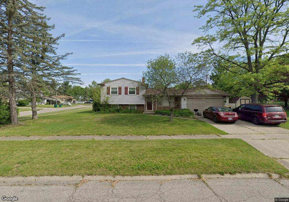
112 Overbrook Dr Flushing, MI 48433
Estimated Value: $187,431 - $237,000
Studio
1
Bath
1,288
Sq Ft
$168/Sq Ft
Est. Value
About This Home
This home is located at 112 Overbrook Dr, Flushing, MI 48433 and is currently estimated at $216,358, approximately $167 per square foot. 112 Overbrook Dr is a home located in Genesee County with nearby schools including Seymour Elementary School, Flushing Middle School, and Flushing High School.
Ownership History
Date
Name
Owned For
Owner Type
Purchase Details
Closed on
Sep 25, 2003
Sold by
Anagnostopoulos Dimitrios
Bought by
Anagnostopoulos Amy M
Current Estimated Value
Home Financials for this Owner
Home Financials are based on the most recent Mortgage that was taken out on this home.
Original Mortgage
$111,500
Outstanding Balance
$51,012
Interest Rate
6.04%
Mortgage Type
New Conventional
Estimated Equity
$165,346
Purchase Details
Closed on
Sep 27, 2000
Sold by
Wittock Terry R and Hubbell Wittock Pamela
Bought by
Anagnostopoulos Dimitrios and Anagnostopoulos Amy
Create a Home Valuation Report for This Property
The Home Valuation Report is an in-depth analysis detailing your home's value as well as a comparison with similar homes in the area
Home Values in the Area
Average Home Value in this Area
Purchase History
| Date | Buyer | Sale Price | Title Company |
|---|---|---|---|
| Anagnostopoulos Amy M | -- | Cislo Title Company | |
| Anagnostopoulos Dimitrios | $119,900 | Guaranty Title Company |
Source: Public Records
Mortgage History
| Date | Status | Borrower | Loan Amount |
|---|---|---|---|
| Open | Anagnostopoulos Amy M | $111,500 |
Source: Public Records
Tax History
| Year | Tax Paid | Tax Assessment Tax Assessment Total Assessment is a certain percentage of the fair market value that is determined by local assessors to be the total taxable value of land and additions on the property. | Land | Improvement |
|---|---|---|---|---|
| 2025 | $3,200 | $78,600 | $0 | $0 |
| 2024 | $2,772 | $72,200 | $0 | $0 |
| 2023 | $2,662 | $65,100 | $0 | $0 |
| 2022 | $2,780 | $59,100 | $0 | $0 |
| 2021 | $2,780 | $53,600 | $0 | $0 |
| 2020 | $2,355 | $51,200 | $0 | $0 |
| 2019 | $2,322 | $48,200 | $0 | $0 |
| 2018 | $2,580 | $43,500 | $0 | $0 |
| 2017 | $2,455 | $42,900 | $0 | $0 |
| 2016 | $2,435 | $37,806 | $0 | $0 |
| 2015 | $2,426 | $0 | $0 | $0 |
| 2012 | -- | $40,800 | $40,800 | $0 |
Source: Public Records
Map
Nearby Homes
- 608 Autumn Dr
- 0 E River Rd Unit 50180952
- 501 Spring Ln
- 0 Winters Eave Dr Unit 50117986
- 241 Aberdeen Ct Unit 11 bldg 6
- 6289 W River Rd
- 321 Terrace Dr
- 229 Aberdeen Ct
- 100 Aberdeen Dr Unit 36
- 3155 Beech Tree Ln
- 113 N Mckinley Rd
- 468 Windy Bluff
- 6106 E River Rd
- 527 Oakbrook Cir Unit 14
- 210 Mary St
- 000 Potter Rd
- 219 Primrose Ln
- 433 Dutch Mill Dr
- 588 Oakbrook Cir
- 315 N Maple St
- 545 Somerset Dr
- 104 Overbrook Dr
- 108 Overbrook Dr
- 113 Overbrook Dr
- 541 Somerset Dr
- 546 Somerset Dr
- 542 Somerset Dr
- 550 Somerset Dr
- 109 Overbrook Dr
- 538 Somerset Dr
- 607 Somerset Dr
- 537 Somerset Dr
- 600 Somerset Dr
- 542 S Mckinley Rd
- 105 Overbrook Dr
- 100 Overbrook Dr
- 611 Somerset Dr
- 604 Somerset Dr
- 533 Somerset Dr
- 608 Somerset Dr
Your Personal Tour Guide
Ask me questions while you tour the home.