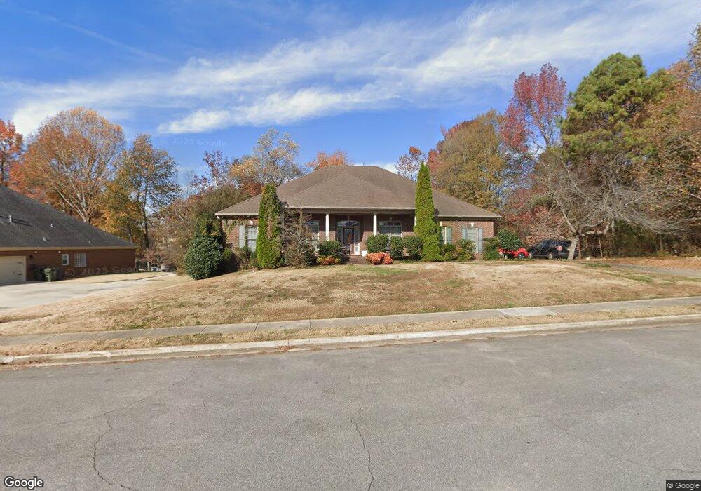
112 Pearle Cove Dr Huntsville, AL 35806
Research Park NeighborhoodEstimated Value: $416,000 - $530,000
--
Bed
--
Bath
3,139
Sq Ft
$153/Sq Ft
Est. Value
About This Home
This home is located at 112 Pearle Cove Dr, Huntsville, AL 35806 and is currently estimated at $480,268, approximately $153 per square foot. 112 Pearle Cove Dr is a home with nearby schools including Monrovia Elementary School, Monrovia Middle School, and Sparkman High School.
Ownership History
Date
Name
Owned For
Owner Type
Purchase Details
Closed on
Mar 27, 2023
Sold by
Greer Bonnie Morgan
Bought by
Henry James R and Henry June A
Current Estimated Value
Purchase Details
Closed on
Feb 29, 2008
Sold by
Dailey Thomas J and Dailey Deborah K
Bought by
Morgan Wendell J
Home Financials for this Owner
Home Financials are based on the most recent Mortgage that was taken out on this home.
Original Mortgage
$220,000
Interest Rate
5.2%
Mortgage Type
New Conventional
Purchase Details
Closed on
Jul 27, 2007
Sold by
Fogle Frank R
Bought by
Dailey Thomas J and Dailey Deborah K
Home Financials for this Owner
Home Financials are based on the most recent Mortgage that was taken out on this home.
Original Mortgage
$94,050
Interest Rate
6.71%
Mortgage Type
Future Advance Clause Open End Mortgage
Create a Home Valuation Report for This Property
The Home Valuation Report is an in-depth analysis detailing your home's value as well as a comparison with similar homes in the area
Home Values in the Area
Average Home Value in this Area
Purchase History
| Date | Buyer | Sale Price | Title Company |
|---|---|---|---|
| Henry James R | $361,500 | None Listed On Document | |
| Morgan Wendell J | -- | -- | |
| Dailey Thomas J | -- | -- |
Source: Public Records
Mortgage History
| Date | Status | Borrower | Loan Amount |
|---|---|---|---|
| Previous Owner | Morgan Wendell J | $220,000 | |
| Previous Owner | Dailey Thomas J | $94,050 |
Source: Public Records
Tax History Compared to Growth
Tax History
| Year | Tax Paid | Tax Assessment Tax Assessment Total Assessment is a certain percentage of the fair market value that is determined by local assessors to be the total taxable value of land and additions on the property. | Land | Improvement |
|---|---|---|---|---|
| 2024 | $1,525 | $43,520 | $5,000 | $38,520 |
| 2023 | $1,525 | $40,140 | $3,320 | $36,820 |
| 2022 | $1,258 | $36,060 | $3,320 | $32,740 |
| 2021 | $1,258 | $36,060 | $3,320 | $32,740 |
| 2020 | $1,130 | $32,520 | $3,310 | $29,210 |
| 2019 | $1,093 | $31,520 | $3,310 | $28,210 |
| 2018 | $1,019 | $29,500 | $0 | $0 |
| 2017 | $1,019 | $29,500 | $0 | $0 |
| 2016 | $1,019 | $29,500 | $0 | $0 |
| 2015 | $1,019 | $29,500 | $0 | $0 |
| 2014 | $1,003 | $29,080 | $0 | $0 |
Source: Public Records
Map
Nearby Homes
- 115 Misty Hollow Way
- 1.4 acres Jeff Rd NW
- 10.4 acres Jeff Rd NW
- 2031 Blake Bottom Rd NW Unit 15
- 2031 Blake Bottom Rd NW
- 2031 Blake Bottom Rd NW Unit 2
- 104 Raymon Cir
- 229 Brooklet Ct
- 120 Arbery Dr NW
- 1 ACRE EASEMENT Jeff Rd NW
- 124 Huston Ct
- 131 Fairington Rd NW
- 989 Jeff Rd NW
- 113 Thomas Woods Ct
- 109 Sarah Jane Dr
- 140 Lovvorn Ln NW
- 100 Gordy Dr
- 122 Kingswood Dr
- 108 Holbrook Dr
- 195 Sarah Jane Dr
- 110 Pearle Cove Dr
- 113 Pearle Cove Dr
- 100 Old Pointe Way
- 108 Pearle Cove Dr
- 116 Pearle Cove Dr
- 103 Old Pointe Way
- 106 Pearle Cove Dr
- 107 Pearle Cove Dr
- 102 Old Pointe Way
- 117 Pearle Cove Dr
- 117 Pearle Cove Dr
- 118 Creekmound Dr
- 118 Pearle Cove Dr
- 124 Creekmound Dr
- 105 Old Pointe Way
- 104 Old Pointe Way
- 104 Pearle Cove Dr
- 126 Creekmound Dr
- 122 Creekmound Dr
- 120 Creekmound Dr