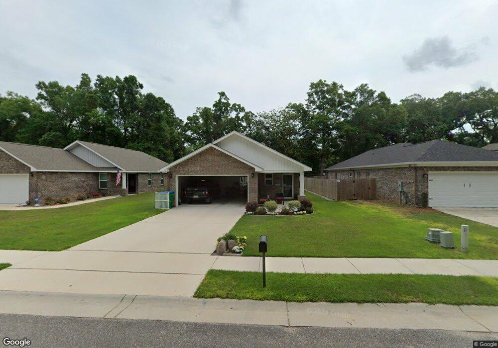
112 Pierce Ct Saraland, AL 36571
Estimated Value: $250,000 - $273,749
3
Beds
2
Baths
1,611
Sq Ft
$162/Sq Ft
Est. Value
About This Home
This home is located at 112 Pierce Ct, Saraland, AL 36571 and is currently estimated at $261,687, approximately $162 per square foot. 112 Pierce Ct is a home located in Mobile County with nearby schools including Saraland Elementary School, Nelson Leon Adams Middle School/Saraland Middle School, and Saraland High School.
Ownership History
Date
Name
Owned For
Owner Type
Purchase Details
Closed on
Dec 10, 2020
Sold by
D R Horton Inc
Bought by
Roberts Charles Theodore and Roberts Linda D
Current Estimated Value
Home Financials for this Owner
Home Financials are based on the most recent Mortgage that was taken out on this home.
Original Mortgage
$87,900
Outstanding Balance
$78,397
Interest Rate
2.8%
Mortgage Type
New Conventional
Estimated Equity
$183,290
Purchase Details
Closed on
Nov 30, 2016
Sold by
Hart N Ken N and Hart Dorothy A
Bought by
Hart N Ken N and Hart Dorothy A
Create a Home Valuation Report for This Property
The Home Valuation Report is an in-depth analysis detailing your home's value as well as a comparison with similar homes in the area
Home Values in the Area
Average Home Value in this Area
Purchase History
| Date | Buyer | Sale Price | Title Company |
|---|---|---|---|
| Roberts Charles Theodore | $207,900 | None Listed On Document | |
| Hart N Ken N | $35,000 | None Available |
Source: Public Records
Mortgage History
| Date | Status | Borrower | Loan Amount |
|---|---|---|---|
| Open | Roberts Charles Theodore | $87,900 |
Source: Public Records
Tax History Compared to Growth
Tax History
| Year | Tax Paid | Tax Assessment Tax Assessment Total Assessment is a certain percentage of the fair market value that is determined by local assessors to be the total taxable value of land and additions on the property. | Land | Improvement |
|---|---|---|---|---|
| 2024 | $1,122 | $22,130 | $3,500 | $18,630 |
| 2023 | $1,105 | $21,620 | $3,500 | $18,120 |
| 2022 | $1,115 | $21,810 | $3,500 | $18,310 |
| 2021 | $250 | $4,200 | $4,200 | $0 |
| 2020 | $207 | $3,480 | $3,480 | $0 |
| 2019 | $208 | $3,500 | $3,500 | $0 |
| 2018 | $208 | $3,500 | $0 | $0 |
| 2017 | $208 | $3,500 | $0 | $0 |
| 2016 | $345 | $5,800 | $0 | $0 |
| 2013 | $302 | $5,800 | $0 | $0 |
Source: Public Records
Map
Nearby Homes
- 208 Strange Ave
- 228 Lucille St
- 111 Bethel Forest Dr S
- 114 Bethel Forest Dr S
- 325 Bryant Ct
- 108 Craig Dr
- 32 Everett Ave E
- 234 Autumn Dr
- 410 Allen Cir
- 21 Frances St
- 253 Autumn Dr
- 127 Lillian Ave
- 629 Pine St
- 323 First Ave
- 118 2nd Ave
- 728 Shiloh St
- 129 Melinda Dr
- 127 Anderson Rd
- 505 Norton Ave
- 429 1st Ave
- 112 Pierce Ct Unit 13
- 110 Pierce Ct Unit 12
- 110 Pierce Ct
- 114 Pierce Ct
- 108 Pierce Ct Unit 11
- 108 Pierce Ct
- 116 McKeough Ave Unit 15
- 116 McKeough Ave
- 114 McKeough Ave
- 106 Pierce Ct Unit 10
- 124 McKeough Ave
- 104 Pierce Ct
- 113 Pierce Ct Unit 1
- 113 Pierce Ct
- 111 Pierce Ct
- 112 McKeough Ave
- 108 McKeough Ave Unit M&B
- 108 McKeough Ave
- 109 Pierce Ct
- 102 Pierce Ct