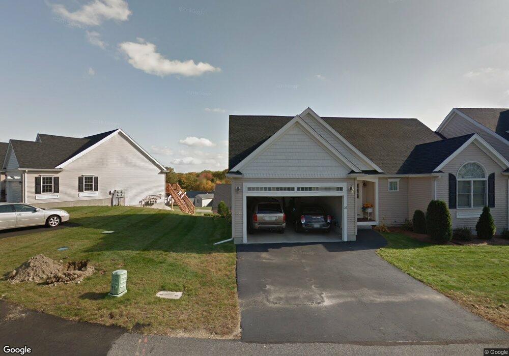
112 Quarry Rd Whitinsville, MA 01588
Estimated Value: $479,255 - $515,000
2
Beds
2
Baths
1,388
Sq Ft
$355/Sq Ft
Est. Value
About This Home
This home is located at 112 Quarry Rd, Whitinsville, MA 01588 and is currently estimated at $493,064, approximately $355 per square foot. 112 Quarry Rd is a home located in Worcester County with nearby schools including Northbridge Elementary School, Northbridge Middle School, and Northbridge High School.
Ownership History
Date
Name
Owned For
Owner Type
Purchase Details
Closed on
Oct 20, 2023
Sold by
Marseglia Richard V
Bought by
Richard V Marseglia T V and Richard Marseglia
Current Estimated Value
Purchase Details
Closed on
Apr 30, 2013
Sold by
J & F Marinella Dev Corp
Bought by
Mcinnis William R and Mcinnis Leslie E
Home Financials for this Owner
Home Financials are based on the most recent Mortgage that was taken out on this home.
Original Mortgage
$159,920
Interest Rate
3.64%
Mortgage Type
New Conventional
Purchase Details
Closed on
Jan 4, 2013
Sold by
J & F Marinella Dev Corp
Bought by
Marseglia Richard
Home Financials for this Owner
Home Financials are based on the most recent Mortgage that was taken out on this home.
Original Mortgage
$180,000
Interest Rate
3.35%
Mortgage Type
New Conventional
Create a Home Valuation Report for This Property
The Home Valuation Report is an in-depth analysis detailing your home's value as well as a comparison with similar homes in the area
Home Values in the Area
Average Home Value in this Area
Purchase History
| Date | Buyer | Sale Price | Title Company |
|---|---|---|---|
| Richard V Marseglia T V | -- | None Available | |
| Richard V Marseglia T V | -- | None Available | |
| Mcinnis William R | $199,920 | -- | |
| Mcinnis William R | $199,920 | -- | |
| Mcinnis William R | $199,920 | -- | |
| Marseglia Richard | $240,000 | -- | |
| Marseglia Richard V | $240,000 | -- |
Source: Public Records
Mortgage History
| Date | Status | Borrower | Loan Amount |
|---|---|---|---|
| Previous Owner | Mcinnis William R | $159,920 | |
| Previous Owner | Marseglia Richard V | $180,000 |
Source: Public Records
Tax History Compared to Growth
Tax History
| Year | Tax Paid | Tax Assessment Tax Assessment Total Assessment is a certain percentage of the fair market value that is determined by local assessors to be the total taxable value of land and additions on the property. | Land | Improvement |
|---|---|---|---|---|
| 2025 | $5,218 | $442,600 | $0 | $442,600 |
| 2024 | $4,894 | $404,800 | $0 | $404,800 |
| 2023 | $4,812 | $371,300 | $0 | $371,300 |
| 2022 | $4,570 | $331,900 | $0 | $331,900 |
| 2021 | $4,546 | $313,700 | $0 | $313,700 |
| 2020 | $4,167 | $301,100 | $0 | $301,100 |
| 2019 | $3,743 | $288,600 | $0 | $288,600 |
| 2018 | $3,609 | $278,900 | $0 | $278,900 |
| 2017 | $3,671 | $271,300 | $0 | $271,300 |
| 2016 | $3,594 | $261,400 | $0 | $261,400 |
| 2015 | $3,427 | $256,100 | $0 | $256,100 |
| 2014 | $3,410 | $257,200 | $0 | $257,200 |
Source: Public Records
Map
Nearby Homes
- 708 Marston Rd
- 192 Rebecca Rd
- 46 Rebecca Rd
- 86 Kingsnorth St
- 5 Summit St
- 157 Rolling Ridge Dr Unit 84
- 135 Windstone Dr
- 21 Granite St
- 140 Rolling Ridge Dr Unit 78
- Lots 1-9 Spring St
- 33 Crestwood Cir Unit 45
- 121 East St Unit 121
- 73 Plummer Ave
- 39 Crestwood Cir Unit 42
- 159 Rolling Ridge Dr Unit 85
- 169 Rolling Ridge Dr Unit 97
- 18 East St Unit 24
- 128 Linwood Ave
- 119 Susanne Dr
- 831 Providence Rd Unit 837
- 42 Edmonds Cir Unit 42
- 4 Edmunds Cir Unit 21
- 30 Edmonds Cir
- 32 Edmonds Cir
- 34 Edmonds Cir
- 36 Edmonds Cir
- 40 Edmonds Cir
- 42 Edmonds Cir
- 116 Quarry Rd
- 114 Quarry Rd
- 104 Quarry Rd
- 102 Quarry Rd
- 100 Quarry Rd
- 86 Quarry Rd
- 84 Quarry Rd
- 82 Quarry Rd
- 39 Edmonds Cir
- 37 Edmonds Cir
- 35 Edmonds Cir
- 33 Edmonds Cir