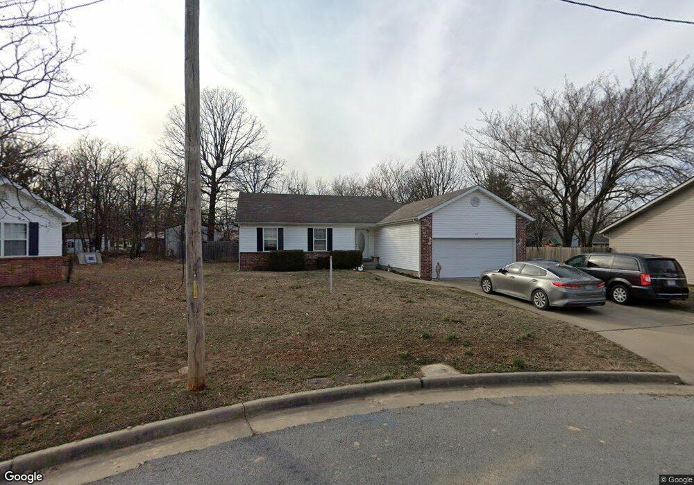
112 Randolph Dr Carl Junction, MO 64834
Estimated Value: $207,575 - $233,000
3
Beds
2
Baths
1,532
Sq Ft
$146/Sq Ft
Est. Value
About This Home
This home is located at 112 Randolph Dr, Carl Junction, MO 64834 and is currently estimated at $223,644, approximately $145 per square foot. 112 Randolph Dr is a home located in Jasper County with nearby schools including Carl Junction Primary School (K-1), Carl Junction Intermediate School, and Carl Junction Primary School (2-3).
Ownership History
Date
Name
Owned For
Owner Type
Purchase Details
Closed on
Nov 29, 2021
Sold by
Samuel Virginia L
Bought by
Trust Agreement Of Howard K Samuel And Virgin
Current Estimated Value
Home Financials for this Owner
Home Financials are based on the most recent Mortgage that was taken out on this home.
Original Mortgage
$57,500
Outstanding Balance
$52,512
Interest Rate
3.14%
Mortgage Type
New Conventional
Estimated Equity
$171,132
Purchase Details
Closed on
Jan 5, 2018
Sold by
Watkins Quest Llc
Bought by
Samuel Virginia L
Purchase Details
Closed on
Aug 11, 2017
Sold by
Jpmorgan Chase Bank National Association
Bought by
Watkins Quest Llc
Purchase Details
Closed on
Nov 27, 2007
Sold by
Burk John C and Wellmann Burk Andrea
Bought by
Cortes Efrain N and Negron Marangeli
Home Financials for this Owner
Home Financials are based on the most recent Mortgage that was taken out on this home.
Original Mortgage
$109,650
Interest Rate
6.4%
Mortgage Type
Purchase Money Mortgage
Create a Home Valuation Report for This Property
The Home Valuation Report is an in-depth analysis detailing your home's value as well as a comparison with similar homes in the area
Purchase History
| Date | Buyer | Sale Price | Title Company |
|---|---|---|---|
| Trust Agreement Of Howard K Samuel And Virgin | -- | Waco Title | |
| Trust Agreement Of Howard K Samuel And Virgin | -- | Waco Title | |
| Samuel Virginia L | -- | -- | |
| Watkins Quest Llc | -- | None Available | |
| Cortes Efrain N | -- | Abbey |
Source: Public Records
Mortgage History
| Date | Status | Borrower | Loan Amount |
|---|---|---|---|
| Open | Trust Agreement Of Howard K Samuel And Virgin | $57,500 | |
| Closed | Trust Agreement Of Howard K Samuel And Virgin | $57,500 | |
| Previous Owner | Cortes Efrain N | $109,650 |
Source: Public Records
Tax History
| Year | Tax Paid | Tax Assessment Tax Assessment Total Assessment is a certain percentage of the fair market value that is determined by local assessors to be the total taxable value of land and additions on the property. | Land | Improvement |
|---|---|---|---|---|
| 2025 | $1,119 | $21,120 | $2,100 | $19,020 |
| 2024 | $1,126 | $19,130 | $2,100 | $17,030 |
| 2023 | $1,126 | $19,130 | $2,100 | $17,030 |
| 2022 | $1,167 | $19,770 | $2,100 | $17,670 |
| 2021 | $1,001 | $19,770 | $2,100 | $17,670 |
| 2020 | $937 | $18,190 | $2,100 | $16,090 |
| 2019 | $890 | $18,190 | $2,100 | $16,090 |
| 2018 | $910 | $18,640 | $0 | $0 |
| 2017 | $906 | $18,510 | $0 | $0 |
| 2016 | $917 | $18,920 | $0 | $0 |
| 2015 | $898 | $18,920 | $0 | $0 |
| 2014 | $898 | $18,920 | $0 | $0 |
Source: Public Records
Map
Nearby Homes
- 123 Rocky Ln
- 25122 Gum Rd
- 121 Forest Dr
- 401 Dogwood Trails Loop
- 112 Red Oak Dr
- 6548 Mo-171
- 25452 Leffen Ln
- XXX Lone Elm
- Lot 1B Hwy 171 & Fir Rd
- Lot 1A Hwy 171 & Fir Rd
- 5981 Pearl St
- 2626 Joplin St
- Lot 1 Hwy 171 & Fir Rd
- Xxx Wall St
- LOT 4C Hwy 171 & Fir Rd Unit 4C
- 128 Par Ln
- Lot 14 Brenden Ln
- 232 Hickory Place
- 306 Lakeview Ln
- TBD Wall St
- 110 Randolph Dr
- 114 Randolph Dr
- 117 Rocky Ln
- 108 Randolph Dr
- 125 Randolph Dr
- 105 Randolph Dr
- 121 Randolph Dr
- 103 Randolph Dr
- 107 Randolph Dr
- 117 Randolph Dr
- 115 Rocky Ln
- 115 Rocky Ln Unit 1
- 115 Randolph Dr
- 113 Randolph Dr
- 125 Rocky Ln
- 107 Kellie Ln
- 102 Randolph Dr
- 112 Kellie Ln
- 109 Kellie Ln
- 122 Rocky Ln
Your Personal Tour Guide
Ask me questions while you tour the home.