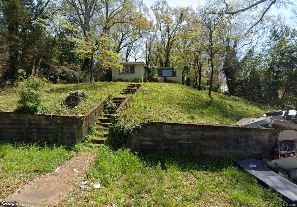
112 Revis St Lagrange, GA 30241
Estimated Value: $65,091 - $103,000
3
Beds
1
Bath
1,472
Sq Ft
$58/Sq Ft
Est. Value
About This Home
This home is located at 112 Revis St, Lagrange, GA 30241 and is currently estimated at $84,697, approximately $57 per square foot. 112 Revis St is a home located in Troup County with nearby schools including Hollis Hand Elementary School, Franklin Forest Elementary School, and Ethel W. Kight Elementary School.
Ownership History
Date
Name
Owned For
Owner Type
Purchase Details
Closed on
Oct 18, 2023
Sold by
Peoples Land Acquisition Llc
Bought by
Da Real Backend Business Llc
Current Estimated Value
Purchase Details
Closed on
Feb 22, 2021
Sold by
Riversouth Properties Llc
Bought by
Peoples Land Acquisition Llc
Purchase Details
Closed on
Jan 13, 2021
Sold by
Dunson Valerie Lynn
Bought by
Riversouth Properties Llc
Purchase Details
Closed on
Jun 25, 2002
Sold by
Mildred Davis Dunson
Bought by
Dunson Valerie Lynn
Purchase Details
Closed on
Mar 12, 1959
Sold by
Heardy Dunson
Bought by
Mildred Davis Dunson
Purchase Details
Closed on
Nov 15, 1956
Sold by
Mildred D Dunson
Bought by
Heardy Dunson
Create a Home Valuation Report for This Property
The Home Valuation Report is an in-depth analysis detailing your home's value as well as a comparison with similar homes in the area
Purchase History
| Date | Buyer | Sale Price | Title Company |
|---|---|---|---|
| Da Real Backend Business Llc | $2,000 | -- | |
| Peoples Land Acquisition Llc | $2,500 | -- | |
| Riversouth Properties Llc | -- | -- | |
| Dunson Valerie Lynn | -- | -- | |
| Mildred Davis Dunson | -- | -- | |
| Heardy Dunson | -- | -- |
Source: Public Records
Tax History
| Year | Tax Paid | Tax Assessment Tax Assessment Total Assessment is a certain percentage of the fair market value that is determined by local assessors to be the total taxable value of land and additions on the property. | Land | Improvement |
|---|---|---|---|---|
| 2025 | $77 | $2,836 | $2,640 | $196 |
| 2024 | $78 | $2,844 | $2,640 | $204 |
| 2023 | $122 | $4,488 | $2,640 | $1,848 |
| 2022 | $122 | $4,368 | $2,640 | $1,728 |
| 2021 | $501 | $18,596 | $1,560 | $17,036 |
| 2020 | $501 | $18,596 | $1,560 | $17,036 |
| 2019 | $453 | $17,008 | $1,560 | $15,448 |
| 2018 | $429 | $16,200 | $1,656 | $14,544 |
| 2017 | $429 | $16,200 | $1,656 | $14,544 |
| 2016 | $430 | $16,240 | $1,656 | $14,584 |
| 2015 | $429 | $16,179 | $1,594 | $14,584 |
| 2014 | $409 | $15,484 | $1,594 | $13,890 |
| 2013 | -- | $16,048 | $1,600 | $14,448 |
Source: Public Records
Map
Nearby Homes
Your Personal Tour Guide
Ask me questions while you tour the home.