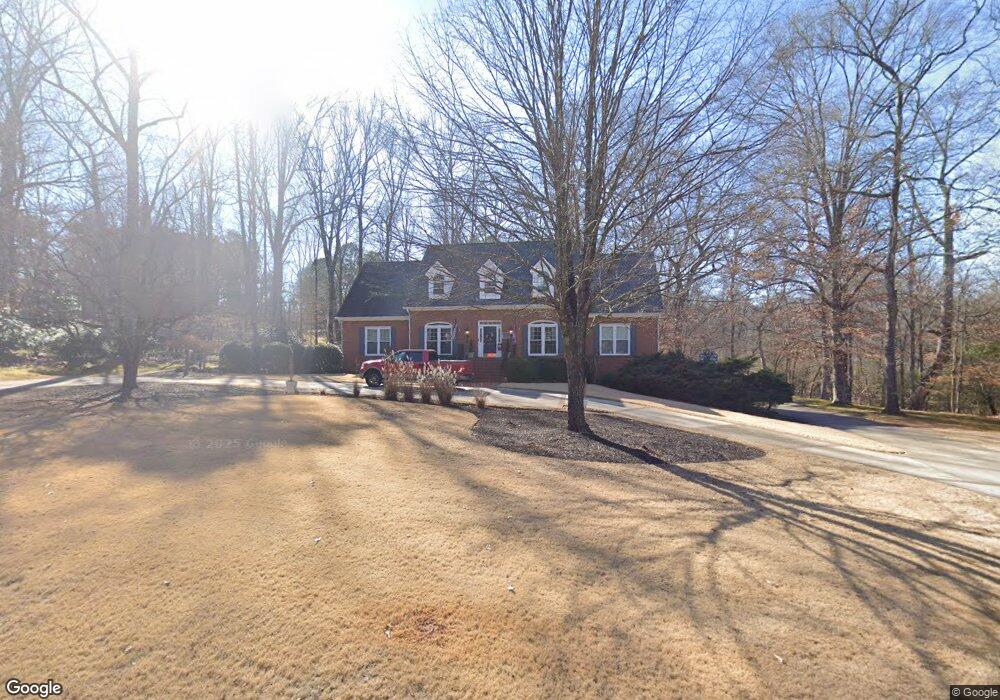
112 River Bottom Cir Athens, GA 30606
Estimated Value: $569,408 - $695,000
--
Bed
1
Bath
3,486
Sq Ft
$182/Sq Ft
Est. Value
About This Home
This home is located at 112 River Bottom Cir, Athens, GA 30606 and is currently estimated at $633,602, approximately $181 per square foot. 112 River Bottom Cir is a home located in Clarke County with nearby schools including Timothy Elementary School, Clarke Middle School, and Clarke Central High School.
Ownership History
Date
Name
Owned For
Owner Type
Purchase Details
Closed on
Jan 1, 2012
Sold by
Hanson George W and Hanson Sandra G
Bought by
Hanson Sandra Griffin
Current Estimated Value
Purchase Details
Closed on
Sep 25, 2002
Sold by
Hanson George W
Bought by
Hanson Sandra G
Purchase Details
Closed on
Mar 15, 1996
Sold by
Hanson George W
Bought by
Hanson Sandra G
Purchase Details
Closed on
Dec 30, 1986
Sold by
Chc Development Co
Bought by
Hanson George W and Hanso Sandra G
Create a Home Valuation Report for This Property
The Home Valuation Report is an in-depth analysis detailing your home's value as well as a comparison with similar homes in the area
Home Values in the Area
Average Home Value in this Area
Purchase History
| Date | Buyer | Sale Price | Title Company |
|---|---|---|---|
| Hanson Sandra Griffin | -- | -- | |
| Hanson Sandra G | -- | -- | |
| Hanson George W | -- | -- | |
| Hanson Sandra G | -- | -- | |
| Hanson George W | -- | -- | |
| Hanson George W | $25,000 | -- |
Source: Public Records
Tax History Compared to Growth
Tax History
| Year | Tax Paid | Tax Assessment Tax Assessment Total Assessment is a certain percentage of the fair market value that is determined by local assessors to be the total taxable value of land and additions on the property. | Land | Improvement |
|---|---|---|---|---|
| 2025 | $4,458 | $232,652 | $29,900 | $202,752 |
| 2024 | $4,458 | $212,186 | $29,900 | $182,286 |
| 2023 | $4,495 | $200,058 | $29,900 | $170,158 |
| 2022 | $4,260 | $169,923 | $29,900 | $140,023 |
| 2021 | $4,265 | $153,230 | $29,900 | $123,330 |
| 2020 | $4,157 | $145,344 | $29,900 | $115,444 |
| 2019 | $4,069 | $136,594 | $29,900 | $106,694 |
| 2018 | $4,064 | $136,212 | $27,600 | $108,612 |
| 2017 | $3,909 | $125,155 | $27,600 | $97,555 |
| 2016 | $3,829 | $122,778 | $27,600 | $95,178 |
| 2015 | $3,849 | $123,190 | $27,600 | $95,590 |
| 2014 | $3,786 | $121,174 | $27,600 | $93,574 |
Source: Public Records
Map
Nearby Homes
- 212 Huntington Shoals Dr
- 256 Cherokee Ridge
- 575 Vaughn Rd
- 141 Huntington Shoals Dr
- 450 River Bottom Rd
- 240 W Huntington Rd
- 532 Huntington Rd Unit 7
- 470 Huntington Rd Unit 5
- 115 Woodhaven St
- 637 Huntington Rd Unit B1
- 682 Chesterfield Rd
- 190 W Huntington Rd
- 184 Hillsborough Dr
- 241 Meeler Cir
- 215 Claystone Trace
- 212 Meeler Cir
- 164 Lucy Ln
- 125 Mitchell Bluff
- 114 River Bottom Cir
- 111 River Bottom Cir
- 380 Cherokee Ridge
- 116 River Bottom Cir
- 388 Cherokee Ridge
- 108 River Bottom Cir
- 115 River Bottom Cir
- 0 River Bottom Cir Unit 7393553
- 0 River Bottom Cir Unit 8758875
- 0 River Bottom Cir Unit 8511746
- 0 River Bottom Cir Unit 8124198
- 0 River Bottom Cir Unit 7247264
- 390 Cherokee Ridge
- 372 Cherokee Ridge
- 105 River Bottom Cir
- 398 Cherokee Ridge
- 106 River Bottom Cir
- 118 River Bottom Cir
- 119 River Bottom Cir
- 364 Cherokee Ridge