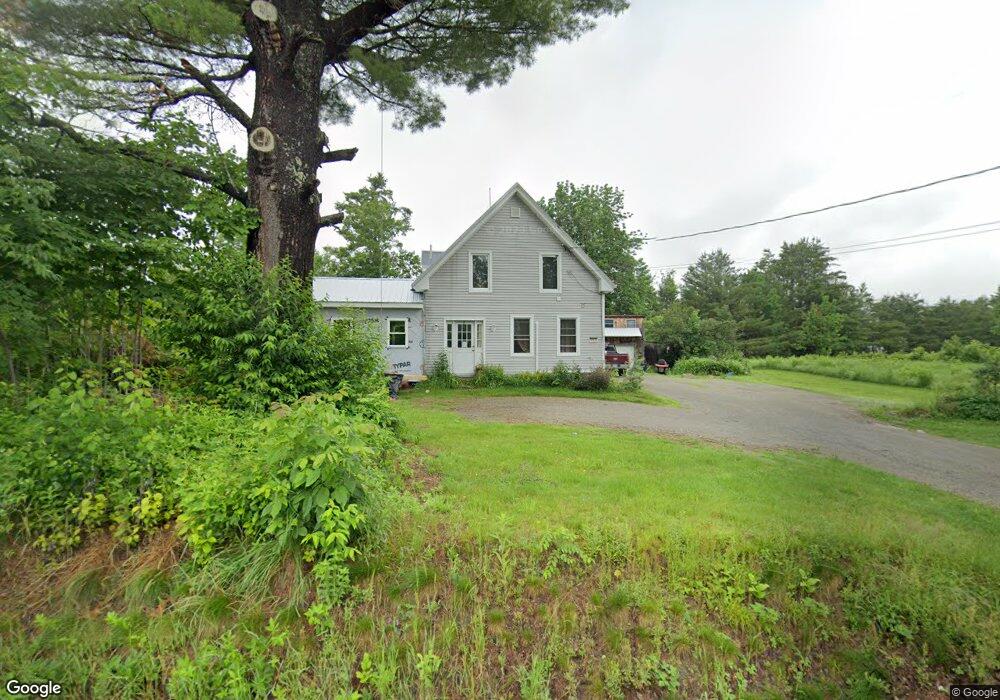
112 River Rd New Portland, ME 04961
Estimated Value: $171,237 - $280,000
4
Beds
2
Baths
1,296
Sq Ft
$171/Sq Ft
Est. Value
About This Home
This home is located at 112 River Rd, New Portland, ME 04961 and is currently estimated at $222,059, approximately $171 per square foot. 112 River Rd is a home.
Ownership History
Date
Name
Owned For
Owner Type
Purchase Details
Closed on
Feb 28, 2008
Sold by
Rundlett Brian S
Bought by
Rundlett Brian S and Rundlett Stacie M
Current Estimated Value
Home Financials for this Owner
Home Financials are based on the most recent Mortgage that was taken out on this home.
Original Mortgage
$100,000
Outstanding Balance
$62,214
Interest Rate
5.8%
Estimated Equity
$159,845
Purchase Details
Closed on
Sep 7, 2006
Sold by
Rundeltt Clayton A Est and Petersen
Bought by
Rundlett Brian S
Home Financials for this Owner
Home Financials are based on the most recent Mortgage that was taken out on this home.
Original Mortgage
$58,600
Interest Rate
9%
Create a Home Valuation Report for This Property
The Home Valuation Report is an in-depth analysis detailing your home's value as well as a comparison with similar homes in the area
Home Values in the Area
Average Home Value in this Area
Purchase History
| Date | Buyer | Sale Price | Title Company |
|---|---|---|---|
| Rundlett Brian S | -- | -- | |
| Rundlett Brian S | -- | -- | |
| Rundlett Brian S | -- | -- | |
| Rundlett Brian S | -- | -- | |
| Rundlett Brian S | -- | -- | |
| Rundlett Brian S | -- | -- |
Source: Public Records
Mortgage History
| Date | Status | Borrower | Loan Amount |
|---|---|---|---|
| Open | Rundlett Brian S | $100,000 | |
| Closed | Rundlett Brian S | $100,000 | |
| Closed | Rundlett Brian S | $58,600 |
Source: Public Records
Tax History Compared to Growth
Tax History
| Year | Tax Paid | Tax Assessment Tax Assessment Total Assessment is a certain percentage of the fair market value that is determined by local assessors to be the total taxable value of land and additions on the property. | Land | Improvement |
|---|---|---|---|---|
| 2024 | $1,754 | $124,400 | $8,700 | $115,700 |
| 2023 | $1,125 | $81,500 | $7,200 | $74,300 |
| 2022 | $1,113 | $75,200 | $7,200 | $68,000 |
| 2021 | $1,191 | $55,900 | $5,500 | $50,400 |
| 2020 | $1,286 | $55,900 | $5,500 | $50,400 |
| 2019 | $1,068 | $55,900 | $5,500 | $50,400 |
| 2018 | $957 | $52,900 | $5,000 | $47,900 |
| 2017 | $947 | $52,900 | $5,000 | $47,900 |
| 2016 | $913 | $51,000 | $4,500 | $46,500 |
| 2015 | $891 | $52,400 | $4,500 | $47,900 |
| 2014 | $891 | $52,400 | $4,500 | $47,900 |
| 2013 | $939 | $54,600 | $3,000 | $51,600 |
Source: Public Records
Map
Nearby Homes
- 42 43 47 & 49 River Rd
- 42 43 47 & 49 River Rd
- 130 Bennett Hill Rd
- 0 River Rd Unit 1621274
- 273 Lemon Stream Rd
- 301 Carrabassett Rd
- 368 Lemon Stream Rd
- 15 Spruce Rd
- Lot 18&20 Carrabassett Rd
- MR8 L4-5 Shingle Mill Rd
- MR8 L4-4 Shingle Mill Rd
- 155 Anson Valley Rd
- 56 School St
- 152 Johnson Rd
- M12 Lot 5 22
- 320 School St
- 176 Long Falls Dam Rd
- 205 Long Falls Dam Rd
- 575 4 Mile Square Rd
- Lot 4 Middlegate Ln
- 611 River Rd
- 768 River Rd
- 107 River Rd
- 118 River Rd
- 105 River Rd
- 92 River Rd
- 82 River Rd
- 186 River Rd
- 89 River Rd
- Lot 14 A Route 146 River Rd
- 16 & 20 Tannery Bridge Rd
- 76 River Rd
- 56 Wire Bridge Rd
- 20 Tannery Bridge Rd
- 160 River Rd
- 61 Wire Bridge Rd
- 68 River Rd
- 388 Bennett Hill Rd
- 14 Bennett Hill Rd
- 0 Rte 146