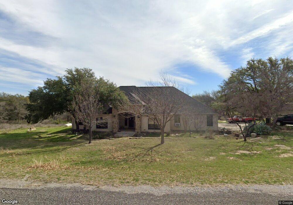
112 Rockridge Ct Weatherford, TX 76087
Estimated Value: $467,000 - $555,000
--
Bed
--
Bath
2,328
Sq Ft
$221/Sq Ft
Est. Value
About This Home
This home is located at 112 Rockridge Ct, Weatherford, TX 76087 and is currently estimated at $513,345, approximately $220 per square foot. 112 Rockridge Ct is a home located in Parker County with nearby schools including Austin Elementary School, Hall Middle School, and Weatherford High School.
Ownership History
Date
Name
Owned For
Owner Type
Purchase Details
Closed on
Mar 25, 2006
Sold by
Whitling Jimmy D and Whitling Anna M
Bought by
Hamiter Tom and Hamiter Lisa D
Current Estimated Value
Purchase Details
Closed on
Mar 16, 2005
Sold by
Lee Doyle and Lee Rebecca
Bought by
Hamiter Tom and Hamiter Lisa D
Purchase Details
Closed on
Apr 12, 1993
Bought by
Hamiter Tom and Hamiter Lisa D
Purchase Details
Closed on
Jan 1, 1901
Bought by
Hamiter Tom and Hamiter Lisa D
Create a Home Valuation Report for This Property
The Home Valuation Report is an in-depth analysis detailing your home's value as well as a comparison with similar homes in the area
Home Values in the Area
Average Home Value in this Area
Purchase History
| Date | Buyer | Sale Price | Title Company |
|---|---|---|---|
| Hamiter Tom | -- | Alamo Title | |
| Hamiter Tom | -- | -- | |
| Whitling Jimmy D | -- | None Available | |
| Hamiter Tom | -- | -- | |
| Hamiter Tom | -- | -- |
Source: Public Records
Tax History Compared to Growth
Tax History
| Year | Tax Paid | Tax Assessment Tax Assessment Total Assessment is a certain percentage of the fair market value that is determined by local assessors to be the total taxable value of land and additions on the property. | Land | Improvement |
|---|---|---|---|---|
| 2025 | $5,385 | $433,531 | -- | -- |
| 2024 | $5,385 | $394,119 | -- | -- |
| 2023 | $5,385 | $358,290 | $0 | $0 |
| 2022 | $6,064 | $325,720 | $80,000 | $245,720 |
| 2021 | $6,575 | $325,720 | $80,000 | $245,720 |
| 2020 | $6,054 | $298,490 | $40,000 | $258,490 |
| 2019 | $5,945 | $298,490 | $40,000 | $258,490 |
| 2018 | $5,433 | $249,790 | $35,000 | $214,790 |
| 2017 | $5,544 | $249,790 | $35,000 | $214,790 |
| 2016 | $5,321 | $239,710 | $35,000 | $204,710 |
| 2015 | $4,880 | $239,710 | $35,000 | $204,710 |
| 2014 | $3,800 | $198,030 | $35,000 | $163,030 |
Source: Public Records
Map
Nearby Homes
- 221 Arapahoe Ridge
- 344 Clear Lake Ln
- 105 Country Green Ct
- 115 Autumn Springs Ct
- 104 Carriage Hill Ct
- 2113 Country Brook Dr
- 2020 Maplewood Dr
- 2218 Lake Country Dr
- 2214 Lake Country Dr
- 1910 Maplewood Dr
- 2102 Clear Creek Dr
- 2116 Clear Lake Rd
- 1905 Clear Creek Dr
- 2202 Lakeforest Dr
- 2904 E Bankhead Hwy
- 510 Lockwood Ln
- 401 Dixon Rd
- 1421 Highlake Ln
- 2001 Santa fe Dr
- 368 Lockwood Ln
- 117 Rockridge Ct
- 106 Rockridge Ct
- 113 Rockridge Ct
- 109 Rockridge Ct
- 27 Rockridge Ct
- 106 Woodhaven Ct
- 105 Rockridge Ct
- 102 Rockridge Ct
- 1925 Circleview Dr
- 115 Ancient Bend
- 1917 Circleview Dr
- 1933 Circleview Dr
- 121 Arapahoe Ridge
- 106 Walnut Ct
- 1805 Circleview Dr
- 120 Ancient Bend
- 1911 Circleview Dr
- 1922 Circleview Dr
- 1802 Circleview Dr
- 1926 Circleview Dr