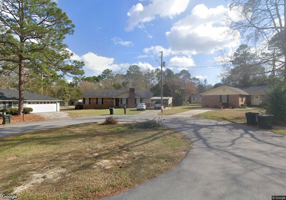
112 Rogers Ct Statesboro, GA 30458
Estimated Value: $214,000 - $262,000
3
Beds
2
Baths
1,820
Sq Ft
$133/Sq Ft
Est. Value
About This Home
This home is located at 112 Rogers Ct, Statesboro, GA 30458 and is currently estimated at $241,399, approximately $132 per square foot. 112 Rogers Ct is a home located in Bulloch County with nearby schools including Statesboro High School, Sallie Zetterower Elementary School, and Langston Chapel Middle School.
Ownership History
Date
Name
Owned For
Owner Type
Purchase Details
Closed on
Feb 22, 2016
Sold by
Akins Christopher F
Bought by
Chris Akins Rentals Llc
Current Estimated Value
Purchase Details
Closed on
Mar 24, 2005
Sold by
Federico Ramona L
Bought by
Akins Christopher F
Home Financials for this Owner
Home Financials are based on the most recent Mortgage that was taken out on this home.
Original Mortgage
$92,135
Interest Rate
5.62%
Mortgage Type
New Conventional
Purchase Details
Closed on
Jun 1, 2001
Bought by
Federico Ramona L
Purchase Details
Closed on
Jul 1, 1986
Bought by
Seamans Gregory L and Seamans Lisa
Create a Home Valuation Report for This Property
The Home Valuation Report is an in-depth analysis detailing your home's value as well as a comparison with similar homes in the area
Home Values in the Area
Average Home Value in this Area
Purchase History
| Date | Buyer | Sale Price | Title Company |
|---|---|---|---|
| Chris Akins Rentals Llc | -- | -- | |
| Akins Christopher F | $102,500 | -- | |
| Federico Ramona L | -- | -- | |
| Seamans Gregory L | -- | -- |
Source: Public Records
Mortgage History
| Date | Status | Borrower | Loan Amount |
|---|---|---|---|
| Previous Owner | Akins Christopher F | $92,135 |
Source: Public Records
Tax History Compared to Growth
Tax History
| Year | Tax Paid | Tax Assessment Tax Assessment Total Assessment is a certain percentage of the fair market value that is determined by local assessors to be the total taxable value of land and additions on the property. | Land | Improvement |
|---|---|---|---|---|
| 2024 | $2,121 | $77,376 | $6,880 | $70,496 |
| 2023 | $1,748 | $61,036 | $5,960 | $55,076 |
| 2022 | $1,045 | $53,269 | $5,960 | $47,309 |
| 2021 | $930 | $46,111 | $5,960 | $40,151 |
| 2020 | $922 | $44,418 | $5,960 | $38,458 |
| 2019 | $931 | $44,601 | $5,960 | $38,641 |
| 2018 | $922 | $42,341 | $5,960 | $36,381 |
| 2017 | $891 | $40,457 | $5,960 | $34,497 |
| 2016 | $891 | $39,447 | $5,960 | $33,487 |
| 2015 | $862 | $38,003 | $5,960 | $32,043 |
| 2014 | $792 | $38,003 | $5,960 | $32,043 |
Source: Public Records
Map
Nearby Homes
- 20 Greenwood Ave
- 204 S Edgewood Dr
- 321 Farmington Rd
- 218 S Edgewood Dr
- 1508 Oneal Dr
- 0 Lanier Dr Unit 10329553
- 111 Dumbarton Dr
- 9 Robin Hood Rd
- 217 Wildwood Dr
- 0 Henry Blvd Unit 10609902
- 313 Gentilly Rd
- 203 Gentilly Rd
- 0 Northside Dr E Unit 10610985
- 503 Saxon Cove
- 202 Tannery Ln
- 141 Griffith Ln
- 313 Donaldson St
- 362 Savannah Ave
- 360 Savannah Ave
- 510 S College St
- 114 Rogers Ct
- 110 Rogers Ct
- 210 John Paul Ave
- 212 John Paul Ave
- 208 John Paul Ave
- 206 John Paul Ave
- 108 Rogers Ct
- 116 Rogers Ct
- 214 John Paul Ave
- 106 Rogers Ct
- 0 John Paul Ave Unit 3183215
- 0 John Paul Ave Unit 7510731
- 0 John Paul Ave Unit 7452794
- 0 John Paul Ave Unit 7177739
- 0 John Paul Ave Unit 7252644
- 0 John Paul Ave Unit 7150488
- 0 John Paul Ave Unit 8576404
- 0 John Paul Ave Unit 7631769
- 0 John Paul Ave
- 204 John Paul Ave