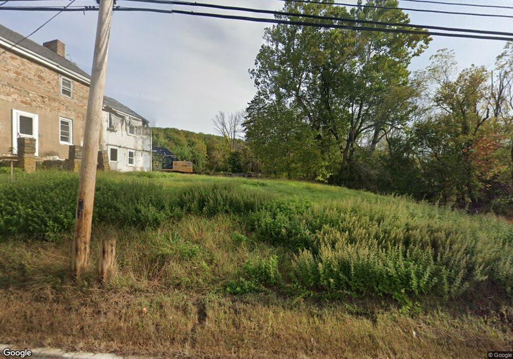
112 Route173 Union Twp., NJ 08802
Estimated Value: $288,000 - $572,000
--
Bed
--
Bath
2,116
Sq Ft
$208/Sq Ft
Est. Value
About This Home
This home is located at 112 Route173, Union Twp., NJ 08802 and is currently estimated at $440,686, approximately $208 per square foot. 112 Route173 is a home located in Hunterdon County with nearby schools including Union Township Elementary School, Union Township Middle School, and North Hunterdon High School.
Ownership History
Date
Name
Owned For
Owner Type
Purchase Details
Closed on
Aug 4, 2023
Sold by
Campanelli Laurie
Bought by
Cervid Forest Resources Llc
Current Estimated Value
Purchase Details
Closed on
Jun 23, 2023
Sold by
Anand Amitoz
Bought by
Campanelli Laurie
Purchase Details
Closed on
Dec 10, 2020
Sold by
Wood Randall S and Wood Mary Susan
Bought by
Anand Amitoz
Purchase Details
Closed on
Jul 10, 1995
Sold by
Glester Grace and Gleason Grace
Bought by
Wood Randall S and Wood Mary Susan
Create a Home Valuation Report for This Property
The Home Valuation Report is an in-depth analysis detailing your home's value as well as a comparison with similar homes in the area
Home Values in the Area
Average Home Value in this Area
Purchase History
| Date | Buyer | Sale Price | Title Company |
|---|---|---|---|
| Cervid Forest Resources Llc | -- | Stewart Title | |
| Campanelli Laurie | $275,000 | Stewart Title | |
| Campanelli Laurie | $275,000 | Stewart Title | |
| Anand Amitoz | $172,000 | Cortes And Hay Ttl Agcy Inc | |
| Wood Randall S | $145,000 | -- |
Source: Public Records
Tax History Compared to Growth
Tax History
| Year | Tax Paid | Tax Assessment Tax Assessment Total Assessment is a certain percentage of the fair market value that is determined by local assessors to be the total taxable value of land and additions on the property. | Land | Improvement |
|---|---|---|---|---|
| 2025 | $5,433 | $256,400 | $169,800 | $86,600 |
| 2024 | $5,464 | $256,400 | $169,800 | $86,600 |
| 2023 | $5,464 | $256,400 | $169,800 | $86,600 |
| 2022 | $4,628 | $150,900 | $114,800 | $36,100 |
| 2021 | $4,313 | $150,900 | $114,800 | $36,100 |
| 2020 | $4,424 | $150,900 | $114,800 | $36,100 |
| 2019 | $4,313 | $150,900 | $114,800 | $36,100 |
| 2018 | $4,132 | $150,900 | $114,800 | $36,100 |
| 2017 | $3,994 | $150,900 | $114,800 | $36,100 |
| 2016 | $3,925 | $150,900 | $114,800 | $36,100 |
| 2015 | $3,976 | $150,900 | $114,800 | $36,100 |
| 2014 | $3,999 | $150,900 | $114,800 | $36,100 |
Source: Public Records
Map
Nearby Homes
- 420 Bellwood Ave
- 584 County Road 614
- 69 Baptist Church Rd
- 368 Strotz Rd
- 484 Route614
- 853 Norton Church Rd
- 0 Baptist Church Rd
- 601 Fox Farm Rd
- 140 Driftway E
- 759 County Road 625
- 745 County Road 625
- N/A Gravel Hill Rd
- 58 Oakwood Blvd
- 324 Tunnel Rd
- 18 Bridle Path Dr
- 92 Country Acres Dr
- 919 Iron Bridge Rd
- 634 County Road 579
- 531 Ludlow Station Rd
- 2 Stony Brook Ln
- 313 Strotz Rd
- 586 Route 614
- 315 Strotz Rd
- 422 Bellwood Ave
- 418 Bellwood Ave
- 416 Bellwood Ave
- 317 Strotz Rd
- 414 Bellwood Ave
- 144 State Route 173
- 19 White Oak Dr
- 425 Bellwood Ave
- 412 Bellwood Ave
- 730 Marudy Dr
- 319 Strotz Rd
- 727 Marudy Dr
- 711 Marudy Dr
- 142 State Route 173
- 712 Marudy Dr
- 13 White Oak Dr
- 21 White Oak Dr