Estimated Value: $172,000 - $207,000
2
Beds
1
Bath
1,915
Sq Ft
$96/Sq Ft
Est. Value
About This Home
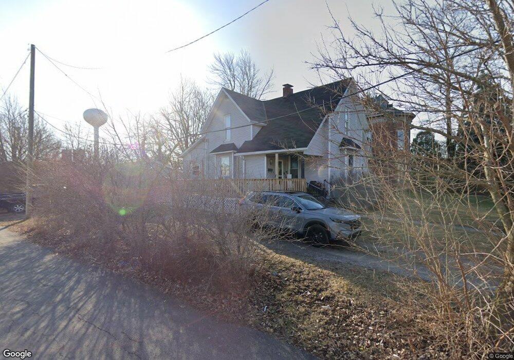
This home is located at 112 S Johnson St, Ada, OH 45810 and is currently estimated at $184,382, approximately $96 per square foot. 112 S Johnson St is a home located in Hardin County with nearby schools including Ada Elementary School and Ada High School.
Ownership History
Date
Name
Owned For
Owner Type
Purchase Details
Closed on
Feb 14, 2013
Sold by
Umphress Jon W and Umphress Susan J
Bought by
Wyndham Enterprises Ltd
Current Estimated Value
Home Financials for this Owner
Home Financials are based on the most recent Mortgage that was taken out on this home.
Original Mortgage
$58,500
Outstanding Balance
$26,392
Interest Rate
3.38%
Mortgage Type
Future Advance Clause Open End Mortgage
Estimated Equity
$157,990
Create a Home Valuation Report for This Property
The Home Valuation Report is an in-depth analysis detailing your home's value as well as a comparison with similar homes in the area
Home Values in the Area
Average Home Value in this Area
Purchase History
| Date | Buyer | Sale Price | Title Company |
|---|---|---|---|
| Wyndham Enterprises Ltd | $79,000 | None Available |
Source: Public Records
Mortgage History
| Date | Status | Borrower | Loan Amount |
|---|---|---|---|
| Open | Wyndham Enterprises Ltd | $58,500 |
Source: Public Records
Tax History Compared to Growth
Tax History
| Year | Tax Paid | Tax Assessment Tax Assessment Total Assessment is a certain percentage of the fair market value that is determined by local assessors to be the total taxable value of land and additions on the property. | Land | Improvement |
|---|---|---|---|---|
| 2024 | $1,794 | $44,970 | $3,000 | $41,970 |
| 2023 | $1,782 | $44,970 | $3,000 | $41,970 |
| 2022 | $1,719 | $37,940 | $2,910 | $35,030 |
| 2021 | $1,889 | $37,940 | $2,910 | $35,030 |
| 2020 | $1,915 | $37,940 | $2,910 | $35,030 |
| 2019 | $1,726 | $34,560 | $2,770 | $31,790 |
| 2018 | $1,689 | $34,560 | $2,770 | $31,790 |
| 2017 | $1,652 | $34,560 | $2,770 | $31,790 |
| 2016 | $1,299 | $28,480 | $2,690 | $25,790 |
| 2015 | $1,244 | $28,480 | $2,690 | $25,790 |
| 2014 | $4,288 | $28,480 | $2,690 | $25,790 |
| 2013 | $1,547 | $29,990 | $2,690 | $27,300 |
Source: Public Records
Map
Nearby Homes
- 211 S Main St
- 308-310 S Simon St
- 210 N Gilbert St
- 211 W Buckeye Ave Unit 211 1/2
- 314 E University Ave
- 442 Edwards St
- 503 E North Ave
- 710 S Main St
- 128 W North Ave
- 629 N Main St
- 820 S Main St
- 602 Conley Ave
- 916 S Main St
- 318 Willeke Ave
- 4071 Township Road 35
- 3931 County Road 80
- 803 N Front St
- 3769 County Road 304
- 303 N Front St
- 6782 County Road 15
- 118 S Johnson St
- 113 S Johnson St
- 115 S Johnson St
- 130 S Johnson St
- 121 S Johnson St
- 211 E Buckeye Ave
- 138 S Johnson St
- 218 E Lincoln Ave
- 125 E Buckeye Ave Unit 3
- 125 E Buckeye Ave
- 125 E Buckeye Ave
- 220 E Lincoln Ave
- 224 E Lincoln Ave
- 220 E Buckeye Ave
- 226 E Lincoln Ave
- 212 E Buckeye Ave
- 222 E Buckeye Ave
- 302 E Lincoln Ave
- 125 E Lincoln Ave
- 221 E Lincoln Ave