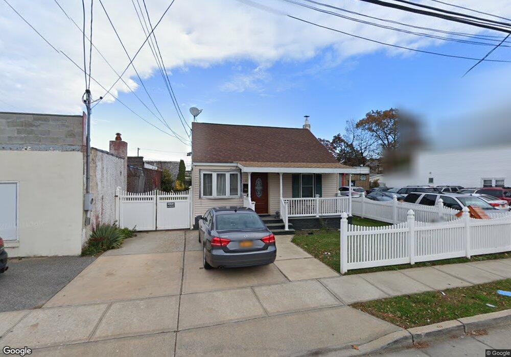
112 S Strong Ave Lindenhurst, NY 11757
Estimated Value: $546,000 - $970,000
3
Beds
2
Baths
624
Sq Ft
$1,064/Sq Ft
Est. Value
About This Home
This home is located at 112 S Strong Ave, Lindenhurst, NY 11757 and is currently estimated at $663,895, approximately $1,063 per square foot. 112 S Strong Ave is a home located in Suffolk County with nearby schools including West Gates Elementary School, Lindenhurst Middle School, and Lindenhurst Senior High School.
Ownership History
Date
Name
Owned For
Owner Type
Purchase Details
Closed on
Apr 10, 2014
Sold by
Rodriguez Ruben and Rodriguez Genobeba
Bought by
Vargas Paulo
Current Estimated Value
Home Financials for this Owner
Home Financials are based on the most recent Mortgage that was taken out on this home.
Original Mortgage
$148,000
Outstanding Balance
$112,592
Interest Rate
4.36%
Mortgage Type
New Conventional
Estimated Equity
$551,303
Purchase Details
Closed on
Sep 19, 1995
Sold by
The Money Store
Bought by
Rodriguez Ruben and Rodriguez Genobeba
Create a Home Valuation Report for This Property
The Home Valuation Report is an in-depth analysis detailing your home's value as well as a comparison with similar homes in the area
Home Values in the Area
Average Home Value in this Area
Purchase History
| Date | Buyer | Sale Price | Title Company |
|---|---|---|---|
| Vargas Paulo | $185,000 | -- | |
| Rodriguez Ruben | $63,000 | Stewart Title Insurance Co |
Source: Public Records
Mortgage History
| Date | Status | Borrower | Loan Amount |
|---|---|---|---|
| Open | Vargas Paulo | $148,000 |
Source: Public Records
Tax History Compared to Growth
Tax History
| Year | Tax Paid | Tax Assessment Tax Assessment Total Assessment is a certain percentage of the fair market value that is determined by local assessors to be the total taxable value of land and additions on the property. | Land | Improvement |
|---|---|---|---|---|
| 2024 | $8,381 | $2,210 | $330 | $1,880 |
| 2023 | $7,484 | $2,210 | $330 | $1,880 |
| 2022 | $4,964 | $2,210 | $330 | $1,880 |
| 2021 | $4,964 | $2,210 | $330 | $1,880 |
| 2020 | $5,139 | $1,620 | $330 | $1,290 |
| 2019 | $5,938 | $0 | $0 | $0 |
| 2018 | -- | $1,620 | $330 | $1,290 |
| 2017 | $4,942 | $1,620 | $330 | $1,290 |
| 2016 | $4,950 | $1,620 | $330 | $1,290 |
| 2015 | -- | $1,620 | $330 | $1,290 |
| 2014 | -- | $1,620 | $330 | $1,290 |
Source: Public Records
Map
Nearby Homes
- 145 S 15th St
- 540 Scudder Ave
- 366 W Gates Ave
- 215 Cortland St
- 205 S 12th St
- 21 Cambridge Dr W Unit 21
- 92 Cambridge Dr Unit 92
- 209 28th St
- 14 Cambridge Dr W
- 203 29th St
- 257 S 11th St
- 104 27th St
- 369 S 16th St
- 307 Ferndale Ct
- 274 S 10th St
- 404 Kensington Ct
- 196 W Gates Ave
- 540 Oak St
- 159 Copiague Place
- 90 27th St
- 669 W Hoffman Ave
- 669 W Hoffman Ave
- 669 W Hoffman Ave
- 128 S Strong Ave
- 651 W Hoffman Ave
- 141 S 16th St
- 176 S Strong Ave
- 173 S 16th St
- 178 S Strong Ave
- 140 S 16th St
- 180 S Strong Ave
- 152 S 16th St
- 175 S 16th St
- 184 S Strong Ave
- 109 S 15th St
- 160 S 16th St
- 188 S Strong Ave
- 155 S 15th St
- 622 Oak St Unit 622 628 630
- 622 Oak St Unit 622