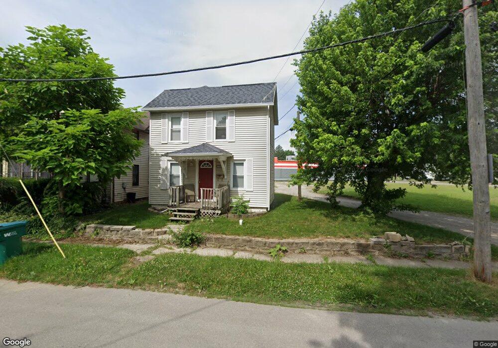
112 Scott St La Porte, IN 46350
Estimated Value: $119,485 - $178,000
2
Beds
1
Bath
1,176
Sq Ft
$121/Sq Ft
Est. Value
About This Home
This home is located at 112 Scott St, La Porte, IN 46350 and is currently estimated at $142,871, approximately $121 per square foot. 112 Scott St is a home located in LaPorte County with nearby schools including Carver Elementary School, Hailmann Elementary School, and La Porte High School.
Ownership History
Date
Name
Owned For
Owner Type
Purchase Details
Closed on
Nov 28, 2020
Sold by
Red Bridge Farm Llc
Bought by
Maxsafe Holdings Llc
Current Estimated Value
Purchase Details
Closed on
Apr 2, 2020
Sold by
Maxsafe Holding Llc
Bought by
Red Bridge Farm Llc
Purchase Details
Closed on
Oct 8, 2019
Sold by
Laporte County Auditor
Bought by
Maxsafe Holdings Llc
Create a Home Valuation Report for This Property
The Home Valuation Report is an in-depth analysis detailing your home's value as well as a comparison with similar homes in the area
Home Values in the Area
Average Home Value in this Area
Purchase History
| Date | Buyer | Sale Price | Title Company |
|---|---|---|---|
| Maxsafe Holdings Llc | -- | None Available | |
| Red Bridge Farm Llc | -- | None Available | |
| Maxsafe Holdings Llc | $16,000 | None Available |
Source: Public Records
Tax History Compared to Growth
Tax History
| Year | Tax Paid | Tax Assessment Tax Assessment Total Assessment is a certain percentage of the fair market value that is determined by local assessors to be the total taxable value of land and additions on the property. | Land | Improvement |
|---|---|---|---|---|
| 2024 | $1,135 | $54,500 | $10,200 | $44,300 |
| 2022 | $1,246 | $62,300 | $8,500 | $53,800 |
| 2021 | $1,276 | $63,800 | $8,500 | $55,300 |
| 2020 | $1,304 | $63,800 | $8,500 | $55,300 |
| 2019 | $1,334 | $64,300 | $8,200 | $56,100 |
| 2018 | $1,986 | $57,300 | $6,500 | $50,800 |
| 2017 | $1,192 | $57,200 | $6,500 | $50,700 |
| 2016 | $1,034 | $49,300 | $8,400 | $40,900 |
| 2014 | $946 | $47,300 | $8,400 | $38,900 |
Source: Public Records
Map
Nearby Homes
- 503 Grove St
- 0 Brighton St Unit NRA542345
- 414 Allen St
- 205 Lawrence St
- 107 Lincolnway
- 202 Jefferson Ave
- 330 Virginia Ave
- 208 Norton St
- 717 E Lincolnway
- 906 Linwood Ave
- 403 Rose St
- 506 Pulaski St
- 206 Ohio St
- 910 Scott St
- 706 Detroit St
- 161 W Mcclung Rd
- 810 Virginia Ave
- 413 Jefferson Ave
- 0 E Jefferson Ave
- 807 Division St