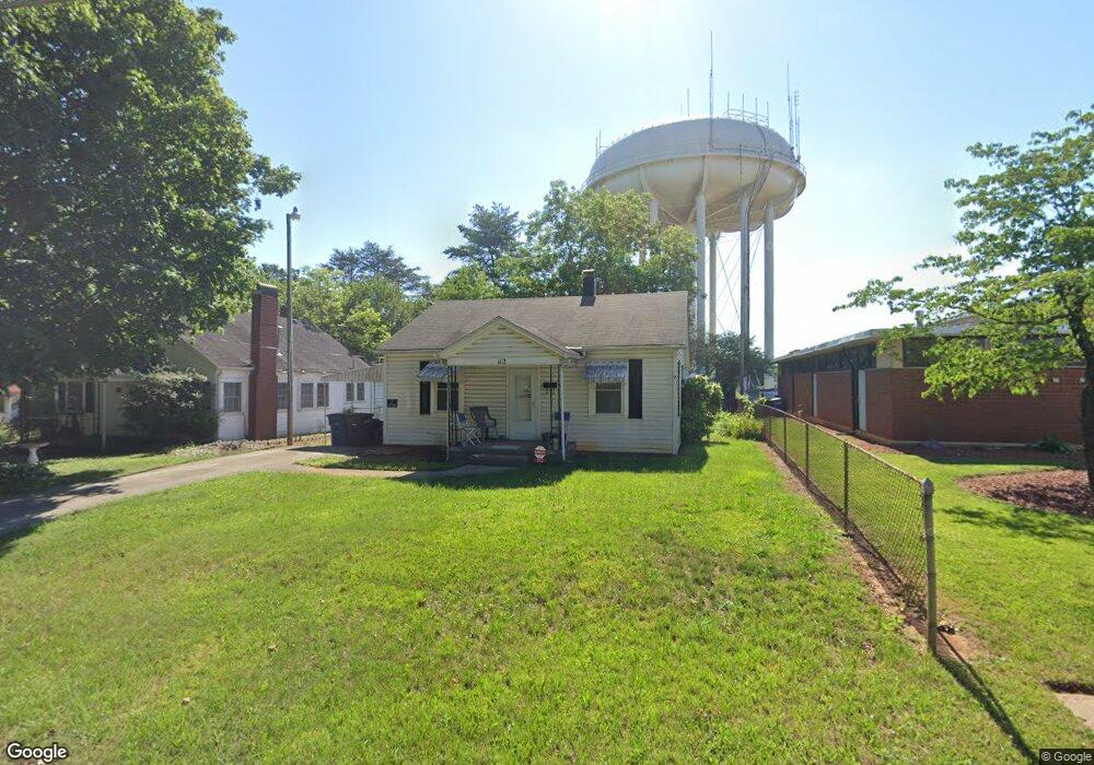
112 Security Dr Statesville, NC 28677
Estimated Value: $99,898 - $304,000
2
Beds
1
Bath
945
Sq Ft
$173/Sq Ft
Est. Value
About This Home
This home is located at 112 Security Dr, Statesville, NC 28677 and is currently estimated at $163,725, approximately $173 per square foot. 112 Security Dr is a home located in Iredell County with nearby schools including N.B. Mills Elementary School, West Iredell Middle School, and West Iredell High School.
Ownership History
Date
Name
Owned For
Owner Type
Purchase Details
Closed on
Aug 6, 2007
Sold by
Walker Joyce Reavis and Walker Joe Roy
Bought by
Jordan Larry Wayne
Current Estimated Value
Purchase Details
Closed on
Jul 1, 1986
Purchase Details
Closed on
May 1, 1985
Purchase Details
Closed on
Jun 1, 1955
Create a Home Valuation Report for This Property
The Home Valuation Report is an in-depth analysis detailing your home's value as well as a comparison with similar homes in the area
Home Values in the Area
Average Home Value in this Area
Purchase History
| Date | Buyer | Sale Price | Title Company |
|---|---|---|---|
| Jordan Larry Wayne | $42,000 | None Available | |
| -- | $25,500 | -- | |
| -- | $18,000 | -- | |
| -- | -- | -- |
Source: Public Records
Tax History Compared to Growth
Tax History
| Year | Tax Paid | Tax Assessment Tax Assessment Total Assessment is a certain percentage of the fair market value that is determined by local assessors to be the total taxable value of land and additions on the property. | Land | Improvement |
|---|---|---|---|---|
| 2024 | $653 | $58,250 | $12,600 | $45,650 |
| 2023 | $653 | $58,250 | $12,600 | $45,650 |
| 2022 | $603 | $44,530 | $12,600 | $31,930 |
| 2021 | $659 | $44,530 | $12,600 | $31,930 |
| 2020 | $659 | $44,530 | $12,600 | $31,930 |
| 2019 | $655 | $44,530 | $12,600 | $31,930 |
| 2018 | $543 | $36,770 | $12,600 | $24,170 |
| 2017 | $535 | $36,770 | $12,600 | $24,170 |
| 2016 | $535 | $36,770 | $12,600 | $24,170 |
| 2015 | $397 | $36,770 | $12,600 | $24,170 |
| 2014 | $403 | $39,270 | $12,600 | $26,670 |
Source: Public Records
Map
Nearby Homes
- 1713 Forest Dr
- 328 N Miller Ave
- 50 S Miller Ave Unit A
- 50 S Miller Ave Unit B
- 2321 Cline St
- 127 Bristol Rd
- 1716 Younger Ave
- 214 H St
- 612 Stewart Ct
- 541 Hedrick Dr
- 1709 Younger Ave
- 417 Central Dr
- 407 Central Dr
- 1261 Elizabeth Ave
- 2607 Moss Rd
- 1245 Mitchell Ave
- 440 N Oakland Ave
- 266 N Lackey St
- 3 Williams Ave
- 133 Buffalo Shoals Rd
- 114 Security Dr
- 1914 Guy St
- 202 Security Dr
- 1925 Guy St
- 1919 Guy St
- 113 Security Dr
- 210 Security Dr
- 201 Security Dr
- 1901 W Front St
- 1923 Guy St
- 1923 Guy St
- 1809 W Front St Unit C
- 1809 W Front St Unit B
- 1809 W Front St Unit A
- 203 Security Dr
- 1914 Cline St
- 214 Security Dr
- 1933 Guy St
- 1912 Cline St
- 130 Woodlawn Dr