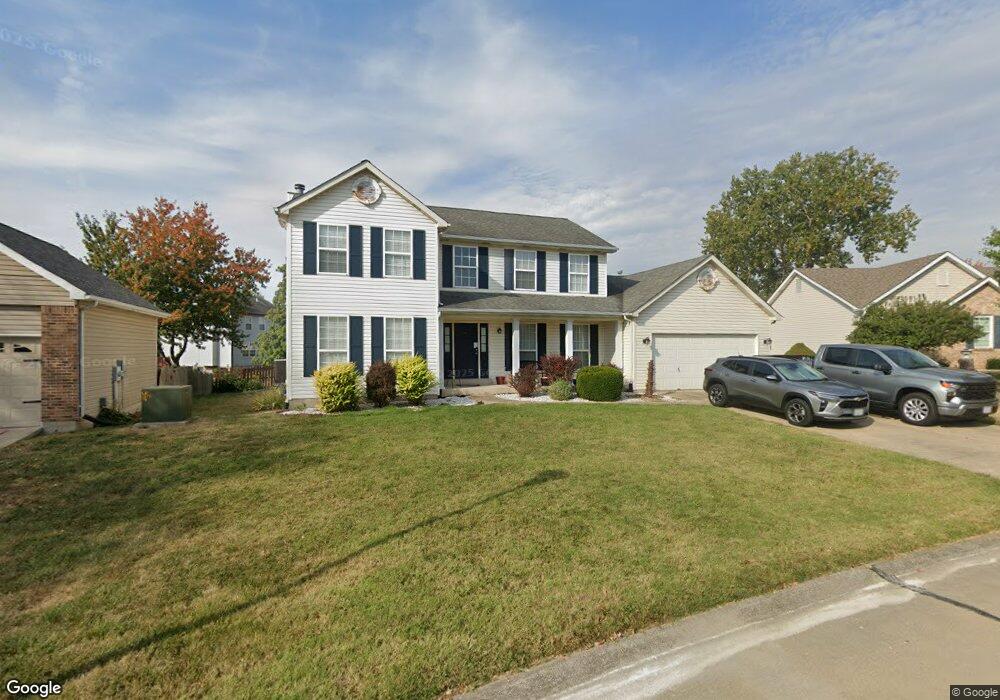
112 Spangle Way Ct O Fallon, MO 63366
Estimated Value: $417,000 - $452,000
About This Home
This home is located at 112 Spangle Way Ct, O Fallon, MO 63366 and is currently estimated at $436,002, approximately $170 per square foot. 112 Spangle Way Ct is a home located in St. Charles County with nearby schools including Rock Creek Elementary School, Fort Zumwalt West Middle School, and Fort Zumwalt West High School.
Ownership History
We collect this data history from publicly available records. To have your information removed, we recommend requesting removal directly through your county’s website.
Purchase Details
Purchase Details
Home Financials for this Owner
Home Financials are based on the most recent Mortgage that was taken out on this home.Home Values in the Area
Average Home Value in this Area
Purchase History
We collect this data history from publicly available records. To have your information removed, we recommend requesting removal directly through your county’s website.
| Date | Buyer | Sale Price | Title Company |
|---|---|---|---|
| -- | -- | ||
| -- | -- |
Mortgage History
We collect this data history from publicly available records. To have your information removed, we recommend requesting removal directly through your county’s website.
| Date | Status | Borrower | Loan Amount |
|---|---|---|---|
| Closed | $144,000 |
Tax History
We collect this data history from publicly available records. To have your information removed, we recommend requesting removal directly through your county’s website.
| Year | Tax Paid | Tax Assessment Tax Assessment Total Assessment is a certain percentage of the fair market value that is determined by local assessors to be the total taxable value of land and additions on the property. | Land | Improvement |
|---|---|---|---|---|
| 2025 | $4,234 | $70,930 | -- | -- |
| 2023 | $4,236 | $64,063 | $0 | $0 |
| 2022 | $4,364 | $61,462 | $0 | $0 |
| 2021 | $4,367 | $61,462 | $0 | $0 |
| 2020 | $3,747 | $51,011 | $0 | $0 |
| 2019 | $3,756 | $51,011 | $0 | $0 |
| 2018 | $3,536 | $45,843 | $0 | $0 |
| 2017 | $3,494 | $45,843 | $0 | $0 |
| 2016 | $3,172 | $41,446 | $0 | $0 |
| 2015 | $2,949 | $41,446 | $0 | $0 |
| 2014 | $2,796 | $38,644 | $0 | $0 |
Map
- 7 Windsor Chair Ct
- 3 Revolutionary Way Ct
- 1156 Ivy Point Dr
- 1473 Shelby Point Dr
- 1442 Shelby Point Dr
- 1436 Soaring Eagle Dr
- 1435 Soaring Eagle Dr
- 1311 Norwood Hills Dr
- 1307 Norwood Hills Dr
- 1357 Crooked Stick Dr
- 1241 Pinehurst Club Ct
- 951 Annabrook Park Dr
- 633 Longhorn Dr
- 1100 Cypress Point Dr
- 2323 Sundance Dr
- 2404 Stoney Brook Dr
- 64 Hickory Meadows Ct
- 406 Winter Wind Dr
- 6 Merribrook Ct
- 16 Saddleback Ct
- 110 Spangle Way Ct
- 108 Spangle Way Ct
- 1412 Presidents Landing Dr
- 1418 Presidents Landing Dr
- 1406 Presidents Landing Dr
- 114 Spangle Way Ct
- 1424 Presidents Landing Dr
- 5 Town Cryer Ct
- 106 Spangle Way Ct
- 113 Spangle Way Ct
- 1400 Presidents Landing Dr
- 7 Town Cryer Ct
- 3 Town Cryer Ct
- 116 Spangle Way Ct
- 117 Spangle Way Ct
- 107 Spangle Way Ct
- 740 Fife And Drum Dr
- 1413 Presidents Landing Dr
- 105 Spangle Way Ct
- 1419 Presidents Landing Dr
Ask me questions while you tour the home.