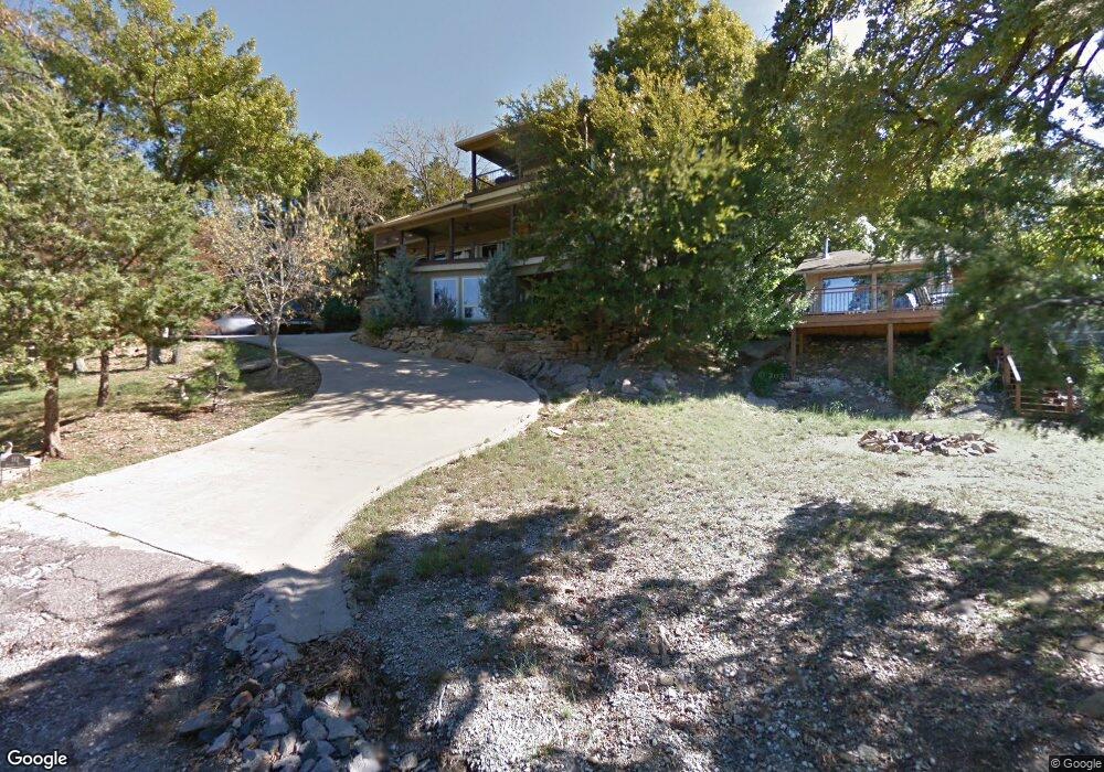
112 Sunset Trail Pottsboro, TX 75076
Estimated Value: $570,232 - $749,000
--
Bed
--
Bath
2,310
Sq Ft
$279/Sq Ft
Est. Value
About This Home
This home is located at 112 Sunset Trail, Pottsboro, TX 75076 and is currently estimated at $645,558, approximately $279 per square foot. 112 Sunset Trail is a home located in Grayson County with nearby schools including Pottsboro Elementary School, Pottsboro Middle School, and Pottsboro High School.
Ownership History
Date
Name
Owned For
Owner Type
Purchase Details
Closed on
Jul 3, 2024
Sold by
Collins Emilie S
Bought by
Emilie S Collins Living Trust and Collins
Current Estimated Value
Purchase Details
Closed on
Nov 8, 2021
Sold by
Jaco Troy Dale
Bought by
Collins Emilie Sue
Purchase Details
Closed on
Feb 11, 2005
Sold by
Jaco Troy Dale
Bought by
Jaco Troy Dale and Collins Emilie S
Create a Home Valuation Report for This Property
The Home Valuation Report is an in-depth analysis detailing your home's value as well as a comparison with similar homes in the area
Home Values in the Area
Average Home Value in this Area
Purchase History
| Date | Buyer | Sale Price | Title Company |
|---|---|---|---|
| Emilie S Collins Living Trust | -- | None Listed On Document | |
| Collins Emilie Sue | -- | None Available | |
| Collins Emilie Sue | -- | None Available | |
| Jaco Troy Dale | -- | -- |
Source: Public Records
Tax History Compared to Growth
Tax History
| Year | Tax Paid | Tax Assessment Tax Assessment Total Assessment is a certain percentage of the fair market value that is determined by local assessors to be the total taxable value of land and additions on the property. | Land | Improvement |
|---|---|---|---|---|
| 2025 | $8,103 | $643,306 | -- | -- |
| 2024 | $8,103 | $584,824 | $0 | $0 |
| 2023 | $8,368 | $531,658 | $0 | $0 |
| 2022 | $7,607 | $483,325 | $0 | $0 |
| 2021 | $7,146 | $499,846 | $113,543 | $386,303 |
| 2020 | $6,743 | $399,442 | $112,075 | $287,367 |
| 2019 | $6,592 | $372,636 | $112,075 | $260,561 |
| 2018 | $6,484 | $361,933 | $112,075 | $249,858 |
| 2017 | $6,222 | $342,831 | $112,075 | $230,756 |
| 2016 | $5,520 | $337,550 | $112,075 | $225,475 |
| 2015 | $0 | $326,857 | $112,075 | $214,782 |
| 2014 | -- | $312,568 | $111,472 | $201,096 |
Source: Public Records
Map
Nearby Homes
- 258 Lou-Sand Hill Rd
- 455 Lakepoint Loop
- 588 Lakepoint Loop
- 116 Oak Hills Dr
- 766 Lakepoint Loop
- 33 Queens Dr
- 118 Hacienda Dr
- 355 Lakecrest Dr
- 188 Hacienda Dr
- 16 Wales Dr
- 491 Black Forest Dr
- 191 Black Forest Dr
- 83 Mayfield Ln
- 219 Ray Rd
- 226 Cambridge Dr
- 142 Wales Dr
- 2164 Tanglewood Blvd Unit A208
- 2164 Tanglewood Blvd Unit 115
- 2164 Tanglewood Blvd Unit 207
- 2164 Tanglewood Blvd Unit 215
- 39 Eagles Nest Ln
- 144 Sunset Trail
- 9 Eagles Nest Ln
- 11 Eagles Nest Ln
- 55 Eagles Nest Ln
- 4 Hummingbird Ln
- 83 Hummingbird Ln
- 84 Hummingbird Ln
- 3 Red Bird Ln
- 84 Eagles Nest Ln
- 10 Sunset Trail
- 105 Red Bird Ln
- 6.21 Red Bird Ln
- 1058 Cedar Oak Dr
- 132 Eagles Nest Ln
- 3 Byrd Ln
- 1004 Cedar Oak Dr
- 143 Red Bird Ln
- 1064 Cedar Oak Dr
- 1064 Cedar Oak Dr