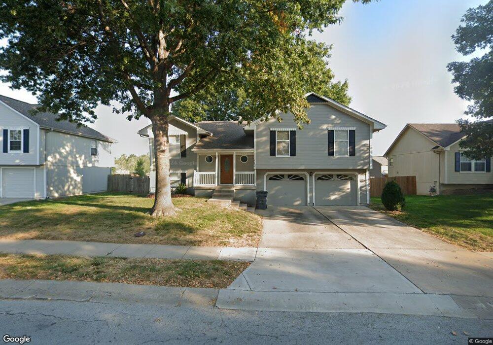
112 SW Nelson Dr Grain Valley, MO 64029
Estimated Value: $278,240 - $322,000
3
Beds
2
Baths
1,379
Sq Ft
$217/Sq Ft
Est. Value
About This Home
This home is located at 112 SW Nelson Dr, Grain Valley, MO 64029 and is currently estimated at $299,810, approximately $217 per square foot. 112 SW Nelson Dr is a home located in Jackson County with nearby schools including Grain Valley High School.
Ownership History
Date
Name
Owned For
Owner Type
Purchase Details
Closed on
Nov 24, 1997
Sold by
Breunig Construction Inc
Bought by
Coleman Kevin P
Current Estimated Value
Home Financials for this Owner
Home Financials are based on the most recent Mortgage that was taken out on this home.
Original Mortgage
$87,730
Outstanding Balance
$14,436
Interest Rate
7.31%
Mortgage Type
FHA
Estimated Equity
$285,374
Purchase Details
Closed on
Jan 30, 1997
Sold by
Countryside Development Llc
Bought by
Breunig Construction Inc
Create a Home Valuation Report for This Property
The Home Valuation Report is an in-depth analysis detailing your home's value as well as a comparison with similar homes in the area
Home Values in the Area
Average Home Value in this Area
Purchase History
| Date | Buyer | Sale Price | Title Company |
|---|---|---|---|
| Coleman Kevin P | -- | Ati Title Company | |
| Breunig Construction Inc | -- | Security Land Title Company |
Source: Public Records
Mortgage History
| Date | Status | Borrower | Loan Amount |
|---|---|---|---|
| Open | Coleman Kevin P | $87,730 |
Source: Public Records
Tax History Compared to Growth
Tax History
| Year | Tax Paid | Tax Assessment Tax Assessment Total Assessment is a certain percentage of the fair market value that is determined by local assessors to be the total taxable value of land and additions on the property. | Land | Improvement |
|---|---|---|---|---|
| 2025 | $3,760 | $43,220 | $7,551 | $35,669 |
| 2024 | $3,619 | $45,651 | $4,248 | $41,403 |
| 2023 | $3,619 | $45,651 | $5,850 | $39,801 |
| 2022 | $2,962 | $32,680 | $4,931 | $27,749 |
| 2021 | $2,893 | $32,680 | $4,931 | $27,749 |
| 2020 | $2,934 | $32,687 | $4,931 | $27,756 |
| 2019 | $2,874 | $32,687 | $4,931 | $27,756 |
| 2018 | $2,583 | $27,445 | $3,188 | $24,257 |
| 2017 | $2,499 | $27,445 | $3,188 | $24,257 |
| 2016 | $2,499 | $26,570 | $2,702 | $23,868 |
| 2014 | $2,469 | $26,049 | $2,649 | $23,400 |
Source: Public Records
Map
Nearby Homes
- 709 SW Harvest Cir
- 836 SW Lee Ann Dr
- 808 SW Country Hill Dr
- 601 SW Nelson Dr
- 309 SW Creek Ridge Dr
- 501 SW Creek Ridge Dr
- 621 SW Tisha Ln
- 506 SW Meadowood Dr
- 725 SW Tisha Ln
- 1001 SW Cross Creek Dr
- 1010 SW Cross Creek Dr
- 1400 SW Cross Creek Dr
- 800 SW Hilltop Ct
- 913 SW Abar Dr
- 115 E Old Us 40 Hwy N A
- 33100 E Oak Hill School Rd
- 636 SW Lakeview Dr
- 207 Pebblebrook St
- 209 SW Cross Creek Dr
- 518 South St
- 108 SW Nelson Dr
- 116 SW Nelson Dr
- 710 SW Woodland Cir
- 104 SW Nelson Dr
- 120 SW Nelson Dr
- 711 SW Woodland Cir
- 229 SW Nelson Dr
- 708 SW Woodland Cir
- 800 SW Woodland Dr
- 801 SW Highland Ave
- 100 SW Nelson Dr
- 200 SW Nelson Dr
- 804 SW Woodland Dr
- 88 SW Nelson Dr
- 82 SW Nelson Dr
- 801 SW Woodland Dr
- 805 SW Highland Ave
- 707 SW Harvest Cir
- 709 SW Woodland Cir
- 808 SW Woodland Dr