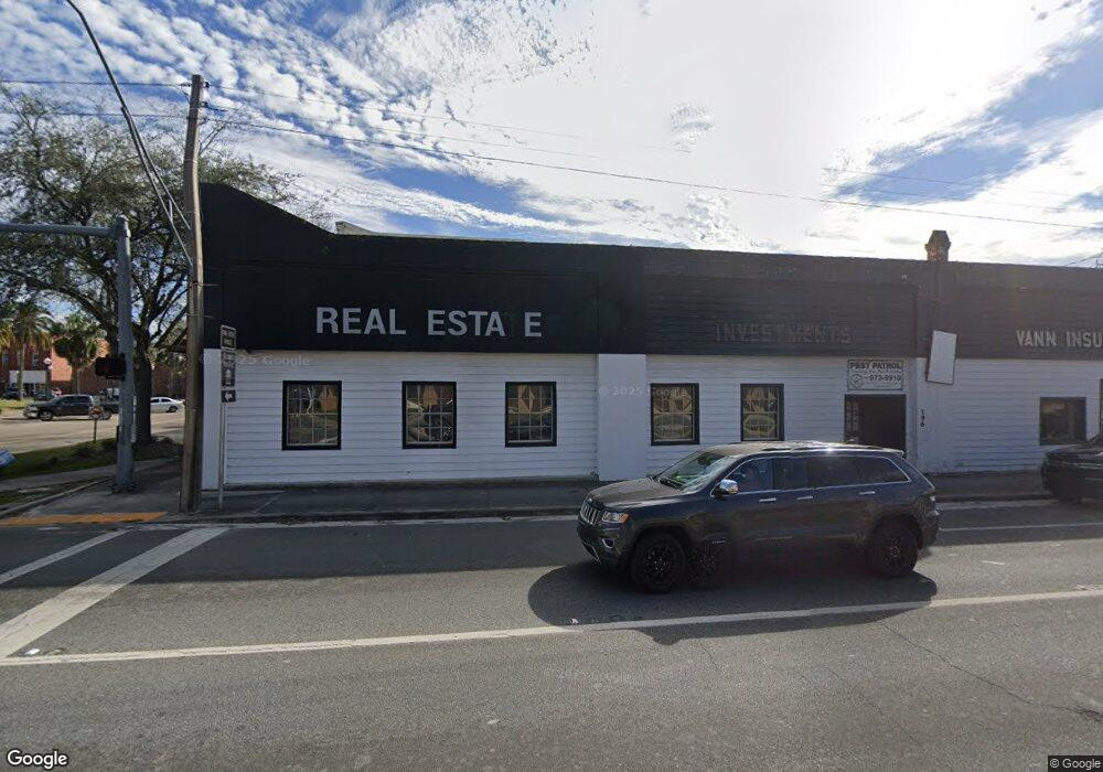
112 SW Range Ave Madison, FL 32340
Estimated Value: $320,744
--
Bed
2
Baths
2,500
Sq Ft
$128/Sq Ft
Est. Value
About This Home
This home is located at 112 SW Range Ave, Madison, FL 32340 and is currently estimated at $320,744, approximately $128 per square foot. 112 SW Range Ave is a home located in Madison County with nearby schools including Madison County Central School, Madison County High School, and James Madison Preparatory Charter High School.
Ownership History
Date
Name
Owned For
Owner Type
Purchase Details
Closed on
Feb 19, 2015
Sold by
Koutz Terry Lynne and Koutz Larry P
Bought by
Jones Benjamin T
Current Estimated Value
Home Financials for this Owner
Home Financials are based on the most recent Mortgage that was taken out on this home.
Original Mortgage
$22,000
Interest Rate
8%
Mortgage Type
Commercial
Purchase Details
Closed on
Oct 1, 2014
Sold by
Milliron Roy F and Milliron Suzanne M
Bought by
Sirmon John W and Sirmon Lynette C
Home Financials for this Owner
Home Financials are based on the most recent Mortgage that was taken out on this home.
Original Mortgage
$127,500
Interest Rate
4.15%
Mortgage Type
Seller Take Back
Create a Home Valuation Report for This Property
The Home Valuation Report is an in-depth analysis detailing your home's value as well as a comparison with similar homes in the area
Home Values in the Area
Average Home Value in this Area
Purchase History
| Date | Buyer | Sale Price | Title Company |
|---|---|---|---|
| Jones Benjamin T | $22,000 | Smith Abstract & Title Llc | |
| Sirmon John W | $137,500 | Attorney |
Source: Public Records
Mortgage History
| Date | Status | Borrower | Loan Amount |
|---|---|---|---|
| Closed | Jones Benjamin T | $22,000 | |
| Previous Owner | Sirmon John W | $127,500 |
Source: Public Records
Tax History Compared to Growth
Tax History
| Year | Tax Paid | Tax Assessment Tax Assessment Total Assessment is a certain percentage of the fair market value that is determined by local assessors to be the total taxable value of land and additions on the property. | Land | Improvement |
|---|---|---|---|---|
| 2024 | $1,935 | $92,114 | $25,875 | $66,239 |
| 2023 | $1,806 | $81,123 | $0 | $0 |
| 2022 | $1,666 | $73,748 | $20,625 | $53,123 |
| 2021 | $1,726 | $74,389 | $20,625 | $53,764 |
| 2020 | $1,615 | $69,077 | $19,612 | $49,465 |
| 2019 | $1,636 | $69,660 | $19,612 | $50,048 |
| 2018 | $1,670 | $70,243 | $0 | $0 |
| 2017 | $1,699 | $70,826 | $19,612 | $51,214 |
| 2016 | $1,705 | $71,409 | $19,612 | $51,797 |
| 2015 | $1,563 | $63,247 | $19,612 | $43,635 |
| 2014 | $1,578 | $63,830 | $0 | $0 |
Source: Public Records
Map
Nearby Homes
- 237 NE Marion St
- 227 SW Range Ave
- 307 SW Dade St
- 140 SW Rutledge St
- 179 S Duval Ave
- 281 NE Duval Ave
- 276 NW Marion St
- 154 NW Livingston St
- TBD Us 90
- 126 NE Patterson St
- 485 SW Jordan St
- 0 Martin Luther King jr Dr Unit MFRTB8389203
- xxx SW Bunker St
- 590 NE Colin Kelly Hwy
- 125 SW Miller St
- 137 SW Miller St
- 155 SE Madison St
- 205 SW Millinor St
- 0 Madison Ave Unit 224089151
- 249 NE Bevan Loop
- 128 SW Range Ave
- 134 SW Range Ave
- 00 Interstate 10
- 6918 Us Hwy 90
- 0 Florida 53 Unit MFRU8213671
- 0 Florida 53 Unit 279351
- 0 Florida 53
- 0 Florida 53
- 0 Florida 53 Unit 365027
- 0 Florida 53
- 0 Florida 53
- 0 Florida 53
- 0 Florida 53
- Vacant Florida 53
- 186 Us-90 Unit End
- 178 E Base St Unit Interior
- E Base St Unit 1
- E Base St
- 199 E Base St
- 306 SW Pinckney St
