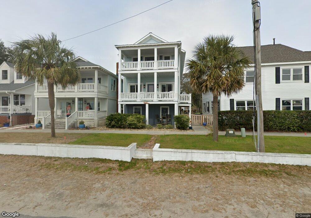
112 W Bay St Southport, NC 28461
Estimated Value: $748,000 - $1,088,959
3
Beds
3
Baths
1,701
Sq Ft
$561/Sq Ft
Est. Value
About This Home
This home is located at 112 W Bay St, Southport, NC 28461 and is currently estimated at $953,990, approximately $560 per square foot. 112 W Bay St is a home located in Brunswick County with nearby schools including Southport Elementary School, South Brunswick Middle School, and South Brunswick High School.
Ownership History
Date
Name
Owned For
Owner Type
Purchase Details
Closed on
Jun 22, 2023
Sold by
Home Place Of Wilmington Llc
Bought by
Heflin Terry P and Heflin Bonnie W
Current Estimated Value
Purchase Details
Closed on
Jun 26, 2017
Sold by
Herring Davis C and Herring Ellen
Bought by
Herring Bonner Davis and Herring Karna S
Purchase Details
Closed on
Feb 1, 1994
Bought by
Herring Davis C
Create a Home Valuation Report for This Property
The Home Valuation Report is an in-depth analysis detailing your home's value as well as a comparison with similar homes in the area
Home Values in the Area
Average Home Value in this Area
Purchase History
| Date | Buyer | Sale Price | Title Company |
|---|---|---|---|
| Heflin Terry P | $159,500 | None Listed On Document | |
| Heflin Terry P | $159,500 | None Listed On Document | |
| Herring Bonner Davis | -- | None Available | |
| Herring Davis C | -- | -- |
Source: Public Records
Tax History Compared to Growth
Tax History
| Year | Tax Paid | Tax Assessment Tax Assessment Total Assessment is a certain percentage of the fair market value that is determined by local assessors to be the total taxable value of land and additions on the property. | Land | Improvement |
|---|---|---|---|---|
| 2025 | $6,715 | $912,520 | $325,280 | $587,240 |
| 2024 | $6,715 | $912,520 | $325,280 | $587,240 |
| 2023 | $5,188 | $912,520 | $325,280 | $587,240 |
| 2022 | $5,188 | $520,050 | $171,200 | $348,850 |
| 2021 | $4,543 | $520,050 | $171,200 | $348,850 |
| 2020 | $3,371 | $377,260 | $171,200 | $206,060 |
| 2019 | $3,832 | $173,010 | $171,200 | $1,810 |
| 2018 | $3,658 | $173,200 | $171,200 | $2,000 |
| 2017 | $3,646 | $173,200 | $171,200 | $2,000 |
| 2016 | $3,406 | $173,200 | $171,200 | $2,000 |
| 2015 | $3,406 | $429,050 | $171,200 | $257,850 |
| 2014 | $3,540 | $472,514 | $239,680 | $232,834 |
Source: Public Records
Map
Nearby Homes
- 216 W Bay St
- 111 N Caswell Ave
- 209 N Lord St
- 220 N Caswell Ave
- 229 N Caswell Ave
- 210 W West St
- 207 Clarendon Ave
- 109 S Atlantic Ave
- 311 College St
- 2308 Crescent Bay Dr
- 2293 Crescent Bay Dr
- 424 West St
- 516 W Brunswick St
- 403 N Howe St
- 312 E West St
- 409 N Lord St
- 600 W Brunswick St Unit 12
- 606 W Brown St Unit K
- 606 W Brown St Unit D
- 608 W Brown St Unit C
- 114 W Bay St
- 120 W Bay St
- 0 W Bay St
- 101 W Bay St
- 113 S Howe St
- 206 W Bay St
- 206 W Bay St Unit W
- 111 S Howe St
- 16 N Lord St
- 14 N Lord St
- 105 S Howe St
- Lot 29 N Lord
- 15 N Lord St
- 0 N Carolina 211
- 2200000250 N Carolina 211
- 63.22acres N Carolina 211
- 205 W Moore St
- 22 N Howe St
- 110 E Moore St
- 3 N Howe St