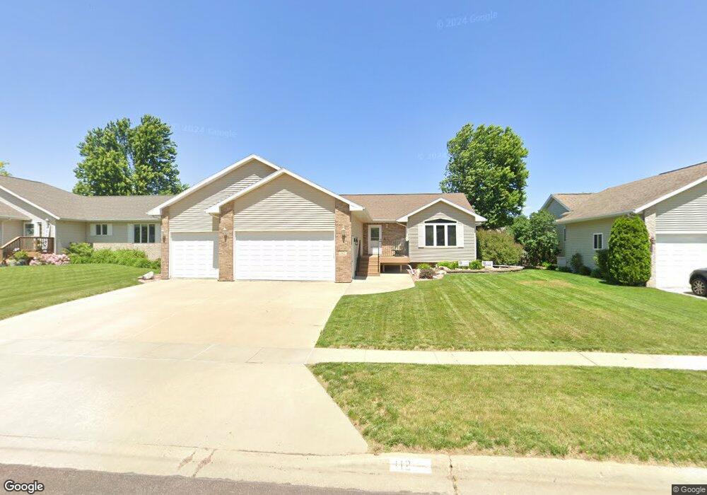
112 W Elm St Brandon, SD 57005
Estimated Value: $438,071 - $481,000
4
Beds
3
Baths
2,663
Sq Ft
$174/Sq Ft
Est. Value
About This Home
This home is located at 112 W Elm St, Brandon, SD 57005 and is currently estimated at $463,268, approximately $173 per square foot. 112 W Elm St is a home located in Minnehaha County with nearby schools including Robert Bennis Elementary School, Brandon Valley Middle School, and Brandon Valley Intermediate School.
Ownership History
Date
Name
Owned For
Owner Type
Purchase Details
Closed on
Aug 1, 2018
Sold by
Lyng David E and Lyng Mary J
Bought by
Putnam Norm and Putnam Carla
Current Estimated Value
Purchase Details
Closed on
Jul 16, 2013
Sold by
Buysse Mark S and Buysse Patriciia K
Bought by
Lyng David E and Lyng Mary J
Home Financials for this Owner
Home Financials are based on the most recent Mortgage that was taken out on this home.
Original Mortgage
$206,910
Interest Rate
3.93%
Mortgage Type
Stand Alone First
Create a Home Valuation Report for This Property
The Home Valuation Report is an in-depth analysis detailing your home's value as well as a comparison with similar homes in the area
Home Values in the Area
Average Home Value in this Area
Purchase History
| Date | Buyer | Sale Price | Title Company |
|---|---|---|---|
| Putnam Norm | $275,000 | None Available | |
| Lyng David E | $229,900 | -- |
Source: Public Records
Mortgage History
| Date | Status | Borrower | Loan Amount |
|---|---|---|---|
| Previous Owner | Lyng David E | $206,910 |
Source: Public Records
Tax History
| Year | Tax Paid | Tax Assessment Tax Assessment Total Assessment is a certain percentage of the fair market value that is determined by local assessors to be the total taxable value of land and additions on the property. | Land | Improvement |
|---|---|---|---|---|
| 2024 | $5,334 | $399,700 | $25,100 | $374,600 |
| 2023 | $5,786 | $412,900 | $25,100 | $387,800 |
| 2022 | $5,338 | $359,900 | $25,100 | $334,800 |
| 2021 | $4,475 | $309,400 | $0 | $0 |
| 2020 | $4,475 | $280,500 | $0 | $0 |
| 2019 | $4,439 | $272,645 | $0 | $0 |
| 2018 | $3,908 | $258,663 | $0 | $0 |
| 2017 | $3,912 | $237,889 | $25,270 | $212,619 |
| 2016 | $3,912 | $234,023 | $25,270 | $208,753 |
| 2015 | $3,916 | $224,487 | $23,465 | $201,022 |
| 2014 | $3,716 | $212,908 | $23,465 | $189,443 |
Source: Public Records
Map
Nearby Homes
- 200 Sunset Dr
- 601 Lakota Ave
- 312 S 1st Ave
- 500 E Cairos Place
- 605 Main Ave S Ave
- 216 Tabor Ct
- 2206 E St
- 900 Parkview Blvd
- 904 N Sioux Blvd
- 404 N Sioux Blvd
- 408 N Sioux Blvd
- 417 Meadowlark Cir
- 412 N Sioux Blvd
- 205 Patrician Dr
- 212 Cir
- 921 Tracy Ave
- 209 W Birchwood Dr
- 509 E Lakeview Dr
- 607 E Lakeview Dr
- 513 E Lakeview Dr
Your Personal Tour Guide
Ask me questions while you tour the home.