Estimated Value: $71,000 - $205,000
--
Bed
1
Bath
1,732
Sq Ft
$79/Sq Ft
Est. Value
About This Home
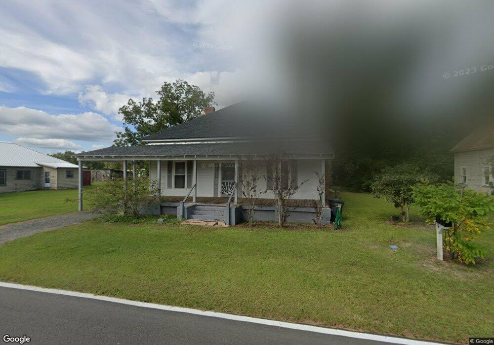
This home is located at 112 W Railroad St, Odum, GA 31555 and is currently estimated at $136,468, approximately $78 per square foot. 112 W Railroad St is a home located in Wayne County with nearby schools including Odum Elementary School, Martha Puckett Middle School, and Wayne County High School.
Ownership History
Date
Name
Owned For
Owner Type
Purchase Details
Closed on
Nov 4, 2022
Sold by
Daniel Jack
Bought by
Price Evette
Current Estimated Value
Purchase Details
Closed on
Feb 19, 2010
Sold by
Daniels Jack
Bought by
Mallard Kevin A and Mallard Marvin
Home Financials for this Owner
Home Financials are based on the most recent Mortgage that was taken out on this home.
Original Mortgage
$21,300
Interest Rate
4.97%
Mortgage Type
Future Advance Clause Open End Mortgage
Purchase Details
Closed on
Nov 1, 2000
Sold by
Bryant Frank and Bryant Ruby
Bought by
Daniel Jack
Purchase Details
Closed on
Jun 1, 2000
Bought by
Bryant Frank and Bryant Ruby
Create a Home Valuation Report for This Property
The Home Valuation Report is an in-depth analysis detailing your home's value as well as a comparison with similar homes in the area
Home Values in the Area
Average Home Value in this Area
Purchase History
| Date | Buyer | Sale Price | Title Company |
|---|---|---|---|
| Price Evette | -- | -- | |
| Mallard Kevin A | $26,000 | -- | |
| Daniel Jack | $25,000 | -- | |
| Bryant Frank | -- | -- |
Source: Public Records
Mortgage History
| Date | Status | Borrower | Loan Amount |
|---|---|---|---|
| Previous Owner | Mallard Kevin A | $21,300 |
Source: Public Records
Tax History Compared to Growth
Tax History
| Year | Tax Paid | Tax Assessment Tax Assessment Total Assessment is a certain percentage of the fair market value that is determined by local assessors to be the total taxable value of land and additions on the property. | Land | Improvement |
|---|---|---|---|---|
| 2024 | $1,048 | $34,774 | $2,114 | $32,660 |
| 2023 | $455 | $17,624 | $2,114 | $15,510 |
| 2022 | $188 | $17,624 | $2,114 | $15,510 |
| 2021 | $205 | $17,624 | $2,114 | $15,510 |
| 2020 | $214 | $17,624 | $2,114 | $15,510 |
| 2019 | $226 | $17,624 | $2,114 | $15,510 |
| 2018 | $226 | $17,624 | $2,114 | $15,510 |
| 2017 | $163 | $17,624 | $2,114 | $15,510 |
| 2016 | $151 | $17,624 | $2,114 | $15,510 |
| 2014 | $150 | $17,624 | $2,114 | $15,510 |
| 2013 | -- | $17,623 | $2,114 | $15,509 |
Source: Public Records
Map
Nearby Homes
- 21 AC Hwy 341
- 0 N Church St
- 10.00 AC Hwy 341 Odum Hwy
- 0 Beards Bluff Rd
- 000 Beards Bluff Rd
- 10 Beards Bluff Rd
- 468 Lake Lanell Rd
- 468 Lake Lannell Rd
- Lot 00 Moss Landing
- Lots 26+ Moss Landing
- Lot 21 Moss Landing
- 0 Tract 3 Hwy 341 & Bennett Mill Pond Rd Unit 1656129
- 0 Tract 6 Hwy 341 & Bennett Mill Rd Unit 1656128
- 0 Bennett Mill Pond Rd
- 796 Lud Oquinn Rd
- 858 Hoke Ogden Rd
- TRACT 2 Bennett Mill Pond Rd
- Tract 4 Bennett Mill Pond Rd
- Tract 3 Bennett Mill Pond Rd
- 104 Railroad St
- 120 W Railroad St
- 104 W Railroad St
- 128 W Railroad St
- 205 N Church St
- 213 N Church St
- 113 N Main St
- 200 Thomas St
- 113 Maggie St
- 201 N Main St
- 312 Railroad St
- 121 Maggie St
- 201 First Ln
- 301 N Church St
- 317 N Church St
- .28 AC S Church St
- 291 Maisie St
- 300 W Railroad St
- .16 AC S Church St
- 120 Carter Ave