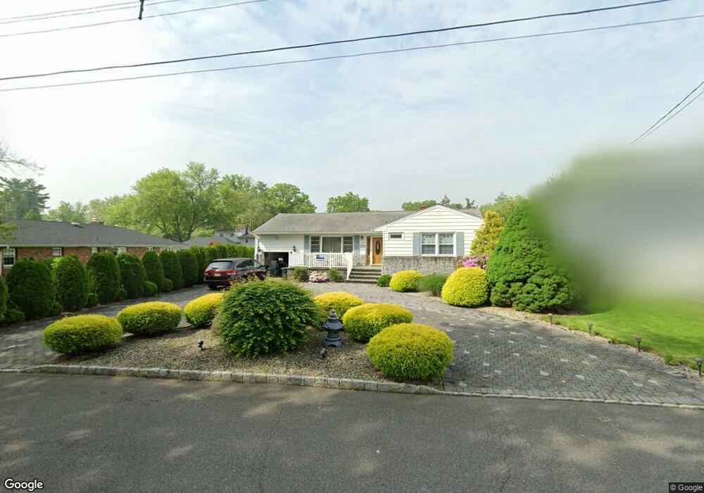
112 Warwick Cir Springfield, NJ 07081
Estimated Value: $726,017 - $795,000
Studio
--
Bath
1,992
Sq Ft
$377/Sq Ft
Est. Value
About This Home
This home is located at 112 Warwick Cir, Springfield, NJ 07081 and is currently estimated at $751,254, approximately $377 per square foot. 112 Warwick Cir is a home located in Union County with nearby schools including Jonathan Dayton High School and St James The Apostle School.
Ownership History
Date
Name
Owned For
Owner Type
Purchase Details
Closed on
Oct 29, 2009
Sold by
Bopp Alan R and Bopp Rachel A
Bought by
Bopp Alan R and Bopp Rachel A
Current Estimated Value
Home Financials for this Owner
Home Financials are based on the most recent Mortgage that was taken out on this home.
Original Mortgage
$202,790
Interest Rate
4.86%
Mortgage Type
New Conventional
Create a Home Valuation Report for This Property
The Home Valuation Report is an in-depth analysis detailing your home's value as well as a comparison with similar homes in the area
Home Values in the Area
Average Home Value in this Area
Purchase History
| Date | Buyer | Sale Price | Title Company |
|---|---|---|---|
| Bopp Alan R | -- | None Available |
Source: Public Records
Mortgage History
| Date | Status | Borrower | Loan Amount |
|---|---|---|---|
| Closed | Bopp Alan R | $202,790 |
Source: Public Records
Tax History
| Year | Tax Paid | Tax Assessment Tax Assessment Total Assessment is a certain percentage of the fair market value that is determined by local assessors to be the total taxable value of land and additions on the property. | Land | Improvement |
|---|---|---|---|---|
| 2025 | $15,352 | $646,400 | $225,400 | $421,000 |
| 2024 | $15,100 | $646,400 | $225,400 | $421,000 |
| 2023 | $15,100 | $646,400 | $225,400 | $421,000 |
| 2022 | $14,020 | $646,400 | $225,400 | $421,000 |
| 2021 | $13,803 | $185,400 | $79,300 | $106,100 |
| 2020 | $13,588 | $185,400 | $79,300 | $106,100 |
| 2019 | $13,404 | $185,400 | $79,300 | $106,100 |
| 2018 | $12,887 | $181,500 | $79,300 | $102,200 |
| 2017 | $12,533 | $181,500 | $79,300 | $102,200 |
| 2016 | $12,289 | $181,500 | $79,300 | $102,200 |
| 2015 | $12,146 | $181,500 | $79,300 | $102,200 |
| 2014 | $11,917 | $181,500 | $79,300 | $102,200 |
Source: Public Records
Map
Nearby Homes
- 20 Kew Dr
- 294 Mountain Ave
- 2 S Audlen Terrace
- 171 S Springfield Ave
- 24 Brook St
- 300 Wilson Rd Unit 24D
- 5B Troy Dr Unit 1
- 10A Troy Dr Unit 10A
- 182 Meisel Ave
- 66 Springbrook Rd
- 32 Ruby St
- 559 S Springfield Ave Unit 559
- 28 Molter Ave
- 148 Locust Dr
- 57C Troy Dr
- 23 Diven St
- 77B Troy Dr Unit 77B
- 97B Troy Dr Unit B
- 105 Battle Hill Ave
- 20 Archbridge Ln
- 108 Warwick Cir
- 3 Windsor Dr
- 76 Shunpike Rd
- 88 Shunpike Rd
- 104 Warwick Cir
- 70 Shunpike Rd
- 111 Warwick Cir
- 94 Shunpike Rd
- 2 Warwick Cir
- 105 Warwick Cir
- 100 Warwick Cir
- 1 Warwick Cir
- 60 Shunpike Rd
- 100 Shunpike Rd
- 6 Warwick Cir
- 96 Warwick Cir
- 11 Warwick Cir
- 56 Shunpike Rd
- 10 Warwick Cir
- 73 Warwick Cir
Your Personal Tour Guide
Ask me questions while you tour the home.